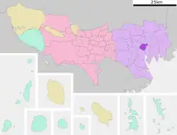
Kanda-Jinbōchō | |
|---|---|
 Kanda-Jinbōchō in 2021 | |
| Coordinates: 35°41′43.77″N 139°45′29.23″E / 35.6954917°N 139.7581194°E | |
| Country | |
| Prefecture | |
| Ward | |
| Area | Kanda |
| Population (2017)[1] | |
| • Total | 3,205 |
Kanda-Jinbōchō (神田神保町), commonly known as Jinbōchō or Jimbōchō, is a district of Chiyoda, Tokyo, Japan, known as Tokyo's center of used-book stores and publishing houses, and as a popular antique and curio shopping area.
The center of Jinbōchō is at the crossing of Yasukuni-dōri and Hakusan-dōri, above Jimbōchō Station on the Tokyo Metro Hanzōmon Line, Toei Mita Line and Toei Shinjuku Line. The prestigious Tokyo Book Binding Club and Literature Preservation Society are located in Jinbōchō, and the area is within walking distance of a number of major universities, including Nihon, Senshu, Meiji, Hosei and Juntendo.
Jinbōchō is officially known (in addresses, etc.) as Kanda-Jinbōchō (神田神保町), and is part of the former ward of Kanda.
History
Jinbōchō is named after a samurai, Nagaharu Jinbō of the Jinbō clan, who lived in the area at the end of the 17th century.
During the late nineteenth century when Japan underwent modernization, foreign studies schools opened in the area, such as Bansho Shirabesho (Institute for Research of Foreign Documents) and Tokyo Gaikokugo Gakko (Tokyo School of Foreign Languages) which would later become the University of Tokyo and Hitotsubashi University. Many bookstores opened in the area, and it became established as a book town. In 1913, a large fire destroyed much of the area. In the wake of the fire, a former teacher named Shigeo Iwanami opened a bookstore in Jinbōchō which eventually grew into today's Iwanami Shoten publishing house. In 1923, the Great Kanto Earthquake caused a fire destroying much of the former Kanda-ku including the Jinbocho library and campus of the University of Tokyo, which was subsequently relocated to Bunkyo-ku. Over time, the area became increasingly popular with university students and intellectuals, and many more small bookstores and cafes opened there.
More recently, the Chiyoda municipal government sponsored a major redevelopment project in Jinbōchō which led to three new high-rise office buildings being completed in 2003, further boosting the local economy. The Jinbōchō Theater was completed in 2007.
 Kanda-Jinbōchō in 2011(Suzuran Street)
 Jinbōchō at Yasukunidori and Hakusan
 Jinbōchō Fall Book Fair
Companies
Many companies are located within Jinbōchō, including the headquarters of Tōkyōdō Shoten, a retail book chain, and manga company Shueisha, known for the anthology manga magazine, Shonen Jump.
In popular culture
- Jinbōchō is an important location in the Read or Die light novel franchise, and is the area where protagonist Yomiko Readman resides.
- Studio Ghibli film The Wind Rises depicts the 1923 Kanto Earthquake and subsequent fire destroying the former Jinbocho campus of Tokyo Imperial University.
- Manga series Dropkick on My Devil! used Jinbōchō as the area where main characters Yurine Hanazono and Jashin-chan reside, the district name was also featured in the plot, episode titles, and lyrics of feature songs.[2][3]
Education
Chiyoda Board of Education operates public elementary and junior high schools. Ochanomizu Elementary School (お茶の水小学校) is the zoned elementary school for Kanda-Jinbōchō 1-3 chōme.[4] There is a freedom of choice system for junior high schools in Chiyoda Ward, and so there are no specific junior high school zones.[5]
See also
References
- ↑ "町丁別世帯数および人口(住民基本台帳)". Chiyoda-ku (in Japanese). December 6, 2017. Retrieved February 24, 2021.
- ↑ "Amazon.co.jp: 邪神ちゃんドロップキックX : 鈴木愛奈, 大森日雅, 久保田未夢, 小見川千明, 小坂井祐莉絵, 佐々木李子, 飯田里穂, 原奈津子, 荒浪和沙, 寺田御子, 山田麻莉奈, 山下七海, 田中美海, 朝ノ瑠璃, 長谷川玲奈, M・A・O, 遊佐浩二, 筆安一幸, 村上桃子, 佐藤光, 山田卓: Prime Video". Amazon.co.jp (in Japanese). Retrieved 28 August 2022.
- ↑ "鈴木愛奈 (Aina Suzuki) – 神保町哀歌 (Jinbouchou Aika) Lyrics". Genius Lyrics. Genius Media Group Inc. Retrieved 28 August 2022.
- ↑ "区立小学校の通学区域". Chiyoda Board of Education. Retrieved 2022-10-08.
- ↑ "区立中学校の通学区域と学校選択". Chiyoda Board of Education. Retrieved 2022-10-08.
千代田区では、[...]
External links
- Jimbou: Book Town (in Japanese)
- Japan Trip 2009: Jinbocho—a pictorial tour of publishers and book stores in Jinbōchō
- Jinbocho Walking Guide— An up-to-date English language walking guide and map for streets and bookstores in Jinbocho.
