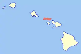
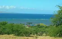
Archeological Sites at Kawela are a number of archeological sites at or near the settlement of Kawela on the southern coast of Molokaʻi, the northernmost of the islands of Maui County, Hawaii. It was the site of two battles in Hawaiian history.

Early history
Ka Wela means "the heat" in the Hawaiian language. It was the name of a traditional land division (ahupuaʻa) of ancient Hawaii, but the name is also used on several other islands.[1]
It is located about 4.5 miles (7.2 km) east of the town of Kaunakakai.[2] A heiau is visible at 21°4′39″N 156°56′40″W / 21.07750°N 156.94444°W on a ridge between the forks of Kawela Gulch.
This is generally thought to be the place of refuge (Puʻuhonua) where the soldiers of Kapiʻioho o kalani fled during a great battle of about 1737.[3]: 70 [4]
In about February 1795, women and children escaped to Molokaʻi when Kamehameha I had just conquered Maui. In pursuit, the vast fleet of war canoes stretched all along the coast from Kawela past Kaunakakai to the area known as Kalamaʻula.[3]: 171 [5] The army met little resistance this time. Queen Kalola was asked if the two kingdoms could be united by marrying off her daughter Keōpūolani, who was considered to have the best royal family background, and thus would be suitable as a mother of future rulers. Her sons and grandsons would rule the Kingdom of Hawaii as the House of Kamehameha.[6] In the late 19th century it was part of the vast Molokaʻi Ranch owned by King Kamehameha V and managed by the family of Rudolph Wilhelm Meyer.[7]
Recent history

The area now has a few vacation homes along the shore, and one subdivision of 120 2-acre (8,100 m2) lots that are zoned for agriculture on the hills. Wadsworth Y. H. Yee, in the Hawaii Senate from the Republican Party of Hawaii proposed the development in the 1970s. Ground was broken on December 20, 1980.[8]
Wetlands and an ancient fishpond near the shore are preserved in the Kakahaiʻa National Wildlife Refuge and Kakahaiʻa park administered by Maui County.[9]
There are 21 which are separately listed on the National Register of Historic Places.[10] The names used in the NRHP all start with the words "Archeological Site" and then an optional list of site numbers from a survey done by the Bernice Pauahi Bishop Museum when the development was proposed[11] with a letter "T" followed by a dash, and then a state site identifier which four numbers separated with dashes, starting with "50-60" indicating the 50th state of Hawaii and the county of Maui County, a map quadrant, and site within the state registry.[12] The sites are scattered through the area, and are located on private property so generally not accessible to the public.[13]
The sites are:
| Reference number | Survey sites | Date listed | State site | Area | Summary |
|---|---|---|---|---|---|
| 82000152 | T-10 | November 3, 1982 | 50-60-04-702 | 0.2 acres (810 m2) | 3 dwellings |
| 82000163 | T-108 | November 5, 1982 | 50-60-03-713 | 4.5 acres (1.8 ha) | Agricultural fields |
| 82000164 | T-111-116; T-182 | November 5, 1982 | 50-60-04-710 | 9 acres (3.6 ha) | 7 burials |
| 82000153 | T-12 | November 4, 1982 | 50-60-04-704 | 0.2 acres (810 m2) | Rock carving |
| 82000165 | T-125-6; T-181 | November 5, 1982 | 50-60-03-714 | 3.9 acres (1.6 ha) | 25 buildings and agricultural sites |
| 82000166 | T-134 | November 5, 1982 | 50-60-03-718 | 0.5 acres (0.20 ha) | Dwellings and burials |
| 82000167 | T-135-6 | November 5, 1982 | 50-60-03-719 | 0.6 acres (0.24 ha) | Building |
| 82000168 | T-155, -158 | November 5, 1982 | 50-60-03-721 | 6.5 acres (2.6 ha) | 11 religious structures |
| 82000169 | T-165-6 | November 5, 1982 | 50-60-03-727 | 0.7 acres (0.28 ha) | 2 buildings |
| 82000154 | T-19 | November 4, 1982 | 50-60-04-705 | 0.1 acres (400 m2) | 1 dwelling |
| 82000150 | T-5, T-122, T-178 | November 3, 1982 | 50-60-04-142 | 0.9 acres (0.36 ha) | 6 religious structures |
| 82000157 | T-57 | November 4, 1982 | 50-60-03-720 | 5 acres (2.0 ha) | 24 grave sites |
| 82000151 | T-6 complex | November 3, 1982 | 50-60-04-700 | 1.6 acres (0.65 ha) | 12 structures |
| 82000158 | T-76 | November 4, 1982 | 50-60-03-724 | 0.5 acres (0.20 ha) | 6 domestic structures |
| 82000170 | T-78 | November 4, 1982 | 50-60-03-723 | 0.2 acres (810 m2) | Religious structure |
| 82000159 | T-79 | November 4, 1982 | 50-60-03-726 | 1 acre (0.40 ha) | 7 domestic structures |
| 82000160 | T-81, -100, -101, -105, -142 | November 4, 1982 | 50-60-03-717 | 1.4 acres (0.57 ha) | 27 burials |
| 82000161 | T-88 | November 4, 1982 | 50-60-04-707 | 0.5 acres (0.20 ha) | Religious structure |
| 82000162 | T-92 | November 5, 1982 | 50-60-04-708 | 1.2 acres (0.49 ha) | 7 domestic structures |
| 82000155 | November 3, 1982 | 50-60-04-140 | 0.9 acres (0.36 ha) | Place of refuge, Puʻuhonua | |
| 82000156 | November 3, 1982 | 50-60-04-144 | 0.3 acres (1,200 m2) | Burial Mound and fishing site | |
| 82000174 | T-20 and T-42-3 | November 3, 1982 | 50-60-04-706 | 1.1 acres (0.45 ha) | Kamehameha V Wall |
References
- ↑ Lloyd J. Soehren (2004). "lookup of Kawela". on Hawaiian place names. Ulukau, the Hawaiian Electronic Library. Retrieved May 19, 2010.
- ↑ U.S. Geological Survey Geographic Names Information System: Kawela
- 1 2 Kamakau, Samuel (1992) [1961]. Ruling Chiefs of Hawaii (Revised ed.). Honolulu: Kamehameha Schools Press. ISBN 0-87336-014-1.
- ↑ Abraham Fornander (1996) [1880]. An Account of the Polynesian Race: Its Origin and Migrations, and the ancient history of the Hawaiian people to the times of Kamehameha I. Vol. II. Trubner & company, republished by Mutual Publishing. ISBN 978-1-56647-147-3. pp 136–138, 284, 288-289
- ↑ "Kawela Battle Field". Hawaii web. Retrieved May 18, 2010.
- ↑ Esther Mookini (1998). "Keopuolani: Sacred Wife, Queen Mother, 1778-1823". Hawaiian Journal of History. Vol. 32. Hawaii Historical Society. pp. 1–24. hdl:10524/569.
- ↑ "East Molokai Watershed Partnership Strategic Plan" (PDF). Archived (PDF) from the original on May 28, 2010. Retrieved May 19, 2010.
- ↑ "Kawela Plantation Homeowners' Association". official web site. Archived from the original on May 12, 2010. Retrieved May 19, 2010.
- ↑ "Kakahaiʻa National Wildlife Refuge". United States Fish and Wildlife Service. Archived from the original on May 14, 2010. Retrieved May 19, 2010.
- ↑ "National Register Information System". National Register of Historic Places. National Park Service. April 15, 2008.
- ↑ Catherine C. Summers (1971). Molokai: a site survey. Dept. of Anthropology, Bernice Pauahi Bishop Museum. ISBN 9780598151100.
- ↑ "National and State Register of Historic Places on Moloka'i" (PDF). Hawaii State Historic Preservation Division. January 2003. Archived (PDF) from the original on May 28, 2010. Retrieved May 18, 2010.
- ↑ "Tax map for Zone 5, section 4, plat 03". Maui County. Retrieved May 20, 2010.

.svg.png.webp)