Location of Desolation Island in the South Shetland Islands.

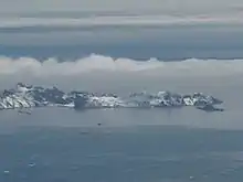
Kozma Cove (on the far side of Desolation Island).

Topographic map of Livingston Island, Greenwich, Robert, Snow and Smith Islands.
Kozma Cove (Zaliv Kozma \'za-liv koz-'ma\) is a 1.8 km wide cove indenting for 1.2 km the north coast of Desolation Island between the two arms of that V-shaped island situated in the entrance to Hero Bay, Livingston Island, Antarctica. The area was frequented by early nineteenth century English and American sealers operating from nearby Blythe Bay. British mapping in 1968, Spanish in 1991 and Bulgarian in 2005 and 2009. Named after the Bulgarian scholar Presbyter Cosmas (10th century AD).
Maps
- L.L. Ivanov et al. Antarctica: Livingston Island and Greenwich Island, South Shetland Islands. Scale 1:100000 topographic map. Sofia: Antarctic Place-names Commission of Bulgaria, 2005.
- L.L. Ivanov. Antarctica: Livingston Island and Greenwich, Robert, Snow and Smith Islands. Scale 1:120000 topographic map. Troyan: Manfred Wörner Foundation, 2009. ISBN 978-954-92032-6-4
References
- Kozma Cove. SCAR Composite Gazetteer of Antarctica.
- Bulgarian Antarctic Gazetteer. Antarctic Place-names Commission. (details in Bulgarian, basic data in English)
External links
- Kozma Cove. Copernix satellite image
This article includes information from the Antarctic Place-names Commission of Bulgaria which is used with permission.
This article is issued from Wikipedia. The text is licensed under Creative Commons - Attribution - Sharealike. Additional terms may apply for the media files.