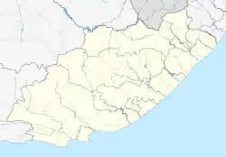
Krakeel River
Krakeelrivier | |
|---|---|
 Krakeel River  Krakeel River | |
| Coordinates: 33°48′50″S 23°43′55″E / 33.814°S 23.732°E | |
| Country | South Africa |
| Province | Eastern Cape |
| District | Sarah Baartman |
| Municipality | Kou-Kamma |
| Area | |
| • Total | 1.06 km2 (0.41 sq mi) |
| Population (2011)[1] | |
| • Total | 1,931 |
| • Density | 1,800/km2 (4,700/sq mi) |
| Racial makeup (2011) | |
| • Black African | 13.2% |
| • Coloured | 78.1% |
| • Indian/Asian | 1.1% |
| • White | 6.7% |
| • Other | 0.8% |
| First languages (2011) | |
| • Afrikaans | 89.5% |
| • Xhosa | 6.3% |
| • English | 2.3% |
| • Other | 1.8% |
| Time zone | UTC+2 (SAST) |
| PO box | 6430 |
Krakeel River is a town in Sarah Baartman District Municipality in the Eastern Cape province of South Africa.
Village in the Langkloof, east of Avontuur and some 200 km from Port Elizabeth. The name is taken from that of the river. The form Krakeelrivier is preferred for official purposes.[2]
References
- 1 2 3 4 "Main Place Krakeel River". Census 2011.
- ↑ "Dictionary of Southern African Place Names (Public Domain)". Human Science Research Council. p. 262.
This article is issued from Wikipedia. The text is licensed under Creative Commons - Attribution - Sharealike. Additional terms may apply for the media files.
.svg.png.webp)