Krasnoperekopsk
Красноперекопск, Яни Капу Yañı Qapı | |
|---|---|
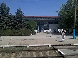 Krasnoperekopsk railway station | |
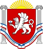
 Flag  Coat of arms | |
.jpg.webp) Krasnoperekopsk Location of Krasnoperekopsk within Crimea 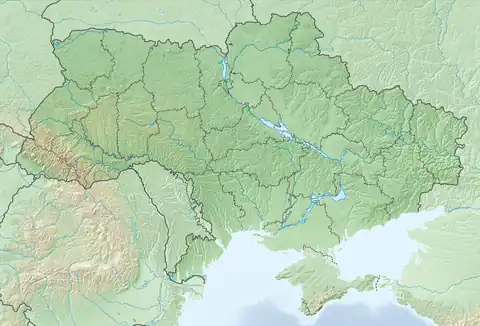 Krasnoperekopsk Krasnoperekopsk (Ukraine) 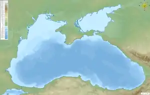 Krasnoperekopsk Krasnoperekopsk (Black Sea) | |
| Coordinates: 45°58′3″N 33°48′1″E / 45.96750°N 33.80028°E | |
| Country | Territory of Ukraine, occupied by Russia[1] |
| Republic | Crimea |
| Area | |
| • Total | 22 km2 (8 sq mi) |
| Elevation | 5 m (16 ft) |
| Population (2014) | |
| • Total | 26 268 |
| • Density | 1,395.45/km2 (3,614.2/sq mi) |
| Time zone | UTC+3 (MSK) |
| Postal code | 96000–96005 |
| Area code | +7-36565 |
Yany Kapu[2] (Ukrainian: Яни Капу), until 2023 Krasnoperekopsk[lower-alpha 1] is a town in Crimea. Following the 2014 annexation of Crimea, it was incorporated into Russia's Republic of Crimea, though the territory is recognised by a majority of countries as part of Ukraine within the Autonomous Republic of Crimea. It is the administrative center of Krasnoperekopsk Raion. Administratively is not a part of the raion (district) and incorporated separately as a town of regional significance. Population: 26,268 (2014 Census).[3]
It is located on the southern part of the Perekop Isthmus, on the shore of the Stare Lake, and about 124 kilometres (77 mi) from the Crimean capital, Simferopol. It lies on the Dzhankoy-Kherson railroad line (one of the two railroad lines connecting the Crimea and the rest of the continent).
History
The city was founded as Bromzavod (Russian: Бромзавод) in 1932 as an industrial settlement for the bromine factory constructed near the Stare Lake (Crimean-Tatar name: Tuzla gölü, Тузла голю, Lake Tuzla, "Salty lake"). In 1936, the settlement became known as Krasno-Perekopsk (Красно-Перекопск) in honor of the Bolshevik-siding forces who stormed Perekop in 1920.[4] In 1964, the name was changed to Krasnoperekopsk, and in 1966, it received the status of a city.
On 12 May 2016, Ukrainian authorities[nb 1] renamed the city Yany Kapu, Ukrainian: Яни Капу; (Crimean Tatar: Yañı Qapı) as part of its decommunization efforts. The renaming will be in effect, when Ukraine take back control of Crimea.[8]
Economy
- Crimean Soda Plant, a major manufacturer of sodium carbonate[9]
- Brom Joint Stock Company, manufactures bromine and bromine-based non-organic and organic compounds
Demographics
| Nationality | Inhabitants | Percentage |
|---|---|---|
| Russians | 16,561 | 52.9% |
| Ukrainians | 13,602 | 43.5% |
| Crimean Tatars | 1,121 | 3.6% |
| Total: | 31,284 | 100% |
Geography
Climate
Krasnoperekopsk's climate is mostly dry and hot in the summer, and mild in the winter. The average temperature ranges from −2.4 °C (27.7 °F) in January, to 23.3 °C (73.9 °F) in July. The average precipitation is 336 mm (13.2 in) per year.
International relations
Twin towns – Sister cities
Krasnoperekopsk is twinned with:
 Dzerzhinsky, Russia[10]
Notes
- ↑ Since the 2014 Crimean crisis, the status of the Crimea and of the city of Sevastopol is under dispute between Russia and Ukraine; Ukraine and the majority of the international community considers the Crimea and Sevastopol an integral part of Ukraine, while Russia, on the other hand, considers the Crimea and Sevastopol an integral part of Russia, with Sevastopol functioning as a federal city within the Crimean Federal District.[5][6][7]
- ↑ Crimean Tatar: Yañı Qapı Russian: Яны Капу, Краснопереко́пск, Ukrainian: Яни Капу, Краснопереко́пськ
References
- ↑ This place is located on the Crimean peninsula, which is internationally recognized as part of Ukraine, but since 2014 under Russian occupation. According to the administrative-territorial division of Ukraine, there are the Ukrainian divisions (the Autonomous Republic of Crimea and the city with special status of Sevastopol) located on the peninsula. Russia claims these as federal subjects of the Russian Federation (the Republic of Crimea and the federal city of Sevastopol).
- ↑ "Про перейменування окремих населених пунктів та районів Автономної Республіки Крим та міста Севастополя". Офіційний вебпортал парламенту України (in Ukrainian). Retrieved 2023-10-06.
- ↑ Russian Federal State Statistics Service (2014). "Таблица 1.3. Численность населения Крымского федерального округа, городских округов, муниципальных районов, городских и сельских поселений" [Table 1.3. Population of Crimean Federal District, Its Urban Okrugs, Municipal Districts, Urban and Rural Settlements]. Федеральное статистическое наблюдение «Перепись населения в Крымском федеральном округе». ("Population Census in Crimean Federal District" Federal Statistical Examination) (in Russian). Federal State Statistics Service. Retrieved January 4, 2016.
- ↑ КРАСНОПЕРЕКОПСЬК, a Soviet-era article
- ↑ Gutterman, Steve. "Putin signs Crimea treaty, will not seize other Ukraine regions". Reuters.com. Retrieved 26 March 2014.
- ↑ "Ukraine crisis timeline". BBC News.
- ↑ UN General Assembly adopts resolution affirming Ukraine's territorial integrity Archived 2018-03-04 at the Wayback Machine, China Central Television (28 March 2014)
- ↑ Верховна Рада України; Постанова від 12.05.2016 № 1352-VIII Про перейменування окремих населених пунктів та районів Автономної Республіки Крим та міста Севастополя (in Ukrainian)
- ↑ Soda Plant website
- ↑ "Дзержинский О городе" (in Russian). Archived from the original on 2018-10-09. Retrieved 2019-06-04.
External links
- Official website Archived 2019-05-18 at the Wayback Machine (in Russian)
- Registration card at Verkhovna Rada
- Krasnoperekopsk travel Guide in Russian
