Kreypau | |
|---|---|
 Coat of arms | |
Location of Kreypau | |
 Kreypau 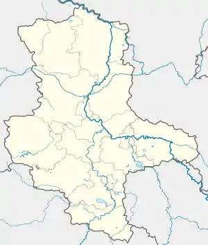 Kreypau | |
| Coordinates: 51°20′N 12°3′E / 51.333°N 12.050°E | |
| Country | Germany |
| State | Saxony-Anhalt |
| District | Saalekreis |
| Town | Leuna |
| Area | |
| • Total | 12.38 km2 (4.78 sq mi) |
| Elevation | 87 m (285 ft) |
| Population (2006-12-31) | |
| • Total | 337 |
| • Density | 27/km2 (71/sq mi) |
| Time zone | UTC+01:00 (CET) |
| • Summer (DST) | UTC+02:00 (CEST) |
| Postal codes | 06231 |
| Dialling codes | 03462 |
Kreypau is a village and a former municipality in the district Saalekreis, in Saxony-Anhalt, Germany. Since 31 December 2009, it is part of the town Leuna.
Geography
Kreypau is located between Leuna und Leipzig on the right bank of the river Saale.
History
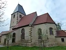
Church in Kreypau
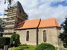
Village church Wölkau, September 2021
Kreypau was a small farming village. The village church wa built in 1550/51, the tower in 1530. The village church of Wölkau was no used from 1996 until its renovation on 2018/2019.
%252C_view_of_the_village.jpg.webp) View of the village Kreypau
View of the village Kreypau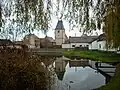 Pond and church in Kreypau
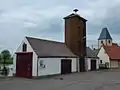 Fire station in Kreypau
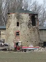 Ruin of windmill in Kreypau, 2011
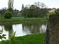 River Saale at former ferry crossing near Kreypau. Leuna is in the background
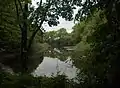 Old Saale riverbed near Kreypau
.jpg.webp) Aerial photo 2021
Aerial photo 2021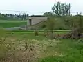 Construction works for the Saale-Elster-Kanal in Kreypau, in the backgroundd Leuna
 West side of the ruined canal lock, Wüsteneutzsch
This article is issued from Wikipedia. The text is licensed under Creative Commons - Attribution - Sharealike. Additional terms may apply for the media files.