| Lake Ciecere | |
|---|---|
| Cieceres ezers (Latvian) | |
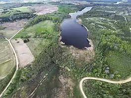
 Aerial view of Lake Ciecere | |
 Lake Ciecere | |
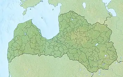
| Location | Saldus Municipality |
| Coordinates | 56°39′21″N 22°33′38″E / 56.65583°N 22.56056°E |
| Primary inflows | Dūņupe, Mazupe |
| Primary outflows | Ciecere |
| Basin countries | Latvia |
| Max. length | 9.5 km (5.9 mi) |
| Max. width | 0.4 km (0.25 mi) |
| Surface area | 2.768 km2 (1.069 sq mi) |
| Average depth | 7.2 m (24 ft) |
| Max. depth | 22 m (72 ft) |
| Surface elevation | 100.3 m (329 ft) |
| Islands | Oak Island |
| Settlements | Brocēni |
Lake Ciecere (Latvian: Cieceres ezers) is a lake in the southern part of Latvia, near the town of Brocēni in Saldus Municipality, Latvia. The lake has the status of a nature reserve.[1]
Geography
The area of the lake is 276.8 hectares. The lake is stretched from north to south; its length is 9.5 km, and its maximum width is 0.4 km.
It is a proglacial lake located in a furrow and is the most expressive example of this type of lake in Latvia. In some places the lake is reminiscent of a river. It is sandy and muddy. Its shores are in places cliffs. One large island is Oak Island (Latvian: Ozolu), which has an area of 14 hectares.
From 1923 to 1977 this island had the status of a natural monument, and from 1977 to 1999 it was a botanical reserve.[1]
The rivers Dunupe and Mazupe flow into the lake, and the river Ciecere flows out of it.
Previously, it was believed that lake has a maximum depth of 50 m, but measurements carried out in 2000 showed that it is no deeper than 22 m.[1]
Fauna
There are seven species of fish in the lake, including common carp, northern pike, European eel, and zander.[2]
References
- 1 2 3 Cieceres ezers www.ezeri.lv database
- ↑ Cieceres Ezers Fishbrain
External links
 Media related to Ciecere Lake (category) at Wikimedia Commons