Anhalt-Bitterfeld | |
|---|---|
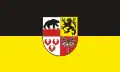 Flag 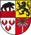 Coat of arms | |
| Country | Germany |
| State | Saxony-Anhalt |
| Capital | Köthen (Anhalt) |
| Area | |
| • Total | 1,455.1 km2 (561.8 sq mi) |
| Population (31 December 2021)[1] | |
| • Total | 155,900 |
| • Density | 110/km2 (280/sq mi) |
| Time zone | UTC+01:00 (CET) |
| • Summer (DST) | UTC+02:00 (CEST) |
| Vehicle registration | ABI, AZE, BTF, KÖT, ZE |
| Website | www.anhalt-bitterfeld.de |
Anhalt-Bitterfeld is a district in Saxony-Anhalt, Germany. Its capital is Köthen (Anhalt). Its area is 1,455.1 km2 (561.8 sq mi).[2]
History
This district was established by merging the former districts of Bitterfeld, Köthen and a large part of Anhalt-Zerbst as part of the reform of 2007.
Former Verwaltungsgemeinschaft
- Osternienburg, disbanded in 2010.
- Raguhn, disbanded in 2010.
Towns and municipalities
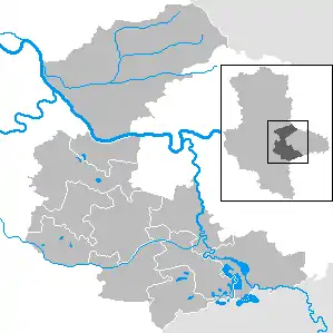
Clickable map of towns and municipalities in the district
The district Anhalt-Bitterfeld consists of the following subdivisions:[3]
| Towns | Municipalities |
|---|---|
References
- ↑ "Bevölkerung der Gemeinden – Stand: 31. Dezember 2021" (PDF) (in German). Statistisches Landesamt Sachsen-Anhalt. June 2022.
- ↑ "Tabellen Bodenfläche". Statistisches Landesamt Sachsen-Anhalt. Retrieved 20 November 2022.
- ↑ "Statistisches Landesamt Sachsen-Anhalt". Archived from the original on 2017-05-15. Retrieved 2009-08-06.
![]() Media related to Landkreis Anhalt-Bitterfeld at Wikimedia Commons
Media related to Landkreis Anhalt-Bitterfeld at Wikimedia Commons
| Urban districts | |
|---|---|
| Rural districts | |
| Former districts | |
51°43′N 12°4′E / 51.717°N 12.067°E
This article is issued from Wikipedia. The text is licensed under Creative Commons - Attribution - Sharealike. Additional terms may apply for the media files.