| City of Caloundra Queensland | |||||||||||||||
|---|---|---|---|---|---|---|---|---|---|---|---|---|---|---|---|
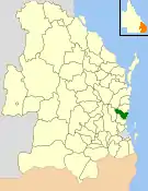
 Location within Queensland | |||||||||||||||
| Population | 90,341 (2006 census)[1] | ||||||||||||||
| • Density | 82.647/km2 (214.054/sq mi) | ||||||||||||||
| Established | 1912 | ||||||||||||||
| Area | 1,093.1 km2 (422.0 sq mi) | ||||||||||||||
| Council seat | Caloundra | ||||||||||||||
| Region | Sunshine Coast | ||||||||||||||
 | |||||||||||||||
| Website | City of Caloundra | ||||||||||||||
| |||||||||||||||
The City of Caloundra was a local government area about 90 kilometres (56 mi) north of Brisbane in the Sunshine Coast region of South East Queensland, Australia. The shire covered an area of 1,093.1 square kilometres (422.0 sq mi); it existed as a local government entity from 1912 until 2008, when it amalgamated with councils further north to form the Sunshine Coast Region.
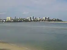
The City covered the urban localities of Caloundra and Kawana Waters and surrounding suburbs, the northern half of Bribie Island and the western hinterland towns of Landsborough, Maleny and Witta.
History
In 1868, the Queensland Government opened up large areas of land for settlement in the Caloundra area which became home to pioneers and timber cutters seeking red cedar wood.[2]
The area was originally incorporated as part of the Caboolture Division on 11 November 1879 under the Divisional Boards Act 1879.[3] With the passage of the Local Authorities Act 1902, Caboolture Division became Shire of Caboolture on 31 March 1903.[3][4]
On 22 February 1912, part of the Shire of Caboolture was split away and was proclaimed as the Shire of Landsborough.[4][5][6] John Tytherleigh, a local businessman with stores in the area, was elected its first chairman and they quickly set to work building the (now heritage-listed) Landsborough Shire Council Chambers in Landsborough. It was reconstructed from local timbers under the guidance of architect Walter Voller in 1924, and the building is today used as a museum housing artefacts including former Premier Frank Nicklin's personal collection.[7]
The first female councillor was Miriam Westaway (née Costello) who represented Division 5 from 29 April 1961 to 30 March 1973. She was one of the first teachers at Caloundra State School. She was active in community groups such as the RSL Women's Auxiliary and a founder of the Caloundra Branch of the Queensland Country Women's Association and the local branch of the Red Cross.[8]
On 19 December 1987, the Shire of Landsborough was granted city status, and was renamed the City of Caloundra,[6][9] reflecting the population boom in the coastal section of the City. The Council Chambers were relocated to Omrah Avenue, Caloundra, and Jack Beausang, the long-serving Chairman of the Shire of Landsborough, was sworn in as its first mayor. He retired undefeated on 17 March 1988, and Don Aldous was elected to replace him.

On 15 March 2008, under the Local Government (Reform Implementation) Act 2007 passed by the Parliament of Queensland on 10 August 2007, the City of Caloundra merged with the Shire of Noosa and the Shire of Maroochy to form the Sunshine Coast Region. However, in 2014, Shire of Noosa was re-established as independent of the Sunshine Coast Region.
Structure
The Shire was subdivided into ten numbered divisions, each of which returned one councillor, and an elected mayor.
Towns and localities
The City of Caloundra included the following settlements:
|
1 - split with the Shire of Maroochy
Population
| Year | Population- |
|---|---|
| 1933 | 4,752 |
| 1947 | 6,460 |
| 1954 | 7,765 |
| 1961 | 8,319 |
| 1966 | 8,798 |
| 1971 | 11,314 |
| 1976 | 16,982 |
| 1981 | 29,705 |
| 1986 | 36,486 |
| 1991 | 53,434 |
| 1996 | 66,336 |
| 2001 | 75,261 |
| 2006 | 90,341 |
Chairmen and mayors
- 1921–1924: John H. Tytherleigh
- 1924–1933: J. Grigor[10]
- 1933–1949: H. M. Bray
- 1949–1955: A. Fleming
- 1955–1958: Duncan MacDonald
- 1958–1961: H. W. Anning
- 1961–1964: Duncan MacDonald
- 1964–1988: Jack Beausang
- 1988–1991: Don C. Aldous
- 1991–1994: Barry Gray
- 1994–2000: Des J. Dwyer
- 2000–2008: Don C. Aldous
See also
References
- ↑ Australian Bureau of Statistics (25 October 2007). "Caloundra (C) (Local Government Area)". 2006 Census QuickStats. Retrieved 21 March 2008. Map
- ↑ City of Caloundra. "Caloundra's Heritage and History". Archived from the original on 20 January 2008. Retrieved 21 March 2008.
- 1 2 "Agency ID 549, Caboolture Divisional Board". Queensland State Archives. Retrieved 20 September 2013.
- 1 2 "Agency ID 550, Caboolture Shire Council". Queensland State Archives. Retrieved 20 September 2013.
- ↑ Queensland Government Gazette, 22 February 1912, p. 435.
- 1 2 "Agency ID 1069, Landsborough Shire Council". Queensland State Archives. Retrieved 20 September 2013.
- ↑ Museum & Gallery Services Queensland. "Landsborough Museum – A Caloundra City Heritage Centre" (PDF). Retrieved 21 March 2008.
- ↑ Unknown (2012). "Landsborough Shire Councillor Miriam Westaway, ca 1965". Retrieved 1 January 2019.
- ↑ Queensland Government Gazette, 19 December 1987, p.1465.
- ↑ Pugh, Theophilus Parsons (1927). Pugh's Almanac for 1927. Retrieved 13 June 2014.
Further reading
- Riis, Erica (2002). The growth of Caloundra. Shire of Landsborough Historical Society Museum. (161 pages)
- Wensley, Anne (1977). An introduction to the history of Caloundra. Shire of Landsborough Historical Society Museum. ISBN 0-9596510-0-4. (37 pages)
External links
- Caloundra City Council website at the Wayback Machine (archived 15 July 2007)
 Media related to Shire of Landsborough at Wikimedia Commons