| Districts of Lumbini | |
|---|---|
| |
| Category | Jilla |
| Location | Nepal |
| Created |
|
| Number | 12 (as of 20 September 2015) |
| Populations | 880,196 – 53,018 |
| Areas | 2,955 square kilometres (1,141 sq mi) - 634 square kilometres (245 sq mi) |
| Government | |
| Subdivisions | |
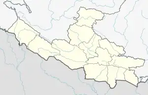
Lumbini Province is divided into 12 districts. A district is administered by the head of the District Coordination Committee and the District Administration Officer. The districts are further divided into municipalities or rural municipalities.[1]
District official include
- Chief District Officer, an official under Ministry of Home Affairs is appointed by the government as the highest administrative officer in a district. The C.D.O is responsible for proper inspection of all the departments in a district such as health, education, security and all other government offices.
- District Coordination Committee acts as an executive to the District Assembly. The DCC coordinates with the Provincial Assembly to establish coordination between the Provincial Assembly and rural municipalities and municipalities and to settle disputes, if any, of political nature. It also maintains coordination between the provincial and Federal government and the local bodies in the district.
 Districts of Nepal in 1952
| Districts | Nepali | Headquarters | Area (km2.) | Population (2011) | Official Website |
|---|---|---|---|---|---|
| Kapilvastu District | कपिलवस्तु जिल्ला | Taulihawa | 1,738 | 571,936 | |
| Nawalparasi (West of Bardaghat Susta) District[2] | नवलपरासी (बर्दघाट सुस्ता पश्चिम) | Ramgram | 634.88 | 321,058 | |
| Rupandehi District | रुपन्देही जिल्ला | Siddharthanagar | 1,360 | 880,196 | |
| Arghakhanchi District | अर्घाखाँची जिल्ला | Sandhikharka | 1,193 | 197,632 | |
| Gulmi District | गुल्मी जिल्ला | Tamghas | 1,149 | 280,160 | |
| Palpa District | पाल्पा जिल्ला | Tansen | 1,373 | 261,180 | |
| Dang Deukhuri District | दाङ देउखुरी जिल्ला | Ghorahi | 2,955 | 552,583 | |
| Pyuthan District | प्युठान जिल्ला | Pyuthan | 1,309 | 228,102 | |
| Rolpa District | रोल्पा जिल्ला | Liwang | 1,879 | 224,506 | |
| Eastern Rukum District[3] | पूर्वी रूकुम जिल्ला | Rukumkot | 1,161.13 | 53,018 | |
| Banke District | बाँके जिल्ला | Nepalganj | 2,337 | 491,313 | |
| Bardiya District | बर्दिया जिल्ला | Gulariya | 2,025 | 426,576 | |
| Lumbini Province | लुम्बिनी प्रदेश | Deukhuri | 22,288 km² | 4,499,272 |
See also
References
- ↑ "स्थानिय तह". 2018-08-31. Archived from the original on 2018-08-31. Retrieved 2021-01-02.
- ↑ "Govt decides to divide parts of Rukum and Nawalparasi". kathmandupost.com. Retrieved 2021-01-02.
- ↑ "Govt decides to divide parts of Rukum and Nawalparasi". kathmandupost.com. Retrieved 2021-01-02.
This article is issued from Wikipedia. The text is licensed under Creative Commons - Attribution - Sharealike. Additional terms may apply for the media files.