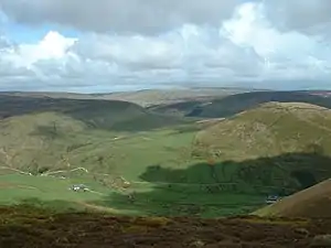
Whin Fell, part of the Bowland Fells SSSI
The list below shows the 69 Sites of Special Scientific Interest (SSSIs) in the Lancashire area of search. Note that English Nature, the designating body for SSSIs in England, uses the 1974-1996 county system, and this list follows the same approach. Some sites that might be expected to be here could therefore be in the Merseyside or Greater Manchester lists.
Of the 69 sites listed, 14 are listed purely for their geological interest, and 49 are listed for biological interest. A further 6 sites have both geological and biological significant features.
For other counties, see List of SSSIs by Area of Search.
Sites
Notes
- A Reason for designation; either for the site's biological interest, or its geological interest.
- B Data rounded to one decimal place.
- C Grid reference is based on the British national grid reference system, also known as OSGB36, and is the system used by the Ordnance Survey.[70]
- D Link to maps using the Nature on the Map service provided by Natural England.
References
- ↑ "Artle Dale" (PDF).
- ↑ "Barn Gill Meadow" (PDF).
- ↑ "Beeston Brook Pasture" (PDF).
- ↑ "Bell Sykes Meadows" (PDF).
- ↑ "Bowland Fells" (PDF).
- ↑ "Burton Wood" (PDF).
- ↑ "Calf Hill And Cragg Woods" (PDF).
- ↑ "Charnock Richard Pasture" (PDF).
- ↑ "Clear Beck Meadow" (PDF).
- ↑ "Clitheroe Knoll Reefs" (PDF).
- ↑ "Cock Wood Gorge" (PDF).
- ↑ "Cockerham Marsh" (PDF).
- ↑ "Coldwell Farm Pasture" (PDF).
- ↑ "Coplow Quarry" (PDF).
- ↑ "Crag Bank" (PDF).
- ↑ "Cringlebarrow And Deepdale" (PDF).
- ↑ "Darwen River Section" (PDF).
- ↑ "Downholland Moss" (PDF).
- ↑ "Eaves Wood" (PDF).
- ↑ "Far Holme Meadow" (PDF).
- ↑ "Field Head Meadow" (PDF).
- ↑ "Gait Barrows" (PDF).
- ↑ "Gale Clough And Shooterslee Wood" (PDF).
- ↑ "Harper Clough And Smalley Delph Quarries" (PDF).
- ↑ "Hawes Water" (PDF).
- ↑ "Heysham Moss" (PDF).
- ↑ "Hodder River Section" (PDF).
- ↑ "Hodge Clough" (PDF).
- ↑ "Jack Scout" (PDF).
- ↑ "Langcliff Cross Meadow" (PDF).
- ↑ "Leck Beck Head Catchment Area" (PDF).
- ↑ "Lee Quarry" (PDF).
- ↑ "Leighton Moss" (PDF).
- ↑ "Light Clough" (PDF).
- ↑ "Little Mearley Clough" (PDF).
- ↑ "Longworth Clough" (PDF).
- ↑ "Lower Red Lees Pasture" (PDF).
- ↑ "Lune Estuary" (PDF).
- ↑ "Lytham Coastal Changes" (PDF).
- ↑ "Lytham St. Anne'S Dunes" (PDF).
- ↑ "Martin Mere, Burscough" (PDF).
- ↑ "Marton Mere, Blackpool" (PDF).
- ↑ "Mere Sands Wood" (PDF).
- ↑ "Morecambe Bay" (PDF).
- ↑ "Myttons Meadows" (PDF).
- ↑ "New Ing Meadow" (PDF).
- ↑ "Newton Marsh" (PDF).
- ↑ "Oak Field" (PDF).
- ↑ "Ravenhead Brickworks" (PDF).
- ↑ "Red Scar And Tun Brook Woods" (PDF).
- ↑ "Ribble Estuary" (PDF).
- ↑ "Robert Hall Moor" (PDF).
- ↑ "Roeburndale Woods" (PDF).
- ↑ "Rough Hey Wood" (PDF).
- ↑ "Salthill And Bellmanpark Quarries" (PDF).
- ↑ "Silverdale Golf Course" (PDF).
- ↑ "South Pennine Moors" (PDF).
- ↑ "Standridge Farm Pasture" (PDF).
- ↑ "Tarnbrook Meadows" (PDF).
- ↑ "Thrang End And Yealand Hall Allotment" (PDF).
- ↑ "Thrang Wood" (PDF).
- ↑ "Thwaite House Moss" (PDF).
- ↑ "Trowbarrow Quarry" (PDF).
- ↑ "Warton Crag" (PDF).
- ↑ "White Coppice Flush" (PDF).
- ↑ "White Moss" (PDF).
- ↑ "Winmarleigh Moss" (PDF).
- ↑ "Wrightington Bar Pasture" (PDF).
- ↑ "Wyre Estuary" (PDF).
- ↑ "Guide to National Grid". Ordnance Survey. Archived from the original on 27 October 2007. Retrieved 2 July 2007.
External links
This article is issued from Wikipedia. The text is licensed under Creative Commons - Attribution - Sharealike. Additional terms may apply for the media files.