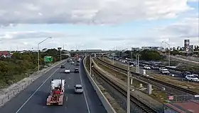
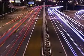
Australian Capital Territory
Canberra region
![]()
Other freeways (no route number)
Gallery
.jpg.webp) Tuggeranong Parkway
Tuggeranong Parkway
New South Wales
New South Wales has the largest number and second highest density of motorways in Australia (behind Victoria), with the majority being located in Sydney City or the metropolitan areas.
Metropolitan Sydney region (urban motorways)
- Speed limit varies between 60 km/h and 110 km/h.
![]()
- Gore Hill Freeway
- Warringah Freeway
- Sydney Harbour Tunnel (tolled for southbound traffic)
- Cahill Expressway
- Eastern Distributor (tolled for northbound traffic)
- Southern Cross Drive
- General Holmes Drive, the Airport Tunnel
![]()
- Lane Cove Tunnel (tolled)
- M2 Hills Motorway
![]()
- Mona Vale Road (St Ives to Belrose, freeways grade road)
- Homebush Bay Drive (Freeway grade for southbound only)
![]()
![]()
- M4 Western Motorway (tolled east of Church Street, Parramatta)
- M4 East (tolled)
- Rozelle Interchange
- Anzac Bridge
- Western Distributor Freeway
- Bradfield Highway (toll)
![]()
- M5 South-West Motorway (tolled East of Heathcote Road, Liverpool and on Belmore Road Exit)
- M5 East Motorway (tolled)
![]()
- Westlink M7 Motorway (tolled)
![]()
![]()
![]()
- The Northern Road
(Oran Park to Bringelly, freeway grade road as part of the Northern Road Upgrades)
![]()
- NorthConnex (tolled)
![]()
![]()
- James Ruse Drive (North of Hassall Street)
- Gladesville Bridge, Hunters Hill – This route was built as part of the F3 but was cancelled.
![]()
- M31 Hume Motorway (Urban Motorway from M5/M7 up to Campbelltown)
![]()
- Warringah Road Underpass
Unnumbered freeway-grade roads
- Cross City Tunnel (tolled)
- Burns Bay Road (South of Lane Cove West) – This route was built as part of the F3 but was cancelled.
- Captain Cook Bridge – The only bit of F6 inside Sydney as a proposed extension but cancelled[1]
- Syd Einfeld Drive (The only part of F7)
Hunter and Central Coast region (rural and urban motorways)
- Speed limit varies between 60 km/h and 110 km/h.
![]()
- M1 Pacific Motorway (Sydney to Newcastle) (Formerly known as the
 )
)
![]()
![]()
![]()
- Teal Street and Stockton Bridge (Freeway Grade Road)[2][3]
- Nelson Bay Road – 30% of this road is freeway grade (See full freeway grade route here )
![]()
![]()
- Motorway Link road (
 only, not part of
  )
)
South Coast region (rural and urban motorways)
![]()
![]()
- Memorial Drive (Wollongong) – Most of this road is freeway grade[4] – (The south 4 km of the road and the north 3 km of the road are, the central bit isn't though)
![]()
- Princes Highway, 16% of which is of motorway or dual carriageway standard.
Rural region (rural motorways)
- Speed limit varies between 90 km/h and 110 km/h.
![]()
![]()
- Pacific Motorway (Northern NSW, from Ballina to QLD border)
- Pacific Highway, 100% of which is of motorway or dual carriageway standard, except for through Coffs Harbour[5] and between Beresfield and Raymond Terrace[6] – but still two lanes as arterial standards in each direction.
![]()
![]()
- Barton Highway – 21% of which is of motorway or dual carriageway standard, with the remainder under construction and proposed for completion by the end of 2023. See freeway route here
![]()
- Hume Motorway
- Hume Highway, 100% of which is dual carriageway standard.
![]()
- Great Western Highway – Lithgow to Mount Lambie
Under construction
![]()
- M1 Princes Motorway Extension
- Pacific Motorway
![]()
![]()
- WestConnex Stage 3 (Major multibillion-dollar tollway/tunnels, connecting the M4 East to A4 Western Distributor and M5 East) – To be completed by 2023.
- Sydney Gateway (Connecting Sydney Airport to the St Peters Interchange and WestConnex)
![]()
- Barton Highway duplication project (To be Completed by mid 2023)
![]()
- Newcastle Inner City Bypass Stage 5
In planning
![]()
- M1 Pacific Motorway Extension
- Newcastle Bypass
- M1 Coffs Harbour Bypass
![]()
- Southconnex – M6 Motorway (Sydney) (F6 extension) – To be Complete by 2024.
![]()
- Western Harbour Tunnel (Major multibillion-dollar tollway/tunnels, connecting WestConnex with the Warringah Freeway)
- Western Harbour Tunnel and Warringah Freeway Upgrade
![]()
![]()
- Outer Sydney Orbital – Estimated to be completed in 2040.
![]()
- Western Sydney Airport Motorway (Major multimillion-dollar motorway, connecting the future Western Sydney Airport to the Westlink M7 Motorway)
Gallery
 M1 Pacific Motorway
M2_Motorway.jpg.webp) M2 Hills Motorway
M2 Hills Motorway M4 Western Motorway
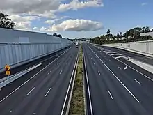 M5 East Motorway
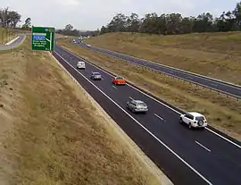 M7 WestLink
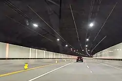 M8 WestConnex
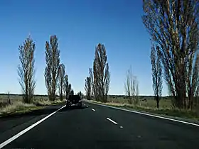 M23 Federal Highway
 M31 Hume Highway
Northern Territory
While the Northern Territory doesn't have any official freeways, parts of the Stuart Highway and the Tiger Brennan Drive are freeway grade roads with grade separate intersections.
![]()
- Tiger Brennan Drive
Queensland
Brisbane region
![]()
![]()
- Bruce Highway (Bald Hills to Kybong)
- Gateway Motorway (Eight Mile Plains to Bald Hills)
- Pacific Motorway (NSW/QLD Border to Eight Mile Plains)
![]()
- Ipswich Motorway (Goodna to Dinmore)
- Warrego Highway (Dinmore to Muirlea)
- Logan Motorway (
 Gailes to Drewvale, Electronically Tolled)
 - Gateway Motorway (
 Drewvale to Eight Mile Plains, Electronically Tolled)
![]()
- Inner City Bypass (Hale Street to Ludwyche Road)
- Pacific Motorway
- Riverside Expressway
- Gympie Arterial Road
- Hale Street
![]()
![]()
![]()
- Logan Motorway (Drewvale to Loganholme, Electronically Tolled)
![]()
- Ipswich Motorway (Goodna to Rocklea)
- Airport Link Tunnel (
 Electronically Tolled)
 - Clem Jones Tunnel (Clem7) (
 Electronically Tolled)
![]()
'No shield'
- Southern Cross Way
- Inner City Bypass (Lutwyche Road to Kingsford Drive)
Motorway grade roads
![]()
- Moreton Bay Road (Freeway grade from Chandler to Capalaba)
![]()
- Mount Lindesay Highway (Freeway grade from Drewvale to North MacLean – see full route here )
Former motorways
- Story Bridge Expressway
Gold Coast region
![]()
![]()
Sunshine Coast region
![]()
![]()
Regional Queensland
![]()
![]()
![]()
![]()
- Toowoomba Bypass
- Warrego Highway (Helidon Spa to Charlton;
 /
/ Helidon Spa to Mort Street Electronically tolled)
 - Gore Highway (Charlton to Athol)
- Warrego Highway (Helidon Spa to Charlton;
South Australia
In South Australia, expressway may refer to a controlled access highway with no at-grade intersections or a limited access road of slightly lower standard with at-grade intersections at some locations.
Unlike some other states, South Australia only uses the 'M' designation on grade separated freeways
![]()
![]()
- Princes Highway (SE Freeway to Tailem Bend)
- South Eastern Freeway
- Port Wakefield Road (Expressway grade road from Virginia to Port Wakefield)
![]()
- Northern Expressway
- North–South Motorway (incomplete, under construction in stages)
- Southern Expressway
![]()
- Port River Expressway
- Salisbury Highway – freeway grade from Port Wakefield Road to North–South Motorway
![]()
- Gawler Bypass – freeway grade road
Planned/proposed
![]()
- North–South Motorway: River Torrens to Darlington upgrade of South Road under investigation.
Tasmania

While Tasmania's highway network has been constructed to a high standard, its grade-separated freeway network is limited. In the past, Hobart and Launceston have each had comprehensive transport studies conducted, proposing grade-separated freeways running through and around them. While some of these roads have been constructed, the majority are limited access featuring at-grade intersections. Devonport and Burnie are the only major population centres with freeway standard roads linking each other. There have been repeated proposals in recent years to fully upgrade the Midland Highway to grade-separated freeway standard.[7][8]
This List is limited to Tasmania's freeway-standard roads.
Hobart region
![]()
![]()
![]()
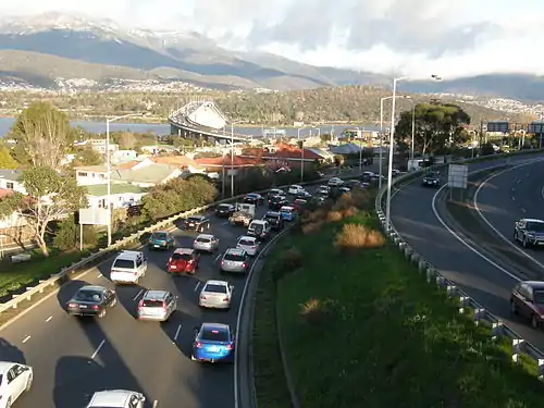
- Southern Outlet (Hobart to Kingston)
![]()
Rural region
![]()
- Bass Highway (Burnie to Devonport and Prospect to Illawarra Main Road)
- Midland Highway (South Launceston to Breadalbane)
Victoria
Victoria has the second largest number (behind New South Wales) and highest density of freeways in Australia, with the majority being located in Melbourne City or the metropolitan areas. While most of Australia has a low population density over a large area, where towns are sparse or located a significant distance from each other; Victoria has towns located throughout the entire state, with large numbers of inhabitants, in both urban and rural areas (many of which are major) such as Ballarat or Bendigo. In addition to the roads listed below, Victoria has a number of dual carriageway standard Highways that are given an "M" designation. Whilst these roads are not officially Freeway standard, many of them may have a number of grade-separated intersections along the route. These routes are not listed below.
Melbourne region (urban freeways)
- Freeways within Greater Melbourne,[9] speed limit varies between 60 km/h and 100 km/h.
![]()
![]()
- CityLink (Southern Link, Fully electronically tolled)
- Monash Freeway
- Princes Freeway (East) (from Narre Warren to Pakenham, continues past Pakenham as Rural Freeway)
- Princes Freeway (West) (from Laverton North to Werribee, continues past Werribee as Rural Freeway)
- West Gate Freeway
Note: "East" and "West" sections of Princes Freeway are officially part of the same freeway and route corridor.
![]()
![]()
- CityLink (Western Link, Fully electronically tolled)
- Tullamarine Freeway
![]()
![]()
- Eastern Freeway
- EastLink (Fully electronically tolled)
- Frankston Freeway
![]()
- Western Freeway (from Derrimut to Melton West, continues past Melton West as Rural Freeway)
![]()
![]()
- Hume Freeway (from Thomastown to Wallan, continues past Wallan as Rural Freeway) – Not entirely freeway standard, In Kalkallo there is residential property, business and local road access with 80 km/h speed limit.
![]()
- Calder Freeway (from Essendon North to Keilor North, continues past Keilor North as Rural Freeway)
![]()
![]()
Other freeway grade roads
These roads are officially designated by the Victorian Government as Freeways and may include some freeway signage, but are generally not considered part of the Melbourne freeway network.
- Airport Drive (from Western Ring Road to Sharps Road, officially Freeway grade road)[10]
![]()
- Ringwood Bypass (from EastLink to Ringwood Street, officially Freeway grade road)[11][12]
Rural region (rural freeways)
On freeways outside of Greater Melbourne,[9] the speed limit varies between 80 km/h and 110 km/h.
![]()
- Princes Freeway (East) (continues at Werribee towards Melbourne as Urban Freeway)
- Princes Freeway (West) (continues at Pakenham towards Melbourne as Urban Freeway) – Not entirely freeway standard, In Yarragon and Trafalgar there is residential property, business and local road access with 60 km/h speed limit.
- Geelong Ring Road (officially part of Princes Freeway)
Note: "East" and "West" sections of Princes Freeway are officially part of the same freeway and route corridor.
![]()
- Western Freeway (continues at Melton West towards Melbourne as Urban Freeway)
![]()
- Hume Freeway (continues at Wallan towards Melbourne as Urban Freeway)
![]()
![]()
- Calder Freeway (continues at Keilor North towards Melbourne as Urban Freeway)
Under construction
- West Gate Tunnel – Under major construction, expected to be complete in 2025.
- North East Link – Under early construction, expected to be complete in 2028.
- Western Highway Duplication (Buangor to Stawell) – Commenced early construction in 2017, currently on hold due to environmental concerns[13]
Gallery
 M1 Geelong Ring Road
 M2 Tullamarine Freeway
 M3 Eastern Freeway
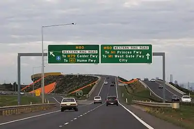 M8 Western Freeway
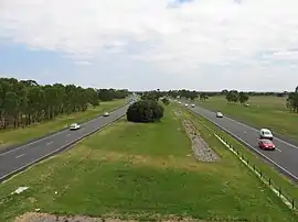 M11 Mornington Peninsula Freeway
 M31 Hume Freeway
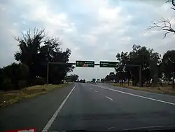 M39 Goulburn Valley Freeway
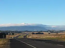 M79 Calder Freeway
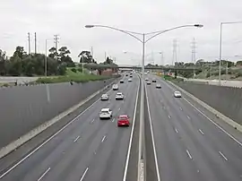 M80 Western Ring Road
Western Australia
Western Australia has three named freeways – Kwinana Freeway, Mitchell Freeway, and Graham Farmer Freeway – but in addition has several highways that are in the process of being upgraded to full freeway standard and are considered part of the Perth freeway network. Their designation may remain as a highway though due to state restrictions on heavy vehicles (e.g. road trains) that are prevented by law from travelling on any road classed as a freeway.
Perth metro freeways
![]()
- Kwinana Freeway[14] (also part of National Route 1 between Leach and Canning Highways)
- Mitchell Freeway[14]
![]()
- Reid Highway (Erindale Road to Altone Road)[14]
- Roe Highway (Morrison Road to Great Eastern Highway Bypass, Great Eastern Highway Bypass to Tonkin Highway, Tonkin Highway to Kwinana Freeway)[14]
![]()
- Tonkin Highway (Great Northern Highway at Muchea to Hale Road, Mills Road to Champion Drive[14])
![]()
- Leach Highway (Airport Drive to Welshpool Road)[15]
![]()
Rural expressways / freeways
- Forrest Highway – Southern extension of Kwinana Freeway at Mandurah through to Bunbury
- Bussell Highway – Bunbury to Capel and from the south side of Capel to Busselton
Under construction
Perth
- Mitchell Freeway southbound widening – A third southbound lane is being added from Hodges Drive to Hepburn Avenue as well as an extra lane will be built from Hepburn Avenue entry ramp to Warwick Road exit ramp.
- Tonkin Gap project – the currently heavily congested section of Tonkin Highway between Collier Road and Great Eastern Highway upgraded to 3 lanes each way dual carriageway
Rural
- Bunbury Outer Ring Road extension – the Bunbury Outer Ring Road will be a freeway between Forrest Highway and South Western Highway[16]
- Albany Ring Road – phase 1, with phase 2 to commence straight after completion of phase 1
In planning
Perth
- Mitchell Freeway Extension (Romeo Road to Moore River)[14]
- Mitchell Freeway southbound – Installation of smart freeway technology with ramp metering from Hester Avenue to Vincent Street
- Roe Highway Extension (Perth Freight Link) (Kwinana Freeway to Stirling Highway). Was under construction but this was halted at the last change of government. Its future remains unclear.
- Roe Highway upgrade (Great Eastern Highway Bypass to Great Northern Highway)
- Reid Highway upgrade (Erindale Road to Mitchell Freeway, Altone Road to Great Northern Highway)
- Tonkin Highway upgrade (Hale Road to Mills Road)
- Tonkin Highway upgrade (Champion Drive to Thomas Road)
- Tonkin Highway Extension (Thomas Road to South Western Highway, Pinjarra)
- Whiteman-Yanchep Freeway (Tonkin Highway/Gnangara Road to Mitchell Freeway (proposed)/Yanchep Beach Road)[17]
- Orrong Road Upgrade – Orrong Road to be upgraded to a 4 lane trenched expressway with service roads alongside from Graham Farmer Freeway to Leach Highway, rising onto a viaduct over Leach Highway and Division Street/Bell Street. May be extended in the future along Orrong and Welshpool Roads as far as Tonkin Highway.
- Great Eastern Highway Bypass, where all current at grade intersections are planned to be removed and the road upgraded to full freeway standard.
Rural
- Busselton Outer Bypass (BOB)
- Perth-Adelaide Freeway "Orange Route" – (Roe Highway, Stratton to Great Eastern Highway bypass at Northam)
See also
References
- ↑ "F6 Extension". Roads Australia. Retrieved 10 September 2020.
- ↑ "Google Maps". Google Maps. Retrieved 18 September 2020.
- ↑ "Google Maps". Google Maps. Retrieved 18 September 2020.
- ↑ "Google Maps". Google Maps. Retrieved 13 September 2020.
- ↑ "Construction of $1.8 billion Coffs Harbour bypass gets underway | 7NEWS". 16 December 2020. Retrieved 12 April 2022 – via YouTube.
- ↑ "M1 Pacific Motorway extension to Raymond Terrace".
- ↑ "Plan for four-lane Midland Highway". The Examiner. December 2010. Retrieved 3 November 2011.
- ↑ "Abbott Doorstop in Launceston – Midland Highway upgrade". Liberal Party of Australia. February 2010. Archived from the original on 27 February 2011. Retrieved 3 November 2011.
- 1 2 "Greater Melbourne and urban zones".
- ↑ "VicRoads Map of Declared Roads".
- ↑ "VicRoads Map of Declared Roads".
- ↑ "Google Maps Street View - Ringwood Bypass".
- ↑ "Western Highway upgrade suspended over VicRoads planning blunder". The Age. 21 February 2017. Retrieved 23 July 2023.
- 1 2 3 4 5 6 7 "Managed Freeways Policy Discussion Paper" (PDF). Main Roads Western Australia. June 2012. pp. 3, 25–26. Archived (PDF) from the original on 27 March 2019. Retrieved 27 March 2019.
- ↑ Seeber, Elisia (13 September 2015). "Grand Gateway to Perth Airport opens". PerthNow. Archived from the original on 20 February 2018. Retrieved 27 March 2019.
Leach Highway has been upgraded to expressway standard
- ↑ "Bunbury Outer Ring Road Stages 2 and 3" (PDF). Main Roads Western Australia. August 2022. Retrieved 26 December 2022.
- ↑ "Whiteman Yanchep Highway". Main Roads Western Australia. Government of Western Australia. Retrieved 12 June 2019.
