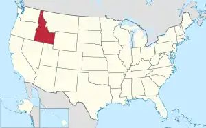
Map of the United States with Idaho highlighted
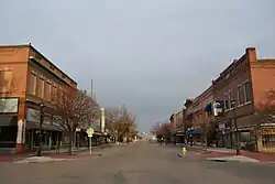
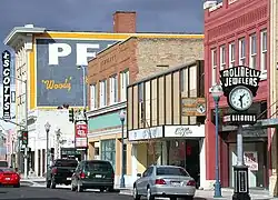
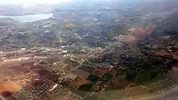
Idaho is a state located in the Western United States. According to the 2020 United States Census, Idaho is the 13th least populous state with 1,839,106 inhabitants but the 11th largest by land area spanning 82,643.12 square miles (214,044.7 km2) of land.[1] Idaho is divided into 44 counties and contains 201 municipalities legally described as cities.[2]
† County seat
†† State capital and county seat
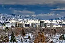
Boise, Idaho, in winter (2013)
| 2020 Rank | City | 2020 Census[3] | 2010 Census[4] | Change | County |
|---|---|---|---|---|---|
| 1 | Boise †† | 235,684 | 205,671 | +14.59% | Ada |
| 2 | Meridian | 117,635 | 75,092 | +56.65% | Ada |
| 3 | Nampa | 100,200 | 81,557 | +22.86% | Canyon |
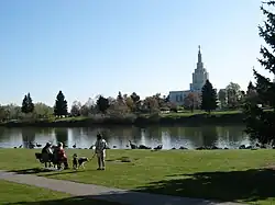
| 4 | Idaho Falls † | 64,818 | 56,813 | +14.09% | Bonneville |
| 5 | Caldwell † | 59,996 | 46,237 | +29.76% | Canyon |
| 6 | Pocatello † | 56,320 | 54,255 | +3.81% | Bannock |
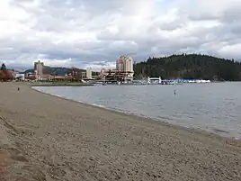
| 7 | Coeur d'Alene † | 54,628 | 44,137 | +23.77% | Kootenai |
| 8 | Twin Falls † | 51,807 | 44,125 | +17.41% | Twin Falls |
| 9 | Rexburg † | 39,409 | 25,484 | +54.64% | Madison |
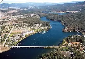
| 10 | Post Falls | 38,485 | 27,574 | +39.57% | Kootenai |
| 11 | Lewiston † | 34,203 | 31,894 | +7.24% | Nez Perce |
| 12 | Eagle | 30,346 | 19,908 | +52.43% | Ada |
| 13 | Moscow † | 25,435 | 23,800 | +6.87% | Latah |
| 14 | Kuna | 24,011 | 15,210 | +57.86% | Ada |
| 15 | Ammon | 17,694 | 13,816 | +28.07% | Bonneville |
| 16 | Mountain Home † | 15,979 | 14,206 | +12.48% | Elmore |
| 17 | Chubbuck | 15,570 | 13,922 | +11.84% | Bannock |
| 18 | Hayden | 15,570 | 13,294 | +17.12% | Kootenai |
| 19 | Jerome † | 12,349 | 10,890 | +13.40% | Jerome |
| 20 | Blackfoot † | 12,346 | 11,899 | +3.76% | Bingham |
| 21 | Garden City | 12,316 | 10,972 | +12.25% | Ada |
| 22 | Burley † | 11,704 | 10,345 | +13.14% | Cassia |
| 23 | Star | 11,117 | 5,793 | +91.90% | Ada |
| 24 | Middleton | 9,425 | 5,524 | +70.62% | Canyon |
| 25 | Rathdrum | 9,211 | 6,826 | +34.94% | Kootenai |
| 26 | Hailey † | 9,161 | 7,960 | +15.09% | Blaine |
| 27 | Sandpoint † | 8,639 | 7,365 | +17.30% | Bonner |
| 28 | Payette † | 8,127 | 7,433 | +9.34% | Payette |
| 29 | Emmett † | 7,647 | 6,557 | +16.62% | Gem |
| 30 | Rupert † | 6,082 | 5,554 | +9.51% | Minidoka |
| 31 | Fruitland | 6,072 | 4,684 | +29.63% | Payette |
| 32 | Weiser † | 5,630 | 5,507 | +2.23% | Washington |
| 33 | Preston † | 5,591 | 5,204 | +7.44% | Franklin |
| 34 | Rigby † | 5,038 | 3,945 | +27.71% | Jefferson |
| 35 | Shelley | 4,785 | 4,409 | +8.53% | Bingham |
| 36 | Kimberly | 4,626 | 3,264 | +41.73% | Twin Falls |
| 37 | American Falls † | 4,568 | 4,457 | +2.49% | Power |
| 38 | Buhl | 4,558 | 4,122 | +10.58% | Twin Falls |
| 39 | Gooding † | 3,707 | 3,567 | +3.92% | Gooding |
| 40 | Heyburn | 3,700 | 3,089 | +19.78% | Minidoka |
| 41 | McCall | 3,686 | 2,991 | +23.24% | Valley |
| 42 | St. Anthony † | 3,606 | 3,542 | +1.81% | Fremont |
| 43 | Ketchum | 3,555 | 2,689 | +32.21% | Blaine |
| 44 | Grangeville † | 3,308 | 3,141 | +5.32% | Idaho |
| 45 | Orofino † | 3,239 | 3,142 | +3.09% | Clearwater |
| 46 | Soda Springs † | 3,133 | 3,058 | +2.45% | Caribou |
| 47 | Salmon † | 3,119 | 3,112 | +0.22% | Lemhi |
| 48 | Wendell | 2,917 | 2,782 | +4.85% | Gooding |
| 49 | Homedale | 2,881 | 2,633 | +9.42% | Owyhee |
| 50 | Filer | 2,738 | 2,508 | +9.17% | Twin Falls |
| 51 | Iona | 2,717 | 1,803 | +50.69% | Bonneville |
| 52 | Montpelier | 2,643 | 2,597 | +1.77% | Bear Lake |
| 53 | Bellevue | 2,560 | 2,287 | +11.94% | Blaine |
| 54 | Dalton Gardens | 2,537 | 2,335 | +8.65% | Kootenai |
| 55 | Bonners Ferry † | 2,520 | 2,543 | −0.90% | Boundary |
| 56 | St. Maries † | 2,357 | 2,402 | −1.87% | Benewah |
| 57 | Spirit Lake | 2,337 | 1,945 | +20.15% | Kootenai |
| 58 | Kellogg | 2,314 | 2,120 | +9.15% | Shoshone |
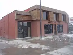
| 59 | Malad City † | 2,299 | 2,095 | +9.74% | Oneida |
| 60 | Victor | 2,157 | 1,928 | +11.88% | Teton |
| 61 | Parma | 2,096 | 1,983 | +5.70% | Canyon |
| 62 | Driggs † | 1,984 | 1,660 | +19.52% | Teton |
| 63 | Sun Valley | 1,783 | 1,406 | +26.81% | Blaine |
| 64 | Aberdeen | 1,756 | 1,994 | −11.94% | Bingham |
| 65 | Sugar City | 1,715 | 1,514 | +13.28% | Madison |
| 66 | Priest River | 1,696 | 1,751 | −3.14% | Bonner |
| 67 | Pinehurst | 1,679 | 1,619 | +3.71% | Shoshone |
| 68 | Shoshone † | 1,653 | 1,461 | +13.14% | Lincoln |
| 69 | Wilder | 1,597 | 1,533 | +4.17% | Canyon |
| 70 | Osburn | 1,567 | 1,555 | +0.77% | Shoshone |
| 71 | New Plymouth | 1,494 | 1,538 | −2.86% | Payette |
| 72 | Ponderay | 1,289 | 1,137 | +13.37% | Bonner |
| 73 | Glenns Ferry | 1,282 | 1,319 | −2.81% | Elmore |
| 74 | Marsing | 1,229 | 1,031 | +19.20% | Owyhee |
| 75 | Paul | 1,195 | 1,169 | +2.22% | Minidoka |
| 76 | Lapwai | 1,169 | 1,137 | +2.81% | Nez Perce |
| 77 | Ucon | 1,160 | 1,108 | +4.69% | Bonneville |
| 78 | Kamiah | 1,117 | 1,295 | −13.75% | Lewis |
| 79 | Hansen | 1,086 | 1,144 | −5.07% | Twin Falls |
| 80 | Genesee | 1,030 | 955 | +7.85% | Latah |
| 81 | Franklin | 1,025 | 641 | +59.91% | Franklin |
| 82 | Plummer | 1,015 | 1,044 | −2.78% | Benewah |
| 83 | Cascade † | 1,005 | 939 | +7.03% | Valley |
| 84 | Hagerman | 968 | 872 | +11.01% | Gooding |
| 85 | Ashton | 949 | 1,127 | −15.79% | Fremont |
| 86 | Kootenai | 941 | 678 | +38.79% | Bonner |
| 87 | Grace | 920 | 915 | +0.55% | Caribou |
| 88 | Challis † | 902 | 1,081 | −16.56% | Custer |
| 89 | Troy | 890 | 862 | +3.25% | Latah |
| 90 | Arco † | 879 | 995 | −11.66% | Butte |
| 91 | Council † | 867 | 839 | +3.34% | Adams |
| 92 | McCammon | 825 | 809 | +1.98% | Bannock |
| 93 | Cottonwood | 822 | 900 | −8.67% | Idaho |
| 94 | Moyie Springs | 822 | 718 | +14.48% | Boundary |
| 95 | Greenleaf | 812 | 846 | −4.02% | Canyon |
| 96 | Hazelton | 803 | 753 | +6.64% | Jerome |
| 97 | Inkom | 792 | 854 | −7.26% | Bannock |
| 98 | Wallace † | 791 | 784 | +0.89% | Shoshone |
| 99 | Teton | 787 | 735 | +7.07% | Fremont |
| 100 | Oakley | 786 | 763 | +3.01% | Cassia |
| 101 | Potlatch | 763 | 804 | −5.10% | Latah |
| 102 | Hauser | 761 | 678 | +12.24% | Kootenai |
| 103 | Dover | 752 | 556 | +35.25% | Bonner |
| 104 | Horseshoe Bend | 715 | 707 | +1.13% | Boise |
| 105 | Menan | 715 | 741 | −3.51% | Jefferson |
| 106 | Athol | 709 | 692 | +2.46% | Kootenai |
| 107 | Carey | 685 | 604 | +13.41% | Blaine |
| 108 | Smelterville | 670 | 627 | +6.86% | Shoshone |
| 109 | Ririe | 667 | 656 | +1.68% | Jefferson |
| 110 | Hayden Lake | 649 | 574 | +13.07% | Kootenai |
| 111 | Mullan | 646 | 692 | −6.65% | Shoshone |
| 112 | Juliaetta | 624 | 579 | +7.77% | Latah |
| 113 | Notus | 609 | 531 | +14.69% | Canyon |
| 114 | Melba | 572 | 513 | +11.50% | Canyon |
| 115 | Downey | 571 | 625 | −8.64% | Bannock |
| 116 | Paris † | 541 | 513 | +5.46% | Bear Lake |
| 117 | Firth | 517 | 477 | +8.39% | Bingham |
| 118 | New Meadows | 517 | 496 | +4.23% | Adams |
| 119 | Kooskia | 514 | 607 | −15.32% | Idaho |
| 120 | Clark Fork | 513 | 536 | −4.29% | Bonner |
| 121 | Dubois † | 511 | 677 | −24.52% | Clark |
| 122 | Weston | 511 | 437 | +16.93% | Franklin |
| 123 | Dayton | 510 | 463 | +10.15% | Franklin |
| 124 | Deary | 508 | 506 | +0.40% | Latah |
| 125 | Georgetown | 503 | 476 | +5.67% | Bear Lake |
| 126 | Roberts | 500 | 580 | −13.79% | Jefferson |
| 127 | Pierce | 467 | 508 | −8.07% | Clearwater |
| 128 | Idaho City † | 466 | 485 | −3.92% | Boise |
| 129 | Craigmont | 458 | 501 | −8.58% | Lewis |
| 130 | Nezperce † | 458 | 466 | −1.72% | Lewis |
| 131 | Fairfield † | 441 | 416 | +6.01% | Camas |
| 132 | Grand View | 440 | 452 | −2.65% | Owyhee |
| 133 | Mackay | 439 | 517 | −15.09% | Custer |
| 134 | Richfield | 431 | 482 | −10.58% | Lincoln |
| 135 | Lewisville | 421 | 458 | −8.08% | Jefferson |
| 136 | Clifton | 413 | 259 | +59.46% | Franklin |
| 137 | Culdesac | 413 | 380 | +8.68% | Nez Perce |
| 138 | Weippe | 400 | 441 | −9.30% | Clearwater |
| 139 | Eden | 393 | 405 | −2.96% | Jerome |
| 140 | Riggins | 372 | 419 | −11.22% | Idaho |
| 141 | Lava Hot Springs | 358 | 407 | −12.04% | Bannock |
| 142 | Basalt | 357 | 394 | −9.39% | Bingham |
| 143 | Winchester | 356 | 340 | +4.71% | Lewis |
| 144 | Arimo | 354 | 355 | −0.28% | Bannock |
| 145 | Declo | 338 | 343 | −1.46% | Cassia |
| 146 | Newdale | 337 | 323 | +4.33% | Fremont |
| 147 | Cambridge | 335 | 328 | +2.13% | Washington |
| 148 | Mud Lake | 321 | 358 | −10.34% | Jefferson |
| 149 | Tetonia | 308 | 269 | +14.50% | Teton |
| 150 | Parker | 302 | 305 | −0.98% | Fremont |
| 151 | Bancroft | 299 | 377 | −20.69% | Caribou |
| 152 | Kendrick | 288 | 303 | −4.95% | Latah |
| 153 | Dietrich | 284 | 332 | −14.46% | Lincoln |
| 154 | Irwin | 259 | 219 | +18.26% | Bonneville |
| 155 | Bliss | 258 | 318 | −18.87% | Gooding |
| 156 | Worley | 253 | 257 | −1.56% | Kootenai |
| 157 | Donnelly | 249 | 152 | +63.82% | Valley |
| 158 | Hollister | 243 | 272 | −10.66% | Twin Falls |
| 159 | Rockland | 242 | 295 | −17.97% | Power |
| 160 | Albion | 234 | 267 | −12.36% | Cassia |
| 161 | Harrison | 233 | 203 | +14.78% | Kootenai |
| 162 | East Hope | 229 | 210 | +9.05% | Bonner |
| 163 | Swan Valley | 225 | 204 | +10.29% | Bonneville |
| 164 | Oldtown | 221 | 184 | +20.11% | Bonner |
| 165 | Castleford | 215 | 226 | −4.87% | Twin Falls |
| 166 | Bloomington | 199 | 206 | −3.40% | Bear Lake |
| 167 | Onaway | 196 | 187 | +4.81% | Latah |
| 168 | Island Park | 193 | 286 | −32.52% | Fremont |
| 169 | Midvale | 193 | 171 | +12.87% | Washington |
| 170 | Wardner | 192 | 188 | +2.13% | Shoshone |
| 171 | Bovill | 191 | 260 | −26.54% | Latah |
| 172 | Stites | 171 | 221 | −22.62% | Idaho |
| 173 | Malta | 167 | 193 | −13.47% | Cassia |
| 174 | Peck | 166 | 197 | −15.74% | Nez Perce |
| 175 | Fernan Lake Village | 164 | 169 | −2.96% | Kootenai |
| 176 | Moore | 162 | 189 | −14.29% | Butte |
| 177 | St. Charles | 161 | 131 | +22.90% | Bear Lake |
| 178 | Crouch | 154 | 162 | −4.94% | Boise |
| 179 | Elk River | 139 | 125 | +11.20% | Clearwater |
| 180 | Ferdinand | 133 | 159 | −16.35% | Idaho |
| 181 | Acequia | 131 | 124 | +5.65% | Minidoka |
| 182 | Stanley | 116 | 63 | +84.13% | Custer |
| 183 | Murtaugh | 114 | 115 | −0.87% | Twin Falls |
| 184 | Huetter | 104 | 100 | +4.00% | Kootenai |
| 185 | Hope | 98 | 86 | +13.95% | Bonner |
| 186 | Leadore | 98 | 105 | −6.67% | Lemhi |
| 187 | Minidoka | 86 | 112 | −23.21% | Minidoka |
| 188 | Tensed | 84 | 123 | −31.71% | Benewah |
| 189 | Hamer | 83 | 48 | +72.92% | Jefferson |
| 190 | White Bird | 83 | 91 | −8.79% | Idaho |
| 191 | Butte City | 78 | 74 | +5.41% | Butte |
| 192 | Placerville | 48 | 53 | −9.43% | Boise |
| 193 | Reubens | 46 | 71 | −35.21% | Lewis |
| 194 | Lost River | 42 | 68 | −38.24% | Custer |
| 195 | Oxford | 42 | 48 | −12.50% | Franklin |
| 196 | Atomic City | 41 | 29 | +41.38% | Bingham |
| 197 | State Line | 39 | 38 | +2.63% | Kootenai |
| 198 | Spencer | 31 | 37 | −16.22% | Clark |
| 199 | Drummond | 13 | 16 | −18.75% | Fremont |
| 200 | Clayton | 10 | 7 | +42.86% | Custer |
| 201 | Warm River | 4 | 3 | +33.33% | Fremont |
See also
References
- ↑ "GCT-PH1 – Population, Housing Units, Area, and Density: 2010 – State — Place and (in selected states) County Subdivision". 2010 United States Census. United States Census Bureau. Archived from the original on February 13, 2020. Retrieved June 17, 2016.
- ↑ "Idaho: 2010 Population and Housing Unit Counts 2010 Census of Population and Housing" (PDF). 2010 United States Census. United States Census Bureau. September 2012. p. III-2. Retrieved August 22, 2016.
- ↑ "Explore Census Data". United States Census Bureau. United States Census Bureau. Retrieved October 15, 2021.
- ↑ "2010 Census Redistricting Data (Public Law 94-171) Summary File". American FactFinder. U.S. Census Bureau, 2010 Census. Archived from the original on February 12, 2020. Retrieved September 6, 2014.
This article is issued from Wikipedia. The text is licensed under Creative Commons - Attribution - Sharealike. Additional terms may apply for the media files.
