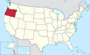
Map of the United States with Oregon highlighted
Oregon is a state located in the Western United States. All population data is based on the 2020 census and 2010 census and the Census Bureau's annual estimates.[1] All area data is based on the 2010 US Gazetteer files. There are 241 municipalities.
List of incorporated cities ranked by population
|
|
Former cities
Cities that have disincorporated.
- Albina
- Beaver Hill
- Damascus[4] (Damascus' disincorporation was reversed as of 2019, then restored in 2020)
- East Portland
- Freewater
- Glenada
- Hammond[5]
- Juntura
- Lemati[6]
- Linnton
- Milton
- Orenco
- Rajneeshpuram
- St. Johns
- Sellwood
- Vanport
- West Salem
- Willamette
- Winchester
See also
References
- 1 2 "Incorporated Places and Minor Civil Divisions: Oregon". Population Census. 2010 United States Census. July 18, 2011. Retrieved August 24, 2011.
- ↑ "Annual Estimates of the Resident Population: April 1, 2010 to July 1, 2018". Census.gov. July 2018. Retrieved September 17, 2019.
- ↑ "US Gazetteer files 2010". United States Census Bureau. Archived from the original on July 2, 2012. Retrieved December 21, 2012.
- ↑ Clackamas County (n.d.), Damascus disincorporation, archived from the original on July 22, 2016, retrieved August 4, 2016.
- ↑ McArthur, Lewis A.; McArthur, Lewis L. (2003) [1928]. Oregon Geographic Names (7th ed.). Portland, Oregon: Oregon Historical Society Press. pp. 373, 440. ISBN 978-0875952772.
- ↑ Voss, David K. (July 30, 1993), National Register of Historic Places Registration Form: Cottage Grove Downtown Commercial Historic District (PDF), retrieved October 14, 2017.
This article is issued from Wikipedia. The text is licensed under Creative Commons - Attribution - Sharealike. Additional terms may apply for the media files.


_(desD0054b).jpg.webp)
.jpg.webp)


.jpg.webp)


_(hooD0006a).jpg.webp)


.jpg.webp)


_(clatDA0042a).jpg.webp)


