| Little Cedar River | |
|---|---|
.jpg.webp) The river along Dale Road in Tobacco Township | |
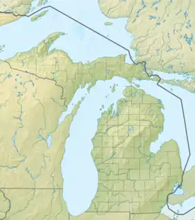 Location within the state of Michigan | |
| Location | |
| Country | United States |
| State | Michigan |
| Physical characteristics | |
| Source | |
| • location | Buckeye Township, Michigan |
| • coordinates | 43°55′08″N 84°24′18″W / 43.91889°N 84.40500°W |
| Mouth | |
• location | Tobacco River |
• coordinates | 43°50′30″N 84°23′17″W / 43.84167°N 84.38806°W |
• elevation | 676 ft (206 m)[1] |
| Length | 8.1 miles (13.0 km) |
Little Cedar River is an 8.1-mile-long (13.0 km)[2] river in Gladwin County in the U.S. state of Michigan.
The Little Cedar rises in Buckeye Township at 43°55′08″N 84°24′18″W / 43.91889°N 84.40500°W,[1] and flows primarily south into the Tobacco River at 43°50′30″N 84°23′17″W / 43.84167°N 84.38806°W.[1]
Pete Drain, which feeds into the Little Cedar, is also known as the Little Cedar River.[3]
Tributaries
From the mouth:
- (right) Otgen Drain[4]
- (left) Snyder Drain[5]
- (right) Hoover Drain[6]
- (right) Crockett Drain[7]
- (left) Dow Creek[8]
- (left) Rich Drain[9]
- (right) Smith Drain[10]
- (right) Hay Drain[11]
- (right) McMahan Drain[12]
- (left) Martin Drain[13]
- (right) Graham Drain[14]
- (left) Bennet Drain[15]
- (right) Pete Drain[3]
References
- 1 2 3 "Little Cedar River". Geographic Names Information System. United States Geological Survey, United States Department of the Interior.
- ↑ U.S. Geological Survey. National Hydrography Dataset high-resolution flowline data. The National Map Archived 2012-03-29 at the Wayback Machine, accessed November 7, 2011
- 1 2 "Pete Drain". Geographic Names Information System. United States Geological Survey, United States Department of the Interior.
- ↑ "Otgen Drain". Geographic Names Information System. United States Geological Survey, United States Department of the Interior.
- ↑ "Snyder Drain". Geographic Names Information System. United States Geological Survey, United States Department of the Interior.
- ↑ "Hoover Drain". Geographic Names Information System. United States Geological Survey, United States Department of the Interior.
- ↑ "Crockett Drain". Geographic Names Information System. United States Geological Survey, United States Department of the Interior.
- ↑ "Dow Creek". Geographic Names Information System. United States Geological Survey, United States Department of the Interior.
- ↑ "Rich Drain". Geographic Names Information System. United States Geological Survey, United States Department of the Interior.
- ↑ "Smith Drain". Geographic Names Information System. United States Geological Survey, United States Department of the Interior.
- ↑ "Hay Drain". Geographic Names Information System. United States Geological Survey, United States Department of the Interior.
- ↑ "McMahan Drain". Geographic Names Information System. United States Geological Survey, United States Department of the Interior.
- ↑ "Martin Drain". Geographic Names Information System. United States Geological Survey, United States Department of the Interior.
- ↑ "Graham Drain". Geographic Names Information System. United States Geological Survey, United States Department of the Interior.
- ↑ "Bennet Drain". Geographic Names Information System. United States Geological Survey, United States Department of the Interior.
This article is issued from Wikipedia. The text is licensed under Creative Commons - Attribution - Sharealike. Additional terms may apply for the media files.