| South Maroota New South Wales | |||||||||||||||
|---|---|---|---|---|---|---|---|---|---|---|---|---|---|---|---|
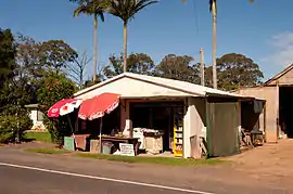
 Store in South Maroota | |||||||||||||||
 South Maroota | |||||||||||||||
| Coordinates | 33°31′27″S 150°56′55″E / 33.52417°S 150.94861°E | ||||||||||||||
| Population | 507 (2011 census)[1] | ||||||||||||||
| Postcode(s) | 2756 | ||||||||||||||
| Elevation | 124 m (407 ft) | ||||||||||||||
| Location | 72 km (45 mi) northwest of Sydney CBD | ||||||||||||||
| LGA(s) | The Hills Shire | ||||||||||||||
| State electorate(s) | Hawkesbury | ||||||||||||||
| Federal division(s) | Berowra | ||||||||||||||
| |||||||||||||||
South Maroota is a suburb in Sydney, New South Wales, Australia 72 kilometres north-west of the Sydney central business district in the local government area of The Hills Shire. The Hawkesbury River forms part of its western boundary.
Heritage listings
South Maroota has a number of heritage-listed sites, including:
- Wisemans Ferry Road: Great Drain[2]
Recreation
South Maroota contains the Pacific Park motocross and water-skiing park, on the bank of the Hawkesbury River. In 1970 Sydney's largest naturist club Kiata Country Club was established
References
- ↑ Australian Bureau of Statistics (31 October 2012). "South Maroota (State Suburb)". 2011 Census QuickStats. Retrieved 27 April 2015.
- ↑ "Great Drain and two house sites". New South Wales State Heritage Register. Department of Planning & Environment. H01402. Retrieved 18 May 2018.
 Text is licensed by State of New South Wales (Department of Planning and Environment) under CC-BY 4.0 licence.
External links
This article is issued from Wikipedia. The text is licensed under Creative Commons - Attribution - Sharealike. Additional terms may apply for the media files.