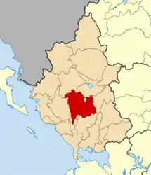
Mousiotitsa
Μουσιωτίτσα | |
|---|---|
 Mousiotitsa Location within the region  | |
| Coordinates: 39°23′N 20°49′E / 39.383°N 20.817°E | |
| Country | Greece |
| Administrative region | Epirus |
| Regional unit | Ioannina |
| Municipality | Dodoni |
| Elevation | 650 m (2,130 ft) |
| Community | |
| • Population | 605 (2011) |
| Time zone | UTC+2 (EET) |
| • Summer (DST) | UTC+3 (EEST) |
| Postal code | 45500 |
| Area code(s) | 02564 |
Mousiotitsa (Greek: Μουσιωτίτσα) or Kato Mousiotitsa (Greek: Κάτω Μουσιωτίτσα) is a village located in the Ioannina regional unit in the Epirus region (Greek: Ήπειρος) of western Greece. Situated 33 km south of the city of Ioannina (Greek: Ιωάννινα) near the springs of the river Louros (Greek: ποταμός Λούρος), the village consists of 4 areas: Kato Mousiotitsa (Greek: Κάτω Μουσιωτίτσα), Ano Mousiotitsa (Greek: 'Ανω Μουσιωτίτσα), Nea Mousiotitsa (Greek: Νέα Μουσιωτίτσα) and Mesoura (Greek: Μεσούρα). It is surrounded by 5 mountains: Bitera (Greek: Μπιτέρα), Spithari (Greek: Σπιθάρι), Pourizi (Greek: Πουρίζι), Kalogeritsa (Greek: Καλογερίτσα) and Katafi (Greek: Καταφή).
The village has a permanent population of around 605 (2011 census), however, in the summer months the numbers can soar past 1000 as expatriates return from abroad (e.g. Sweden, Germany, USA, Canada) and from Athens and other larger cities.[1]
As of 2011 the village belongs to the municipality of Dodoni (Greek: Δωδώνη) after the merger of its previous municipal unit Agios Dimitrios (Greek: Άγιος Δημήτριος) with three other units.[2]
History
Origin and etymology of name
The exact origin of the name Mousiotitsa (Greek: Μουσιωτίτσα) is unknown. Speculation by various scholars suggest the name is likely of partial Slavic origin due to its conspicuous ending of "itsa" - a common occurrence in Slavic settlement names. More local theories suggest the name was derived from old myths of ancient river dwellers known as "Mouses" (Greek: Mούσες) or from a queen who resided in what is now the ruins of a castle dating back to the 3rd century AD.[3]
Initial settlement
It is widely regarded to have been settled in the early 18th century. The old St. Nicholas church is first mentioned in the Greek church archives in the year 1791, however, its construction is dated at around 1770. One of the oldest houses still remaining is dated at 1750. Its first inhabitants are believed to have been Klephts (Greek: κλέφτες) and other refugees fleeing from Ottoman oppression or persecution. The shape of the geographical surroundings shielded the village and its inhabitants from view, thus providing a safe place to dwell.[3]
The village is believed to have belonged to the group of villages that made up the Souli (Greek: Σούλι) mountain settlements. This belief is supported by the fact that local names resemble common Souliot names, alongside knowledge of Arvanitika (Greek: αρβανίτικα) among village elders - a language commonly spoken amongst Souliot.[3]
World War II Massacre
On July 25, 1943, followed by 27 August 1943, German SS troops entered the village and executed a total of 153 civilians. The attack and resulting massacre was seen as retaliation by the Nazi German troops against alleged resistance activity in the village, and that it had supported a deadly attack on a German officer in the nearby area of Zita.[3]
See also
References
- 1 2 "Απογραφή Πληθυσμού - Κατοικιών 2011. ΜΟΝΙΜΟΣ Πληθυσμός" (in Greek). Hellenic Statistical Authority.
- ↑ "ΦΕΚ B 1292/2010, Kallikratis reform municipalities" (in Greek). Government Gazette.
- 1 2 3 4 Σταύρου-Αναγνώστου, Γεωργία (1998). Η προσφορά της Μαρτυρικής Μουσιωτίτσας στη Νεώτερη Ιστορία-Χρονικό του Ολοκαυτώματος (Ιούλιος-Αύγουστος 1943). Ioannina: Έκδοση: Κοινότητα Μουσιωτίτσας.