Middletown Road | ||||||||||||||||||||||||||||||||||||||||||||||||||||||||||||||||||||||||||||||||||||||||||||||||||||||||||||||||||||||||||||||||||||||||||||||||||||||||||||||||||||||||||||||||||||||
|---|---|---|---|---|---|---|---|---|---|---|---|---|---|---|---|---|---|---|---|---|---|---|---|---|---|---|---|---|---|---|---|---|---|---|---|---|---|---|---|---|---|---|---|---|---|---|---|---|---|---|---|---|---|---|---|---|---|---|---|---|---|---|---|---|---|---|---|---|---|---|---|---|---|---|---|---|---|---|---|---|---|---|---|---|---|---|---|---|---|---|---|---|---|---|---|---|---|---|---|---|---|---|---|---|---|---|---|---|---|---|---|---|---|---|---|---|---|---|---|---|---|---|---|---|---|---|---|---|---|---|---|---|---|---|---|---|---|---|---|---|---|---|---|---|---|---|---|---|---|---|---|---|---|---|---|---|---|---|---|---|---|---|---|---|---|---|---|---|---|---|---|---|---|---|---|---|---|---|---|---|---|---|
 View south from northbound platform | ||||||||||||||||||||||||||||||||||||||||||||||||||||||||||||||||||||||||||||||||||||||||||||||||||||||||||||||||||||||||||||||||||||||||||||||||||||||||||||||||||||||||||||||||||||||
| Station statistics | ||||||||||||||||||||||||||||||||||||||||||||||||||||||||||||||||||||||||||||||||||||||||||||||||||||||||||||||||||||||||||||||||||||||||||||||||||||||||||||||||||||||||||||||||||||||
| Address | Middletown Road & Westchester Avenue Bronx, NY 10461 | |||||||||||||||||||||||||||||||||||||||||||||||||||||||||||||||||||||||||||||||||||||||||||||||||||||||||||||||||||||||||||||||||||||||||||||||||||||||||||||||||||||||||||||||||||||
| Borough | The Bronx | |||||||||||||||||||||||||||||||||||||||||||||||||||||||||||||||||||||||||||||||||||||||||||||||||||||||||||||||||||||||||||||||||||||||||||||||||||||||||||||||||||||||||||||||||||||
| Locale | Pelham Bay | |||||||||||||||||||||||||||||||||||||||||||||||||||||||||||||||||||||||||||||||||||||||||||||||||||||||||||||||||||||||||||||||||||||||||||||||||||||||||||||||||||||||||||||||||||||
| Coordinates | 40°50′36″N 73°50′12″W / 40.843424°N 73.836751°W | |||||||||||||||||||||||||||||||||||||||||||||||||||||||||||||||||||||||||||||||||||||||||||||||||||||||||||||||||||||||||||||||||||||||||||||||||||||||||||||||||||||||||||||||||||||
| Division | A (IRT)[1] | |||||||||||||||||||||||||||||||||||||||||||||||||||||||||||||||||||||||||||||||||||||||||||||||||||||||||||||||||||||||||||||||||||||||||||||||||||||||||||||||||||||||||||||||||||||
| Line | IRT Pelham Line | |||||||||||||||||||||||||||||||||||||||||||||||||||||||||||||||||||||||||||||||||||||||||||||||||||||||||||||||||||||||||||||||||||||||||||||||||||||||||||||||||||||||||||||||||||||
| Services | 6 | |||||||||||||||||||||||||||||||||||||||||||||||||||||||||||||||||||||||||||||||||||||||||||||||||||||||||||||||||||||||||||||||||||||||||||||||||||||||||||||||||||||||||||||||||||||
| Transit | ||||||||||||||||||||||||||||||||||||||||||||||||||||||||||||||||||||||||||||||||||||||||||||||||||||||||||||||||||||||||||||||||||||||||||||||||||||||||||||||||||||||||||||||||||||||
| Structure | Elevated | |||||||||||||||||||||||||||||||||||||||||||||||||||||||||||||||||||||||||||||||||||||||||||||||||||||||||||||||||||||||||||||||||||||||||||||||||||||||||||||||||||||||||||||||||||||
| Platforms | 2 side platforms | |||||||||||||||||||||||||||||||||||||||||||||||||||||||||||||||||||||||||||||||||||||||||||||||||||||||||||||||||||||||||||||||||||||||||||||||||||||||||||||||||||||||||||||||||||||
| Tracks | 3 (2 in regular service) | |||||||||||||||||||||||||||||||||||||||||||||||||||||||||||||||||||||||||||||||||||||||||||||||||||||||||||||||||||||||||||||||||||||||||||||||||||||||||||||||||||||||||||||||||||||
| Other information | ||||||||||||||||||||||||||||||||||||||||||||||||||||||||||||||||||||||||||||||||||||||||||||||||||||||||||||||||||||||||||||||||||||||||||||||||||||||||||||||||||||||||||||||||||||||
| Opened | December 20, 1920 | |||||||||||||||||||||||||||||||||||||||||||||||||||||||||||||||||||||||||||||||||||||||||||||||||||||||||||||||||||||||||||||||||||||||||||||||||||||||||||||||||||||||||||||||||||||
| Rebuilt | October 5, 2013 to May 4, 2014 | |||||||||||||||||||||||||||||||||||||||||||||||||||||||||||||||||||||||||||||||||||||||||||||||||||||||||||||||||||||||||||||||||||||||||||||||||||||||||||||||||||||||||||||||||||||
| Opposite- direction transfer | Yes | |||||||||||||||||||||||||||||||||||||||||||||||||||||||||||||||||||||||||||||||||||||||||||||||||||||||||||||||||||||||||||||||||||||||||||||||||||||||||||||||||||||||||||||||||||||
| Traffic | ||||||||||||||||||||||||||||||||||||||||||||||||||||||||||||||||||||||||||||||||||||||||||||||||||||||||||||||||||||||||||||||||||||||||||||||||||||||||||||||||||||||||||||||||||||||
| 2022 | 363,695[2] | |||||||||||||||||||||||||||||||||||||||||||||||||||||||||||||||||||||||||||||||||||||||||||||||||||||||||||||||||||||||||||||||||||||||||||||||||||||||||||||||||||||||||||||||||||||
| Rank | 403 out of 423[2] | |||||||||||||||||||||||||||||||||||||||||||||||||||||||||||||||||||||||||||||||||||||||||||||||||||||||||||||||||||||||||||||||||||||||||||||||||||||||||||||||||||||||||||||||||||||
| ||||||||||||||||||||||||||||||||||||||||||||||||||||||||||||||||||||||||||||||||||||||||||||||||||||||||||||||||||||||||||||||||||||||||||||||||||||||||||||||||||||||||||||||||||||||
| ||||||||||||||||||||||||||||||||||||||||||||||||||||||||||||||||||||||||||||||||||||||||||||||||||||||||||||||||||||||||||||||||||||||||||||||||||||||||||||||||||||||||||||||||||||||
| ||||||||||||||||||||||||||||||||||||||||||||||||||||||||||||||||||||||||||||||||||||||||||||||||||||||||||||||||||||||||||||||||||||||||||||||||||||||||||||||||||||||||||||||||||||||
| ||||||||||||||||||||||||||||||||||||||||||||||||||||||||||||||||||||||||||||||||||||||||||||||||||||||||||||||||||||||||||||||||||||||||||||||||||||||||||||||||||||||||||||||||||||||
| ||||||||||||||||||||||||||||||||||||||||||||||||||||||||||||||||||||||||||||||||||||||||||||||||||||||||||||||||||||||||||||||||||||||||||||||||||||||||||||||||||||||||||||||||||||||
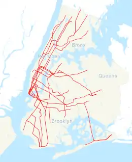
The Middletown Road station is a local station of the IRT Pelham Line of the New York City Subway. Located at Middletown Road and Westchester Avenue in the Bronx, it is served by the 6 train at all times except weekdays in the peak direction, when the <6> train takes over.
History
This station opened on December 20, 1920 as part of the final extension of the Pelham Line from Westchester Square to Pelham Bay Park.[3][4][5] Service to Pelham Bay Park was originally provided by a mix of through and shuttle trains during the 1920s.[6]: 73–74
From October 5, 2013 to May 4, 2014, the station was closed for rehabilitation work.[7] The Metropolitan Transportation Authority (MTA) was sued for violating the Americans with Disabilities Act by not including elevators in the renovation.[8] The MTA lost the lawsuit, being obligated to add ADA improvements to all major renovations in the future.[9][10]
Station layout
| Platform level | Side platform | |
| Southbound local | ← | |
| Peak-direction express | No regular service | |
| Northbound local | | |
| Side platform | ||
| Mezzanine | Fare control, station agent, MetroCard machines | |
| Ground | Street level | Exit/entrance |
This elevated station has two side platforms and three tracks. The center express track is not used in regular service. South of the station are track leads to Westchester Yard, the main yard for all 6 and <6> trains. The center and Manhattan-bound local tracks rise above these leads.[11] The 6 local train serves the station at all times except rush hours in the peak direction, when the <6> express train serves the station instead.[12] The next stop to the south is Westchester Square–East Tremont Avenue, while the next stop to the north is Buhre Avenue.[13]
Both platforms have beige windscreens and red canopies with green frames and support columns in the center. On either ends are white waist-high steel fences with sodium lampposts at regular intervals. The station name signs are in the standard black plates with white Helvetica lettering.
Exits
This station has one wooden elevated mezzanine below the platforms and tracks. Two staircases from the center of each platform go down to the mezzanine, where a turnstile bank provides access to and from the station. Outside fare control, there is a token booth and two street stairs. One goes south down to the triangular corner of Middletown Road and Westchester Avenue and the other to the north side of Westchester Avenue.[14]
References
- ↑ "Glossary". Second Avenue Subway Supplemental Draft Environmental Impact Statement (SDEIS) (PDF). Vol. 1. Metropolitan Transportation Authority. March 4, 2003. pp. 1–2. Archived from the original (PDF) on February 26, 2021. Retrieved January 1, 2021.
- 1 2 "Annual Subway Ridership (2017–2022)". Metropolitan Transportation Authority. 2022. Retrieved November 8, 2023.
- ↑ A Comprehensive General and Industrial Survey: The Bronx in the City of New York. Bronx Board of Trade. 1931. p. 27.
- ↑ Brooklyn Daily Eagle Almanac. Brooklyn Daily Eagle. 1922. p. 372.
- ↑ Moodys Manual of Railroads and Corporation Securities. Moody Manual Company. 1922.
- ↑ Annual Report. J.B. Lyon Company. 1922.
- ↑ Temporary Station Closures Archived April 11, 2014, at the Wayback Machine
- ↑ Ross, Barbara; Gregorian, Dareh (June 29, 2016). "Disability rights groups sue MTA for excluding elevator at newly renovated Bronx subway station". nydailynews.com. Retrieved December 25, 2019.
- ↑ Kim, Elizabeth (March 7, 2019). "Judge Rules MTA Should Have Installed Elevators When It Renovated Bronx Subway Station". Gothamist. Archived from the original on December 25, 2019. Retrieved December 25, 2019.
- ↑ Guse, Clayton (March 6, 2019). "Judge orders MTA to install subway elevators whenever it does major station renovations — and for whatever it costs". nydailynews.com. Retrieved December 25, 2019.
- ↑ Dougherty, Peter (2020). Tracks of the New York City Subway 2020 (16th ed.). Dougherty. OCLC 1056711733.
- ↑ "6 Subway Timetable, Effective August 12, 2023". Metropolitan Transportation Authority. Retrieved August 26, 2023.
- ↑ "Subway Map" (PDF). Metropolitan Transportation Authority. September 2021. Retrieved September 17, 2021.
- ↑ "Middletown Road Neighborhood Map" (PDF). new.mta.info. Metropolitan Transportation Authority. April 2018. Retrieved February 28, 2019.
External links
- nycsubway.org – IRT Pelham Line: Middletown Road
- Station Reporter — 6 Train
- The Subway Nut — Middletown Road Pictures
- Middletown Road entrance from Google Maps Street View
- Platforms from Google Maps Street View


