Route 20 | ||||
|---|---|---|---|---|
| Route information | ||||
| Maintained by MoDOT | ||||
| Length | 31.609 mi[1] (50.870 km) | |||
| Existed | 1922–present | |||
| Major junctions | ||||
| East end | ||||
| West end | ||||
| Location | ||||
| Country | United States | |||
| State | Missouri | |||
| Highway system | ||||
| ||||

Route 20 is a highway in central Missouri. Its eastern terminus is at U.S. Route 65 Business in Marshall; its western terminus is at Route 13 in Higginsville.
Route 20 was one of the original 1922 highways. Its eastern terminus was originally at Huntsville at Route 10 (now U.S. Route 24). Its western terminus was originally in Kansas City at Route 1. In 1926, the section west of Waverly became part of U.S. Route 24 and the section from Waverly to Marshall became part of U.S. Route 65. In 1933/1934, Route 20 was extended west on its current alignment to Higginsville. This section had been planned as Route 96 (Odessa to Marshall) in 1922, but was soon dropped from the state highway system. In 1934/1935, the section from Glasgow to Huntsville became part of Route 3 when that route was extended. The next year, the section from Marshall to Glasgow became part of Route 240. Route 20 connects the towns of Higginsville, Corder, Alma, Blackburn and Marshall.
Major intersections
| County | Location | mi[1] | km | Destinations | Notes |
|---|---|---|---|---|---|
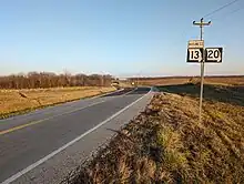
| Lafayette | | 0.000 | 0.000 | Western terminus; Western end of Route 13 Business concurrency | |
| Higginsville | 1.784 | 2.871 | Eastern end of Route 13 Business concurrency | ||
| 1.814 | 2.919 | Southern terminus of Route 213 | |||
| | 4.623 | 7.440 | Southern terminus of Route F | ||
| | 6.635 | 10.678 | Northern terminus of Route V; Southern terminus of Route BB | ||
| | 11.262 | 18.124 | |||
| | 11.772 | 18.945 | Northern terminus of Route W | ||
| Saline | | 16.119 | 25.941 | Southern terminus of Route BB | |
| | 18.873 | 30.373 | Western end of Route 127 concurrency | ||
| | 19.875 | 31.986 | Eastern end of Route 127 concurrency | ||
| | 22.338 | 35.950 | Western end of Route EE concurrency | ||
| | 23.839 | 38.365 | Eastern end of Route EE concurrency | ||
| | 25.950 | 41.762 | Southern terminus of Route Z | ||
| Marshall | 30.581 | 49.215 | |||
| 31.609 | 50.870 | Eastern terminus | |||
1.000 mi = 1.609 km; 1.000 km = 0.621 mi
| |||||
References
- 1 2 Missouri Department of Transportation (February 5, 2018). MoDOT HPMAPS (Map). Missouri Department of Transportation. Retrieved February 5, 2018.