Mitha | |
|---|---|
Village | |
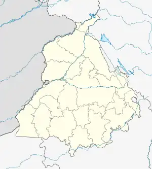 Mitha Location in Punjab, India  Mitha Mitha (India) | |
| Coordinates: 31°17′23″N 75°17′30″E / 31.289715°N 75.291653°E | |
| Country | |
| State | Punjab |
| District | Kapurthala |
| Government | |
| • Type | Panchayati raj (India) |
| • Body | Gram panchayat |
| Population (2011) | |
| • Total | 209 |
| Sex ratio 106/103♂/♀ | |
| Languages | |
| • Official | Punjabi |
| • Other spoken | Hindi |
| Time zone | UTC+5:30 (IST) |
| PIN | 144620 |
| Telephone code | 01822 |
| ISO 3166 code | IN-PB |
| Vehicle registration | PB-09 |
| Website | kapurthala |
Mitha is a village in Kapurthala district of Punjab State, India. It is located 16 kilometres (9.9 mi) from Kapurthala, which is both its district and sub-district headquarters. The village is administrated by a Sarpanch who is an elected representative.
Demography
According to the 2011 Census of India, Mitha had 45 houses and a population of 209, of which 106 were males and 103 females. The literacy rate was 71.82%, lower than the state average of 75.84%. The population of children under the age of 6 was 28, being 13.40% of total population, and the child sex ratio was approximately 474, lower than state average of 846.
Population data
| Particulars | Total | Male | Female |
|---|---|---|---|
| Total No. of Houses | 45 | - | - |
| Population | 209 | 106 | 103 |
| Child (0-6) | 28 | 19 | 9 |
| Schedule Caste | 44 | 27 | 17 |
| Schedule Tribe | 0 | 0 | 0 |
| Literacy | 71.82 % | 72.41 % | 71.28 % |
| Total Workers | 67 | 52 | 15 |
| Main Worker | 67 | 0 | 0 |
| Marginal Worker | 0 | 0 | 0 |
Air travel connectivity
The closest airport to the village is Sri Guru Ram Dass Jee International Airport.
Villages in Kapurthala
References
External links
This article is issued from Wikipedia. The text is licensed under Creative Commons - Attribution - Sharealike. Additional terms may apply for the media files.