Mittenwalde | |
|---|---|
 Flag  Coat of arms | |
Location of Mittenwalde within Dahme-Spreewald district 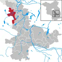 | |
 Mittenwalde 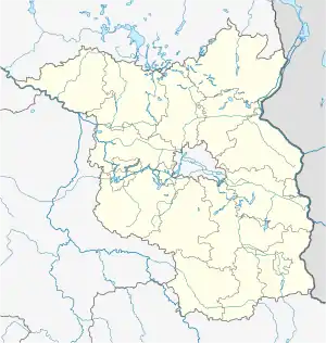 Mittenwalde | |
| Coordinates: 52°16′N 13°32′E / 52.267°N 13.533°E | |
| Country | Germany |
| State | Brandenburg |
| District | Dahme-Spreewald |
| Subdivisions | 6 Ortsteile |
| Government | |
| • Mayor (2016–24) | Maja Buße[1] (CDU) |
| Area | |
| • Total | 98.48 km2 (38.02 sq mi) |
| Elevation | 37 m (121 ft) |
| Population (2021-12-31)[2] | |
| • Total | 9,515 |
| • Density | 97/km2 (250/sq mi) |
| Time zone | UTC+01:00 (CET) |
| • Summer (DST) | UTC+02:00 (CEST) |
| Postal codes | 15749 |
| Dialling codes | 033764 |
| Vehicle registration | LDS |
| Website | www.mittenwalde.de |
Mittenwalde (German: [ˈmɪtn̩ˌvaldə] ⓘ) is a town in the Dahme-Spreewald district, in Brandenburg, Germany. It is situated 30 km southeast of Berlin (centre).
On May 28, 1562, the town of Mittenwalde lent Berlin 400 guilders, a debt which has never been repaid, though the town has attempted to collect the debt on rare occasions. As of 2020, this debt would be equivalent to about 113.92 million euros ($127.05 million) with simple interest, but with compound interest, the debt would be 43.58 quintillion euros, far larger than the global economy.[3]
Demography
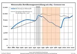 Development of Population since 1875 within the Current Boundaries (Blue Line: Population; Dotted Line: Comparison to Population Development of Brandenburg state; Grey Background: Time of Nazi rule; Red Background: Time of Communist rule)
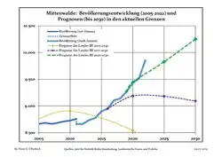 Recent Population Development and Projections (Population Development before Census 2011 (blue line); Recent Population Development according to the Census in Germany in 2011 (blue bordered line); Official projections for 2005-2030 (yellow line); for 2020-2030 (green line); for 2017-2030 (scarlet line)
|
|
|
References
- ↑ Landkreis Dahme-Spreewald Wahl der Bürgermeisterin / des Bürgermeisters, accessed 30 June 2021.
- ↑ "Bevölkerungsentwicklung und Flächen der kreisfreien Städte, Landkreise und Gemeinden im Land Brandenburg 2021" (PDF). Amt für Statistik Berlin-Brandenburg (in German). June 2022.
- ↑ 2012 report on debt
- ↑ Detailed data sources are to be found in the Wikimedia Commons.Population Projection Brandenburg at Wikimedia Commons
This article is issued from Wikipedia. The text is licensed under Creative Commons - Attribution - Sharealike. Additional terms may apply for the media files.