| Mount Hongū | |
|---|---|
| 本宮山 | |
.JPG.webp) Mount Hongū seen from Mount Ishimaki | |
| Highest point | |
| Elevation | 789.2 m (2,589 ft) |
| Geography | |
| Location | Toyokawa, Okazaki, Shinshiro in Aichi Prefecture, Japan |
| Climbing | |
| Easiest route | by car or hiking |
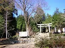
Torii
Mount Hongū (本宮山, Hongū-san) is a mountain located on the border of three cities in Aichi Prefecture, Toyokawa, Okazaki, and Shinshiro.
Wikimedia Commons has media related to Mount Hongū.
This article is issued from Wikipedia. The text is licensed under Creative Commons - Attribution - Sharealike. Additional terms may apply for the media files.