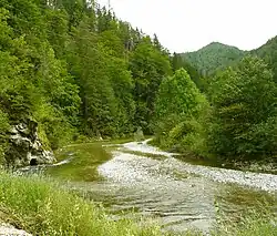
| Mürz | |
|---|---|
 | |
| Location | |
| Country | Austria |
| State | Styria |
| Physical characteristics | |
| Source | |
| • location | confluence of the Stille Mürz and Kalte Mürz near Kaltenbach, Neuberg |
| • coordinates | 47°45′11″N 15°30′31″E / 47.7530°N 15.5085°E |
| Mouth | |
• location | Bruck an der Mur |
• coordinates | 47°24′36″N 15°16′31″E / 47.4099°N 15.2752°E |
| Length | 84.4 km (52.4 mi) [1] |
| Basin size | 1,505 km2 (581 sq mi) |
| Discharge | |
| • average | 20 m3/s (710 cu ft/s) |
| Basin features | |
| Progression | Mur→ Drava→ Danube→ Black Sea |
The Mürz (German pronunciation: [mʏʁt͡s] ⓘ) is a river in Styria, Austria, with a length of 84 km (52 mi). Its drainage basin is 1,505 km2 (581 sq mi).[2]
The Mürz begins at the confluence of the Stille Mürz and Kalte Mürz near Kaltenbach, Neuberg and the border to Lower Austria.[3] It passes through Mürzzuschlag. Along its course are the tracks of the Southern Railway as well as the highway Semmering Schnellstraße. The Mürz discharges into the Mur in Bruck an der Mur.[4]
References
- ↑ Digitaler Atlas der Steiermark (Styria)
- ↑ "Flächenverzeichnis der Flussgebiete: Murgebiet" (PDF). Beiträge zur Hydrografie Österreichs Heft 60. October 2011. p. 72.
- ↑ Google (23 February 2020). "Mürz source" (Map). Google Maps. Google. Retrieved 23 February 2020.
- ↑ Google (23 February 2020). "Mürz mouth" (Map). Google Maps. Google. Retrieved 23 February 2020.
Wikimedia Commons has media related to Mürz.
This article is issued from Wikipedia. The text is licensed under Creative Commons - Attribution - Sharealike. Additional terms may apply for the media files.