| Myers Glacier | |
|---|---|
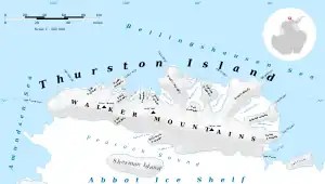 Map of Thurston Island | |
 Location of Myers Glacier in Antarctica | |
| Location | Ellsworth Land |
| Coordinates | 72°16′00″S 100°07′00″W / 72.26667°S 100.11667°W |
| Length | 7 nautical miles (13 km; 8.1 mi) |
| Thickness | unknown |
| Terminus | Peacock Sound |
| Status | unknown |
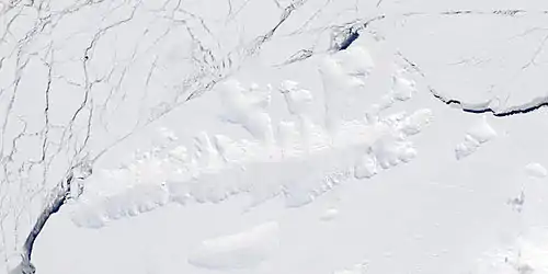
Satellite image of Thurston Island.
Myers Glacier (72°16′S 100°7′W / 72.267°S 100.117°W) is a valley glacier about 7 nautical miles (13 km; 8.1 mi) long, flowing southwest from Mount Noxon on Thurston Island to Abbot Ice Shelf in Peacock Sound. Delineated from aerial photographs taken by U.S. Navy Squadron VX-6 in January 1960. Named by Advisory Committee on Antarctic Names (US-ACAN) for Lieutenant (j.g.) Dale P. Myers, U.S. Navy, helicopter pilot aboard USS Burton Island who made exploratory flights to Thurston Island in February 1960.
See also
Maps
- Thurston Island – Jones Mountains. 1:500000 Antarctica Sketch Map. US Geological Survey, 1967.
- Antarctic Digital Database (ADD). Scale 1:250000 topographic map of Antarctica. Scientific Committee on Antarctic Research (SCAR), 1993–2016.
References
 This article incorporates public domain material from "Myers Glacier". Geographic Names Information System. United States Geological Survey.
This article is issued from Wikipedia. The text is licensed under Creative Commons - Attribution - Sharealike. Additional terms may apply for the media files.