| Newcastle Ridge | |
|---|---|
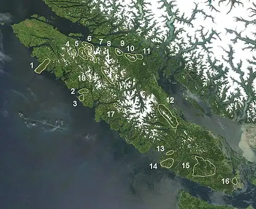
 The Newcastle Ridge is marked 9 on map.
| |
| Highest point | |
| Coordinates | 50°23′07.1″N 126°01′45.1″W / 50.385306°N 126.029194°W |
| Geography | |
| Country | Canada |
| Region | British Columbia |
| Parent range | Vancouver Island Ranges |
The Newcastle Ridge is a mountain ridge on Vancouver Island, British Columbia, Canada, located on the south side of Johnstone Strait between Adam River and Sayward. It is part of the Vancouver Island Ranges which in turn form part of the Insular Mountains.[1]
The highest peak of the ridge is unofficially named Newcastle Peak at 1,333 m (4,373 ft).[1]
See also
References
- 1 2 Newcastle Peak in the Canadian Mountain Encyclopedia
External links
"Newcastle Ridge". BC Geographical Names.
This article is issued from Wikipedia. The text is licensed under Creative Commons - Attribution - Sharealike. Additional terms may apply for the media files.