Newton, Georgia | |
|---|---|
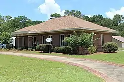
 Newton City Hall | |
 Location in Baker County and the state of Georgia | |
| Coordinates: 31°19′0″N 84°20′22″W / 31.31667°N 84.33944°W | |
| Country | United States |
| State | Georgia |
| County | Baker |
| Area | |
| • Total | 2.28 sq mi (5.91 km2) |
| • Land | 2.18 sq mi (5.65 km2) |
| • Water | 0.10 sq mi (0.26 km2) |
| Elevation | 141 ft (43 m) |
| Population (2020) | |
| • Total | 602 |
| • Density | 276.15/sq mi (106.62/km2) |
| Time zone | UTC-5 (Eastern (EST)) |
| • Summer (DST) | UTC-4 (EDT) |
| ZIP codes | 39870 |
| Area code | 229 |
| FIPS code | 13-55244[2] |
| GNIS feature ID | 0332502[3] |
Newton is a city in Baker County, Georgia, United States. As of the 2020 census, the city population was 602. The city is the county seat of Baker County.[4]
History
Newton was founded in 1837. That same year, the seat of Baker County was transferred to Newton from Byron.[5] There are several properties in Newton listed on the National Register of Historic Places: Baker County Courthouse (Georgia), Notchaway Baptist Church and Cemetery, and Pine Bloom Plantation.
Geography
Newton is located at 31°19′0″N 84°20′22″W / 31.31667°N 84.33944°W (31.316804, -84.339549).[6] According to the United States Census Bureau, the city has a total area of 3.0 square miles (7.8 km2), of which 2.9 square miles (7.5 km2) is land and 0.12 square miles (0.3 km2), or 3.50%, is water.[7]
Demographics
| Census | Pop. | Note | %± |
|---|---|---|---|
| 1860 | 3,225 | — | |
| 1870 | 145 | −95.5% | |
| 1880 | 167 | 15.2% | |
| 1900 | 329 | — | |
| 1910 | 364 | 10.6% | |
| 1920 | 377 | 3.6% | |
| 1930 | 517 | 37.1% | |
| 1940 | 514 | −0.6% | |
| 1950 | 503 | −2.1% | |
| 1960 | 529 | 5.2% | |
| 1970 | 624 | 18.0% | |
| 1980 | 711 | 13.9% | |
| 1990 | 703 | −1.1% | |
| 2000 | 851 | 21.1% | |
| 2010 | 654 | −23.1% | |
| 2020 | 602 | −8.0% | |
| U.S. Decennial Census[8] | |||
According to the census of 2000, there were 851 people, 320 households, and 228 families residing in the city. The population density was 292.7 inhabitants per square mile (113.0/km2). There were 346 housing units at an average density of 119.0 per square mile (45.9/km2). The racial makeup of the city was 43.60% White, 53.94% African American, 0.12% Native American, 0.94% from other races, and 1.41% from two or more races. Hispanic or Latino people of any race were 2.00% of the population. By 2020, its population declined to 602.
Education

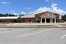
There is one K-12 school building for the Baker County School System. It is located on State Route 37 and was named Baker County Elementary/Middle School in 2001. The old school building that housed the students near the courthouse was built in the late 1960s and named East Baker School. It served the local black population during segregation, and now houses the East Baker Historical Society and 21st Century Community Corporation. The high school was returned to Newton for the 2007–2008 school year. From 1980 to 2007, the high school students traveled from Newton to Camilla for high school, formerly Mitchell-Baker High School. The old building is now used for the Baker County Headstart Center. The new gym for Baker County Schools was expected to be completed in 2009.
Gallery
 Newton Fire Department
 Police station
 Post office
References
- ↑ "2020 U.S. Gazetteer Files". United States Census Bureau. Retrieved December 18, 2021.
- ↑ "U.S. Census website". United States Census Bureau. Retrieved January 31, 2008.
- ↑ "US Board on Geographic Names". United States Geological Survey. October 25, 2007. Retrieved January 31, 2008.
- ↑ "Find a County". National Association of Counties. Retrieved June 7, 2011.
- ↑ Hellmann, Paul T. (May 13, 2013). Historical Gazetteer of the United States. Routledge. p. 241. ISBN 978-1135948597. Retrieved November 30, 2013.
- ↑ "US Gazetteer files: 2010, 2000, and 1990". United States Census Bureau. February 12, 2011. Retrieved April 23, 2011.
- ↑ "Geographic Identifiers: 2010 Demographic Profile Data (G001): Newton city, Georgia". U.S. Census Bureau, American Factfinder. Archived from the original on February 12, 2020. Retrieved October 28, 2013.
- ↑ "Census of Population and Housing". Census.gov. Retrieved June 4, 2015.
