| Dalton New South Wales | |||||||||||||||
|---|---|---|---|---|---|---|---|---|---|---|---|---|---|---|---|
 Royal Hotel, Dalton | |||||||||||||||
 Dalton | |||||||||||||||
| Coordinates | 34°43′0″S 149°12′0″E / 34.71667°S 149.20000°E | ||||||||||||||
| Population | 230 (2021 census)[1] | ||||||||||||||
| Postcode(s) | 2581 | ||||||||||||||
| Elevation | 540 m (1,772 ft) | ||||||||||||||
| Location | |||||||||||||||
| LGA(s) | Upper Lachlan Shire | ||||||||||||||
| County | King | ||||||||||||||
| Parish | Dalton | ||||||||||||||
| State electorate(s) | Goulburn | ||||||||||||||
| Federal division(s) | Hume | ||||||||||||||
| |||||||||||||||
Dalton is a small inland country town in the Southern Tablelands of New South Wales, Australia, in Upper Lachlan Shire. The population was 230 in the 2021 census.
A small river, Oolong Creek, runs through the town, which is situated in an earthquake-prone region.


Location
Dalton is north of the Hume Highway that joins Sydney and Melbourne, between Goulburn and Yass in southern New South Wales, 255 kilometres (158 mi) southwest of Sydney and 79 kilometres (49 mi) north of the national capital, Canberra. Nearby towns are Cullerin, Gundaroo, Gunning, Yass, and Murrumbateman.
History
The area now known as Dalton lies around the margins of the traditional lands of the Gundungurra people in the north and the Ngunnawal people in the south.[2] These two peoples spoke similar, if not identical, languages.
The town was gazetted in 1862.[3] The name was derived from the family name of the wife[4] of the then Governor of New South Wales The Rt Hon. Sir John Young; her name was Adelaide Annabella Tuite daughter of Edward Tuite Dalton.[5]
Quartz reefs containing gold were discovered in the 1860s but were unprofitable when mining was attempted.[6]
Dalton Public School was, in 1878, under the instruction of Mr. J. V. Moore, and held in a building rented for the purpose, which was very inadequate at the time. As the lease of the schoolhouse was soon to expire, and there was small chance of obtaining any other premises, tenders were called for a new building. The number of children on the roll in 1878 was 60, with an average attendance of 45.[7]
The Oolong Bridge across Oolong Creek was officially opened on 2 August 1896, officiated by MP for Yass William Affleck. A crowd of around 300 people attended, which included schoolchildren from the Dalton Public School as well as Felled Timber School.[8][lower-alpha 1]
Historical Buildings
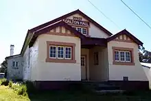
- Anchor Lodge of Good Templar's Hall, built 1890[12][13] and in use until c.1925.[14]
- Police Station, built 1889[15]
- Public School, built 1878[7] replacing an earlier school building dating from c.1860.[16]
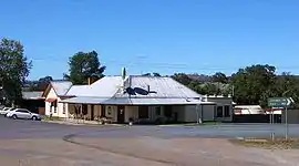
- Royal Hotel, built 1860
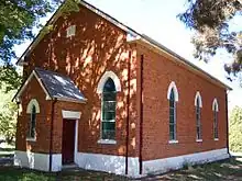
- Dalton Uniting Church (Formerly the Wesleyan Chapel of Wesley Vale)[7][17][18]
- St Matthew's Anglican Church, built 1878[19]
Geology and earthquakes
The underlying rock strata of the region from Dalton to Lake George some 40 kilometres (25 mi) east is geologically active, with the lake formed along a fault system running north–south.[20]
Dalton has a significantly higher rate of earthquakes and tremors than the background rate for the eastern highlands of Australia, and because their foci are very shallow (usually less than 1 km deep) the damage they cause is often disproportionately high: events as low as magnitude ML3.0 have damaged buildings in the region.[21]
Significant earthquakes centred on Dalton/Gunning include an ML5.3 event on 5 July 1888 that was felt in Sydney[22] and represents the first record of seismic activity in the area;[21] the largest recorded event - an ML5.6 event on 18 November 1934 that was also felt in Sydney and agitated the water in the Manuka Pool in Canberra;[21] an ML5.5 event on 10–11 March 1949[23] that caused minor cracking in Canberra buildings[24] and damaged the Anglican Church;[25] and the ML4.3 Oolong event on 9 August 1984 which damaged Oolong Homestead and the Anglican Church.[21]
Several amateur geologists in Dalton and the surrounding region have seismic recorders that automatically send data to Geoscience Australia.
Demographics
In the 2021 Australian census, a population of 230 people was recorded, of whom around 4.3% stated that they were Indigenous Australians. Around 73.4 per cent of the population had both parents born in Australia, with the next highest place of birth for mother or father being England. The top industry of employment, at 12.5%, was sheep farming.[1]
Economy
The vibrancy of Dalton's heyday in the 19th century as a sheep-shearing centre is gone, lost in 1875[26] when the train line was routed through nearby Gunning[27] rather than Dalton. Today the town is taking on a new role as a rural-residential centre, with generally well-maintained wide streets and churches, a school, a viable hotel (pub), post office services, and a petrol station.
The Monaro region is renowned for its sheep wool industry, notably for the Merino breed. The dry-land farming supports both summer and winter wheat, and some other cereal crops, but agriculture also extends to cattle production for meat.[28]
Geography and environment
The Oolong Creek runs through the town.[8] Work has been proceeding on restoring the habitat around the creek, mainly by volunteers in the Dalton Community Association working with NSW Landcare.[29][30]
There is a population of southern pygmy perch, a locally vulnerable species, in the creek, discovered in 2021 by two teenagers. As of 2023 this was only the fourth known remnant population of the fish in New South Wales.[29][31][32] In August 2023, a group of volunteers working with OzFish Unlimited and the local council undertook the translocation of 200 fish to Oolong Creek, to boost the population there.[31]
The endangered yellow-spotted bell frog is also found in the creek.[30]
Footnotes
- ↑ Probably at "Felled Timber Creek", described as "six miles — walking — from Dalton and about twelve miles from Gunning".[9][10] (Note presence of an earlier school of the same name, near Queanbeyan (1875–1879).[11])
References
- 1 2 Australian Bureau of Statistics (28 June 2022). "Dalton (State Suburb)". 2021 Census QuickStats. Retrieved 12 September 2023.
- ↑ Studies, Australian Institute of Aboriginal and Torres Strait Islander (10 January 2021). "Map of Indigenous Australia". aiatsis.gov.au. Retrieved 5 December 2021.
- ↑ "Dalton". New South Wales Government Gazette (Sydney, NSW : 1832 - 1900). 27 June 1862. p. 1143. Retrieved 17 April 2019.
- ↑ "DALTON ON JERRAWA". Goulburn Herald (NSW : 1860 - 1864). 20 August 1862. p. 2. Retrieved 17 April 2019.
- ↑ Ward, John M., "Young, Sir John (1807–1876)", Australian Dictionary of Biography, National Centre of Biography, Australian National University, retrieved 17 April 2019
- ↑ "A Tour in the Southern Districts". Australian Town and Country Journal (Sydney, NSW : 1870 - 1919). 19 January 1878. p. 23. Retrieved 23 February 2021.
- 1 2 3 Australian Town and Country Journal 19 January 1878 page 23
- 1 2 Smith, Garry Norman (15 July 2017). "The view across Oolong Creek". Gunning & District Historical Society. Retrieved 11 September 2023.
- ↑ "More tales from my mother 2 — Felled Timber Creek". Neil's Family Specials and Memory Hole. 24 April 2008. Retrieved 12 September 2023.
- ↑ "Felled Timber Creek". The Yass Courier. Vol. LI, no. 5260. New South Wales, Australia. 20 October 1908. p. 2. Retrieved 12 September 2023 – via National Library of Australia.
- ↑ "Felled Timber/Fell Timber School [1875-1879]". Hall Heritage Centre. Retrieved 12 September 2023.
- ↑ "Good Templary". Goulburn Evening Penny Post (NSW : 1881 - 1940). 29 April 1890. p. 2. Retrieved 23 February 2021.
- ↑ "Dedication of the Good Templar Hall at Dalton". Goulburn Evening Penny Post (NSW : 1881 - 1940). 4 September 1890. p. 4. Retrieved 23 February 2021.
- ↑ "Local and General". Yass Courier (NSW : 1857-1929). 22 January 1925. p. 5. Retrieved 23 February 2021.
- ↑ Goulburn Evening Penny Post 18 July 1889 page 4
- ↑ "Dalton". nswgovschoolhistory.cese.nsw.gov.au. Archived from the original on 11 March 2019. Retrieved 23 February 2021.
- ↑ "Dalton Uniting Church". churchesaustralia.org. Retrieved 10 April 2023.
- ↑ "Opening of the Wesleyan Chapel a Wesley Vale". Goulburn Herald (NSW : 1860 - 1864). 1 September 1860. p. 2. Retrieved 10 April 2023.
- ↑ "St. Matthew's Dalton". Goulburn Herald and Chronicle (NSW : 1864 - 1881). 17 November 1877. p. 3. Retrieved 23 February 2021.
- ↑ Leiba, Marion (December 2007). Earthquakes in the Canberra Region. Canberra: Geoscience Australia. p. 22. ISBN 9781921236402.
- 1 2 3 4 McCue, K., Kennett, B.L.N., Gaull, B.A., Michael-Leiba, M.O., Weekes, J. & Krayshck, C. (1989). "A century of earthquakes in the Dalton-Gunning region of New South Wales". BMR Journal of Australian Geology & Geophysics, 11, 1-9.
- ↑ "Earthquake shocks in New South Wales". South Australian Weekly Chronicle. Vol. XXXI, no. 1, 560. South Australia. 14 July 1888. p. 11. Retrieved 11 September 2023 – via National Library of Australia.
- ↑ Joklok, G.F., (1949). Dalton-Gunning Area, NSW Earth Tremors of March 1949. Bureau of Mineral Resources, Geology and Geophysics, Canberra. viewed 31 October 2015
- ↑ Michael-Leiba, M. (1994). "Fluctuations in seismicity in the Dalton area, NSW, Australia, and their relevance to earthquake forecasting." AGSO Journal of Australian Geology and Geophysics, 15(3), 329-333.
- ↑ "Earth tremors". National Advocate (Bathurst, NSW : 1889 - 1954). 12 March 1949. p. 2. Retrieved 23 February 2021.
- ↑ Gunning Railway Precinct, 2009, NSW Government Office of Environment & Heritage,27 October, viewed on 31 October 2015, at
- ↑ "Opening of the railway to Gunning". Goulburn Herald and Chronicle (NSW : 1864 - 1881). 3 November 1875. p. 2. Retrieved 23 February 2021.
- ↑ "Farming Systems (South)". dpi.nsw.gov.au. 31 March 2022. Archived from the original on 31 March 2022. Retrieved 11 September 2023.
- 1 2 "Oolong Creek, Dalton". NSW Landcare. 3 September 2017. Retrieved 11 September 2023.
- 1 2 "Dalton". Atlas of Living Australia. 19 December 2022. Retrieved 11 September 2023.
- 1 2 Fookes, Tim (11 September 2023). "Southern pygmy perch released into Oolong Creek at Dalton years after chance discovery". ABC News (Australia). Retrieved 11 September 2023.
- ↑ "Oolong Creek, Dalton". NSW Landcare. Retrieved 11 September 2023.