Ostankinsky District | |
|---|---|
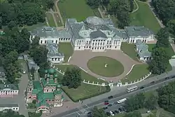
 Ostankino Palace, from the observation deck of the Ostankino Tower, Ostankinsky District | |
.png.webp) Flag .png.webp) Coat of arms | |
Location of Ostankinsky District on the map of Moscow | |
| Coordinates: 55°49′50″N 37°37′16″E / 55.83056°N 37.62111°E | |
| Country | Russia |
| Federal subject | Moscow |
| Population | |
| • Estimate (2018)[1] | 63,148 |
| Time zone | UTC+3 (MSK |
| OKTMO ID | 45358000 |
| Website | http://ostankino.mos.ru/ |
Ostankinsky District, also called simply Ostankino, is an administrative district (raion) of North-Eastern Administrative Okrug, and one of the 125 raions of Moscow, Russia.[3] VDNH exhibition center and Ostankino Tower, the tallest structure in Europe, are located in Ostankinsky. The district is served by Moscow Monorail.
History and etymology
Ostankinsky district is named after Ostankino village, which existed on the site before urbanization. Its name literally means 'remains'; however, despite popular misconception, it was not built on a graveyard. 16th-century sources refer to the village as Ostashkovo, from the Christian name Eustachy.[4]
As a populated place Ostankino has been known at least since the Russian Time of Troubles, but it is better associated with the Sheremetiev estate in the form of a park and palace complex. During the dissolution of the Soviet Union it gained even more fame with its television tower and television centre.
Gallery
 The Sheremetiev estate at Ostankino
 LiAZ-6274 electrobus
See also
References
Notes
- ↑ "26. Численность постоянного населения Российской Федерации по муниципальным образованиям на 1 января 2018 года". Federal State Statistics Service. Retrieved 23 January 2019.
- ↑ "Об исчислении времени". Официальный интернет-портал правовой информации (in Russian). 3 June 2011. Retrieved 19 January 2019.
- ↑ Государственный комитет Российской Федерации по статистике. Комитет Российской Федерации по стандартизации, метрологии и сертификации. №ОК 019-95 1 января 1997 г. «Общероссийский классификатор объектов административно-территориального деления. Код 45», в ред. изменения №278/2015 от 1 января 2016 г.. (State Statistics Committee of the Russian Federation. Committee of the Russian Federation on Standardization, Metrology, and Certification. #OK 019-95 January 1, 1997 Russian Classification of Objects of Administrative Division (OKATO). Code 45, as amended by the Amendment #278/2015 of January 1, 2016. ).
- ↑ История Останкинского района (СВАО) - Электронная Москва