| Přerovská hůra | |
|---|---|
| Bělice, Bílá hůrka | |
 | |
| Highest point | |
| Elevation | 237 m (778 ft) |
| Coordinates | 50°09′50″N 14°50′30″E / 50.16389°N 14.84167°E |
| Geography | |
 Přerovská hůra Location in the Czech Republic | |
| Location | Central Bohemian Region, Czech Republic |
| Parent range | Central Elbe Table |
| Climbing | |
| Easiest route | tourist track |
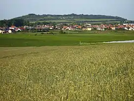
Přerovská hůra (historically also Bělice or Bílá hůrka) is a flat hill in the Central Bohemian Region of the Czech Republic. It is situated in the Central Elbe Table within the Polabí lowland.
A fortification was built on the top of the hill during the Iron Age and was used by the Celts and early Slavs. The fortification is not dug out.
Gallery
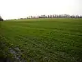 Flat top od Přerovská hůra
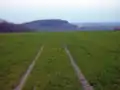 The top of Přerovská hůra - view of Semická hůra
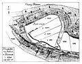 The Top of Přerovská hůra with Oppidum
External links
- Aerial Photography of the top of Přerovská hůra - Celtic Oppidum
- 3D Photographs of The top of Přerovská hůra
Wikimedia Commons has media related to Přerovská hůra.
This article is issued from Wikipedia. The text is licensed under Creative Commons - Attribution - Sharealike. Additional terms may apply for the media files.