| Ballons des Vosges Nature Park | |
|---|---|
IUCN category V (protected landscape/seascape) | |
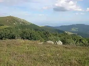
 The Grand Ballon seen from the Storkenkopf | |
 | |
| Location | Grand Est Bourgogne-Franche-Comté, France |
| Coordinates | 47°58′38″N 6°56′06″E / 47.97716038°N 6.93488367°E |
| Area | 2,700 km2 (1,000 sq mi) |
| Established | 1989 |
| Governing body | Fédération des parcs naturels régionaux de France |
| Website | www |
The Ballons des Vosges Regional Nature Park (French: Parc naturel régional des Ballons des Vosges) is a protected area of woodland, pasture, wetland, farmland and historical sites in the regions of Grand Est and Bourgogne-Franche-Comté in northeastern France. The area was officially designated as a regional natural park in 1989.[1] 187 communes belonging to the departments of Haut-Rhin, Vosges, Haute-Saône and Territoire de Belfort are members of the park, which hosts 238,000 inhabitants.[2] It is one of the largest and most populated French regional parks. A wide range of habitats available in the park benefit a variety of wildlife such as boreal owl, lynx, peregrine falcon, western capercaillie, Dianthus superbus, cranberry and Drosera.
Image gallery
- Landscapes


 Mont Hohneck
.JPG.webp) Twilight
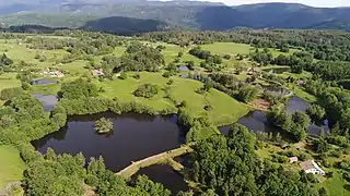
Twilight Landcap of Plateau des Mille Étangs
 Viewpoint Château de Lœwenstein
 Baerenthal dam
- Culture
 Fleckenstein ruins
 Graufthal village
 Cave-houses in Graufthal
 Château de La Petite-Pierre
 A permanent exhibition in the Munster park's headquarters
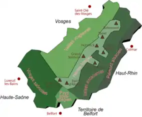
 Map of the nature park
See also
References
- ↑ IUCN Commission on National Parks and Protected Areas (November 1990). 1990 United Nations list of national parks and protected areas. IUCN. p. 88. ISBN 978-2-8317-0032-8. Retrieved 25 March 2013.
- ↑ Comprendre le parc, official web site on
External links
Wikimedia Commons has media related to Parc naturel régional des Ballons des Vosges.
- park website (in French)
This article is issued from Wikipedia. The text is licensed under Creative Commons - Attribution - Sharealike. Additional terms may apply for the media files.