| Manangle New South Wales | |||||||||||||||
|---|---|---|---|---|---|---|---|---|---|---|---|---|---|---|---|
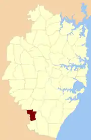
 Location of the parish within Cumberland | |||||||||||||||
| Established | 1835 | ||||||||||||||
| LGA(s) | City of Campbelltown | ||||||||||||||
| County | Cumberland | ||||||||||||||
| Hundred (former) | Campbelltown | ||||||||||||||
| |||||||||||||||
Manangle Parish, Cumberland (also spelled Menangle) is one of the 57 parishes of Cumberland County, New South Wales, a cadastral unit for use on land titles. Its eastern boundary is the Georges River, and western boundary the Nepean River. It includes the southern Sydney suburbs of Menangle Park (including its railway station), Gilead, Rosemeadow and part of Glen Alpine. Major roads in the area include the South Western Freeway, Menangle Road and Appin Road.
References
- "Manangle Parish". Geographical Names Register (GNR) of NSW. Geographical Names Board of New South Wales.
This article is issued from Wikipedia. The text is licensed under Creative Commons - Attribution - Sharealike. Additional terms may apply for the media files.