| Pim | |
|---|---|
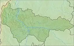
 Mouth location in Khanty-Mansi Autonomous Okrug, Russia | |
| Location | |
| Country | Russia |
| Physical characteristics | |
| Source | Siberian Uvaly |
| Mouth | Ob |
• coordinates | 61°17′11″N 72°00′05″E / 61.2864°N 72.0014°E |
| Length | 390 km (240 mi) |
| Basin size | 12,700 km2 (4,900 sq mi) |
| Basin features | |
| Progression | Ob→ Kara Sea |
The Pim is a river in the Khanty-Mansi Autonomous Okrug in Russia. It is a right tributary of the Ob. It is 390 kilometres (240 mi) long, with a drainage basin of 12,700 square kilometres (4,900 sq mi).[1] The average discharge 166 kilometres (103 mi) from its mouth is 68 cubic metres per second (2,400 cu ft/s). The river is frozen over from the end of November until May.
The town of Lyantor is along the Pim.
References
- ↑ "Река ПИМ in the State Water Register of Russia". textual.ru (in Russian).
This article is issued from Wikipedia. The text is licensed under Creative Commons - Attribution - Sharealike. Additional terms may apply for the media files.