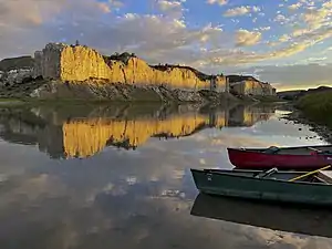
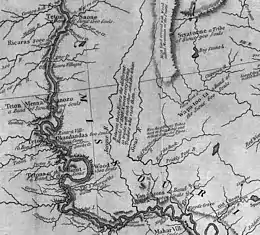
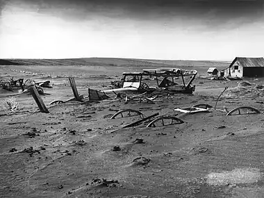
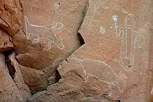
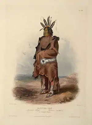
The South Dakota PortalSouth Dakota (/- dəˈkoʊtə/ ⓘ; Sioux: Dakȟóta itókaga, pronounced [daˈkˣota iˈtokaga]) is a U.S. state in the North Central region of the United States. It is also part of the Great Plains. South Dakota is named after the Dakota Sioux tribe, which comprises a large portion of the population with nine reservations currently in the state and has historically dominated the territory. South Dakota is the 17th largest by area, but the 5th least populous, and the 5th least densely populated of the 50 United States. Pierre is the state capital, and Sioux Falls, with a population of about 213,900, is South Dakota's most populous city. The state is bisected by the Missouri River, dividing South Dakota into two geographically and socially distinct halves, known to residents as "East River" and "West River". South Dakota is bordered by the states of North Dakota (to the north), Minnesota (to the east), Iowa (to the southeast), Nebraska (to the south), Wyoming (to the west), and Montana (to the northwest). Humans have inhabited the area for several millennia, with the Sioux becoming dominant by the early 19th century. In the late 19th century, European-American settlement intensified after a gold rush in the Black Hills and the construction of railroads from the east. Encroaching miners and settlers triggered a number of Indian wars, ending with the Wounded Knee Massacre in 1890. As the southern part of the former Dakota Territory, South Dakota became a state on November 2, 1889, simultaneously with North Dakota. They are the 39th and 40th states admitted to the union; President Benjamin Harrison shuffled the statehood papers before signing them so that no one could tell which became a state first. Key events in the 20th century included the Dust Bowl and Great Depression, increased federal spending during the 1940s and 1950s for agriculture and defense, and an industrialization of agriculture that has reduced family farming. Eastern South Dakota is home to most of the state's population, and the area's fertile soil is used to grow a variety of crops. West of the Missouri River, ranching is the predominant agricultural activity, and the economy is more dependent on tourism and defense spending. Most of the Native American reservations are in West River. The Black Hills, a group of low pine-covered mountains sacred to the Sioux, is in the southwest part of the state. Mount Rushmore, a major tourist destination, is there. South Dakota has a temperate continental climate, with four distinct seasons and precipitation ranging from moderate in the east to semi-arid in the west. The state's ecology features species typical of a North American grassland biome. (Full article...) Selected article - Map of North America with the proposed Republic of Lakotah The Republic of Lakotah or Lakotah is a proposed independent republic in North America for the Lakota people. The idea of an independent nation of the Lakota was advanced in 2007 by activist Russell Means and the Lakota Freedom Movement. The suggested territory would be an enclave within the borders of the United States, covering thousands of square miles in North Dakota, South Dakota, Nebraska, Wyoming, and Montana. The proposed national borders are those laid out in the 1851 Treaty of Fort Laramie between the United States government and the Lakota tribes. These lands are now occupied by Indian reservations and non-Native settlements. None of the existing, recognized, Lakota tribal governments support the proposed republic, and they were not consulted about the proposal. (Full article...)CategoriesCategory puzzle Select [►] to view subcategories
South Dakota South Dakota-related lists Communications in South Dakota South Dakota culture Demographics of South Dakota Economy of South Dakota Education in South Dakota Environment of South Dakota Geography of South Dakota Government of South Dakota Health in South Dakota History of South Dakota South Dakota law Military in South Dakota Missing person cases in South Dakota Native American tribes in South Dakota People from South Dakota Politics of South Dakota Professional wrestling in South Dakota Science and technology in South Dakota South Dakota society Sports in South Dakota Tourist attractions in South Dakota Transportation in South Dakota Works about South Dakota Works set in South Dakota Images of South Dakota South Dakota stubs Related portals
|


| 2020 rank | City | 2020 census[1] | 2010 census[2] | Change | County |
|---|---|---|---|---|---|
| 1 | Sioux Falls † | 192,517 | 153,888 | +25.10% | Minnehaha Lincoln |
| 2 | Rapid City † | 74,703 | 67,956 | +9.93% | Pennington |
| 3 | Aberdeen † | 28,495 | 26,091 | +9.21% | Brown |
| 4 | Brookings † | 23,377 | 22,056 | +5.99% | Brookings |
| 5 | Watertown † | 22,655 | 21,482 | +5.46% | Codington |
| 6 | Mitchell † | 15,660 | 15,254 | +2.66% | Davison |
| 7 | Yankton † | 15,411 | 14,454 | +6.62% | Yankton |
| 8 | Huron † | 14,263 | 12,592 | +13.27% | Beadle |
| 9 | Pierre ‡ | 14,091 | 13,646 | +3.26% | Hughes |
| 10 | Spearfish | 12,193 | 10,494 | +16.19% | Lawrence |
| † | County seat |
|---|---|
| ‡ | State capital and county seat |
WikiProjects
- WikiProject South Dakota
- WikiProject United States
New articles
Rules | Match log | Results page (for watching) | Last updated: 2024-01-13 22:42 (UTC)
Note: The list display can now be customized by each user. See List display personalization for details.
- South Dakota State Jackrabbits football, 1889–1909 (edit | talk | history | links | watch | logs | tools) by Cbl62 (talk · contribs · new pages (12)) started on 2024-01-13, score: 50
- Bubodens (edit | talk | history | links | watch | logs | tools) by Mojoceratops66 (talk · contribs · new pages (2)) started on 2024-01-11, score: 20
- Black Hills gold rush (edit | talk | history | links | watch | logs | tools) by Bensci54 (talk · contribs · new pages (58)) started on 2024-01-10, score: 28
- Breathing cave (edit | talk | history | links | watch | logs | tools) by Geolojoey (talk · contribs · new pages (3)) started on 2024-01-08, score: 20
- KLRK (edit | talk | history | links | watch | logs | tools) by Mlaffs (talk · contribs · new pages (11)) started on 2024-01-07, score: 20
- Mary Vanderlinde (edit | talk | history | links | watch | logs | tools) by MoviesandTelevisionFan (talk · contribs · new pages (58)) started on 2024-01-06, score: 36
- Tim Reisch (edit | talk | history | links | watch | logs | tools) by Roc0ast3r (talk · contribs · new pages (26)) started on 2024-01-05, score: 60
- Roger DeGroot (edit | talk | history | links | watch | logs | tools) by Roc0ast3r (talk · contribs · new pages (26)) started on 2024-01-05, score: 60
- Mellissa Heermann (edit | talk | history | links | watch | logs | tools) by Roc0ast3r (talk · contribs · new pages (26)) started on 2024-01-05, score: 40
- Merle C. Pommer (edit | talk | history | links | watch | logs | tools) by MoviesandTelevisionFan (talk · contribs · new pages (58)) started on 2024-01-05, score: 60
Associated Wikimedia
The following Wikimedia Foundation sister projects provide more on this subject:
-
 Commons
Free media repository -
 Wikibooks
Free textbooks and manuals -
 Wikidata
Free knowledge base -
 Wikinews
Free-content news -
 Wikiquote
Collection of quotations -
 Wikisource
Free-content library -
 Wikiversity
Free learning tools -
 Wikivoyage
Free travel guide -
 Wiktionary
Dictionary and thesaurus
Sources
- ↑ "2020 Census Results". United States Census Bureau, Population Division. Retrieved August 14, 2021.
- ↑ "2010 Census Redistricting Data (Public Law 94-171) Summary File". American FactFinder2. U.S. Census Bureau, 2010 Census. Retrieved October 29, 2012.