Prasat
ปราสาท | |
|---|---|
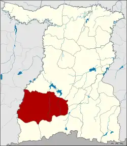 District location in Surin province | |
| Coordinates: 14°38′26″N 103°24′17″E / 14.64056°N 103.40472°E | |
| Country | Thailand |
| Province | Surin |
| Seat | Kang Aen |
| Subdistrict | 18 |
| Muban | 241 |
| District established | 1938 |
| Area | |
| • Total | 908.386 km2 (350.730 sq mi) |
| Population (2015) | |
| • Total | 156,900 |
| • Density | 169.1/km2 (438/sq mi) |
| Time zone | UTC+7 (ICT) |
| Postal code | 32140 |
| Geocode | 3205 |
Prasat (Thai: ปราสาท, pronounced [prāː.sàːt]) is a district (amphoe) in the southern part of Surin province, northeastern Thailand.
Geography
Neighboring districts are (from the north clockwise): Mueang Surin, Lamduan, Sangkha, Kap Choeng, and Phanom Dong Rak of Surin Province; Ban Kruat, Prakhon Chai, Phlapphla Chai, and Krasang of Buriram province.
History
The area of the district was originally part of Mueang Surin district. It was split off as a separate district on 4 March 1938, consisting of the seven tambons: Kang Aen, Bakdai, Ta Bao, Prue, Thung Mon, Phlai, and Thamo.[1]
Administration
Central administration
Prasat district is divided into 18 sub-districts (tambons), which are further subdivided into 241 administrative villages (mubans).
| No. | Name | Thai | Villages | Pop.[2] |
|---|---|---|---|---|
| 1. | Kang Aen | กังแอน | 18 | 18,837 |
| 2. | Thamo | ทมอ | 13 | 6,599 |
| 3. | Phlai | ไพล | 12 | 5,866 |
| 4. | Prue | ปรือ | 19 | 11,566 |
| 5. | Thung Mon | ทุ่งมน | 11 | 7,187 |
| 6. | Ta Bao | ตาเบา | 19 | 9,062 |
| 7. | Nong Yai | หนองใหญ่ | 17 | 11,828 |
| 8. | Khok Yang | โคกยาง | 18 | 14,112 |
| 9. | Khok Sa-at | โคกสะอาด | 20 | 11,354 |
| 10. | Ban Sai | บ้านไทร | 9 | 6,576 |
| 11. | Chok Na Sam | โชคนาสาม | 14 | 11,457 |
| 12. | Chuea Phloeng | เชื้อเพลิง | 12 | 7,756 |
| 13. | Prasat Thanong | ปราสาททนง | 11 | 5,218 |
| 14. | Tani | ตานี | 9 | 7,208 |
| 15. | Ban Phluang | บ้านพลวง | 14 | 7,874 |
| 16. | Kantuatramuan | กันตวจระมวล | 8 | 5,680 |
| 17. | Samut | สมุด | 8 | 4,119 |
| 18. | Prathat Bu | ประทัดบุ | 9 | 4,601 |
Local administration
There are three sub-district municipalities (thesaban tambons) in the district:
- Kang Aen (Thai: เทศบาลตำบลกังแอน) consisting of parts of sub-district Kang Aen.
- Nikhon Prasat (Thai: เทศบาลตำบลนิคมปราสาท) consisting of parts of sub-district Prue.
- Kantuatramuan (Thai: เทศบาลตำบลกันตวจระมวล) consisting of sub-district Kantuatramuan.
There are 17 sub-district administrative organizations (SAO) in the district:
- Kang Aen (Thai: องค์การบริหารส่วนตำบลกังแอน) consisting of parts of sub-district Kang Aen.
- Thamo (Thai: องค์การบริหารส่วนตำบลทมอ) consisting of sub-district Thamo.
- Phlai (Thai: องค์การบริหารส่วนตำบลไพล) consisting of sub-district Phlai.
- Prue (Thai: องค์การบริหารส่วนตำบลปรือ) consisting of parts of sub-district Prue.
- Thung Mon (Thai: องค์การบริหารส่วนตำบลทุ่งมน) consisting of sub-district Thung Mon.
- Ta Bao (Thai: องค์การบริหารส่วนตำบลตาเบา) consisting of sub-district Ta Bao.
- Nong Yai (Thai: องค์การบริหารส่วนตำบลหนองใหญ่) consisting of sub-district Nong Yai.
- Khok Yang (Thai: องค์การบริหารส่วนตำบลโคกยาง) consisting of sub-district Khok Yang.
- Khok Sa-at (Thai: องค์การบริหารส่วนตำบลโคกสะอาด) consisting of sub-district Khok Sa-at.
- Ban Sai (Thai: องค์การบริหารส่วนตำบลบ้านไทร) consisting of sub-district Ban Sai.
- Chok Na Sam (Thai: องค์การบริหารส่วนตำบลโชคนาสาม) consisting of sub-district Chok Na Sam.
- Chuea Phloeng (Thai: องค์การบริหารส่วนตำบลเชื้อเพลิง) consisting of sub-district Chuea Phloeng.
- Prasat Thanong (Thai: องค์การบริหารส่วนตำบลปราสาททนง) consisting of sub-district Prasat Thanong.
- Tani (Thai: องค์การบริหารส่วนตำบลตานี) consisting of sub-district Tani.
- Ban Phluang (Thai: องค์การบริหารส่วนตำบลบ้านพลวง) consisting of sub-district Ban Phluang.
- Samut (Thai: องค์การบริหารส่วนตำบลสมุด) consisting of sub-district Samut.
- Prathat Bu (Thai: องค์การบริหารส่วนตำบลประทัดบุ) consisting of sub-district Prathat Bu.
References
- ↑ ประกาศสำนักนายกรัฐมนตรี เรื่อง ตั้งอำเภอปราสาทและยุบอำเภอชุมพลบุรีลงเป็นกิ่งอำเภอ (PDF). Royal Gazette (in Thai). 54 (ง): 3085. March 14, 1938. Archived from the original (PDF) on April 6, 2012.
- ↑ "Population statistics 2015" (in Thai). Department of Provincial Administration. Retrieved 2016-05-03.
External links