Gorkha
गोरखा | |
|---|---|
| Gorkha Municipality | |
_1.jpg.webp) Gorkha Bazar | |
 Seal | |
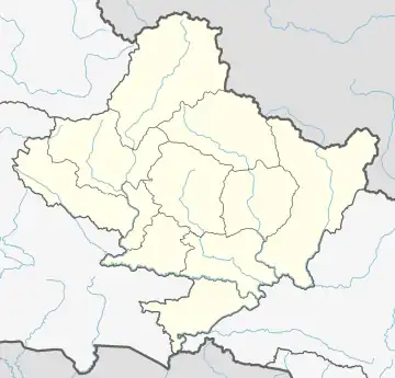
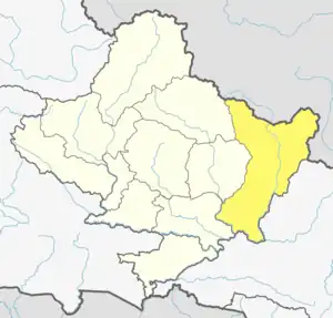
 Gorkha Location in Nepal  Gorkha Gorkha (Nepal) | |
| Coordinates: 28°0′0″N 84°38′0″E / 28.00000°N 84.63333°E | |
| Country | |
| Province | Gandaki Province |
| District | Gorkha District |
| Government | |
| • Mayor | Krishna Rana Magar |
| • Deputy Mayor | Masali Maya Thokar |
| Highest elevation | 1,522 m (4,993 ft) |
| Lowest elevation | 328 m (1,076 ft) |
| Population (2021) | |
| • Total | 53,285 |
| Time zone | UTC+5:45 (NST) |
| Postal code | 34000 |
| Area code | 064 |
| Website | gorkhamun.gov.np |
Gorkha (Nepali: गोरखा, formerly known as Prithbinarayan Municipality) is a municipality in Gorkha District in Gandaki Province of Nepal created in 1996. It was initially named "Prithibinarayan" after King Prithvi Narayan Shah, who was born in Gorkha and united and founded modern Nepal.[1] In 2009, the name was changed to "Gorkha" municipality after the end of the monarchy in Nepal. At the time of the 2021 Nepal census it had a population of 53,285 people living in 12,641 individual households.[2] In 2014, the neighboring Village development committees Nareshwar and Phinam were merged into the municipality.
The old royal palace (Gorkha Durbar), Gorakhnath and Kalika (temple of the goddess Kali) are the main attractions. The Royal Palace itself was destroyed in the 2015 earthquake. However the Gorakhnath shrine and Kalika temple are open with no entrance charges.[3] The lower palace (Tallo Durbar) and a modern park are other major attractions. It is also the starting point of the Manasalu Himal (Mount Manasalu) and Mount Ganesh trekking route. Gorkha Hospital is the hospital and Drabya Saha Multiple Campus and Gorkha Education Campus are the two campuses serving the population.
Demographics
At the time of the 2011 Nepal census, Gorkha Municipality had a population of 50,684. Of these, 85.8% spoke Nepali, 3.4% Gurung, 2.9% Urdu, 2.0% Magar, 1.6% Kumhali, 1.5% Tamang, 0.8% Bhojpuri, 0.8% Newar, 0.3% Ghale, 0.2% Hindi, 0.1% Maithili, 0.1% Rai, 0.1% Tharu and 0.1% other languages as their first language.[4]
In terms of ethnicity/caste, 21.1% were Chhetri, 15.5% Magar, 12.8% Hill Brahmin, 10.1% Sarki, 8.8% Newar, 6.8% Gurung, 5.8% Kami, 4.7% Kumal, 3.2% Musalman, 2.7% Damai/Dholi, 2.4% Tamang, 1.4% Sanyasi/Dasnami, 0.8% Gharti/Bhujel, 0.7% Thakuri, 0.6% Darai, 0.5% Ghale, 0.3% Brahmu/Barahmo, 0.2% Badi, 0.2% Gaine, 0.2% Nuniya, 0.2% Tharu, 0.1% other Dalit, 0.1% Koiri/Kushwaha, 0.1% Limbu, 0.1% Majhi, 0.1% Rai, 0.1% Teli and 0.3% others.[5]
In terms of religion, 87.8% were Hindu, 4.5% Christian, 4.4% Buddhist, 3.1% Muslim and 0.1% others.[6]
In terms of literacy, 76.1% could both read and write, 1.9% could read but not write and 22.0% could neither read nor write.[7]
Media
To promote local culture Gorkha has three Community radio stations, Radio Manaslu - 103.9 MHz, Radio Gorkha - 92.8 MHz and Radio Deurali F.M - 106.4 MHz.
Transportation
Palungtar Airport, also known a Gorkha Airport, is an out of service airport that lies in the neighboring Palungtar Municipality. Gorkha is road accessible from all parts of Nepal. Gorkha has direct bus service from Kathmandu, Pokhara, Chitwan [8]
See also
References
- ↑ Major Tourism Sites in Nepal
- ↑ "National Population and Housing Census 2021". Census Nepal. Central Bureau of Statistics. January 2021. Archived from the original on 2022-06-22.
- ↑ "Gorkha Durbar Guide". The Longest Way Home. 26 September 2019. Retrieved 15 October 2019.
- ↑ NepalMap Language
- ↑ NepalMap Caste
- ↑ NepalMap Religion
- ↑ NepalMap Literacy
- ↑ "Tikapur Airport" (PDF). Civil Aviation authority of Nepal. Archived from the original (PDF) on 19 May 2018. Retrieved 1 May 2018.
