Puerto Lempira | |
|---|---|
Municipality | |
 Dock in Puerto Lempira | |
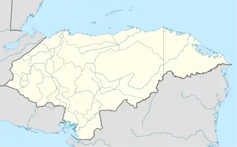
 Puerto Lempira Location in Honduras | |
| Coordinates: 15°16′N 83°46′W / 15.267°N 83.767°W | |
| Country | Honduras |
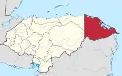
| Department | Gracias a Dios |
| Villages | 31 |
| Area | |
| • Municipality | 7,126 km2 (2,751 sq mi) |
| Elevation | 10 m (30 ft) |
| Population (2023 projection)[1] | |
| • Municipality | 61,626 |
| • Density | 8.6/km2 (22/sq mi) |
| • Urban | 25,662 |
| Time zone | UTC−6 (Central America) |
| Climate | Af |
Puerto Lempira or Auhya Yari is the Miskito capital of the Gracias a Dios department in northeastern Honduras, located on the shores of the Caratasca Lagoon. Though it does not have paved roads, it is the largest town in the La Mosquitia region.[2]
The town is named for the 16th century leader of the indigenous Lenca peoples, Lempira, who directed an ultimately unsuccessful resistance against the Spanish conquistador forces in the 1530s.
Puerto Lempira became the departmental capital in 1975, prior to which it was Brus Laguna. In the 1980s, the town became a centre for CIA operations against the Sandinistas.[3]
Its population is 22,860 (2023 calculation).[4]
Puerto Lempira is sister city to Plattsburgh, New York, US, and has been since 2011.
Demographics
At the time of the 2013 Honduras census, Puerto Lempira municipality had a population of 47,528. Of these, 82.41% were Indigenous (81.98% Miskito), 14.86% Mestizo, 1.34% Afro-Honduran or Black, 1.27% White and 0.13% others.[5]
Culture
Miskito culture is dominant, though not exclusive.
Language
Miskito language is dominant and official in the region, followed by Mayangna and Spanish.
Transportation
The city is served by Puerto Lempira Airport, which operates several flights a week on a regular schedule.
Climate
Like most of the Caribbean side of Central America, Puerto Lempira has a warm, humid and rainy tropical rainforest climate (Köppen Af). Its driest month of March, when the relentlessly wet trade winds are weakest, is only marginally rainy enough to avoid a tropical monsoon classification; however, between June and December monthly rainfall consistently averages above or near 300 millimetres or 12 inches.
| Climate data for Puerto Lempira (1961-1990, extremes 1961-present) | |||||||||||||
|---|---|---|---|---|---|---|---|---|---|---|---|---|---|
| Month | Jan | Feb | Mar | Apr | May | Jun | Jul | Aug | Sep | Oct | Nov | Dec | Year |
| Record high °C (°F) | 33.0 (91.4) |
35.2 (95.4) |
36.4 (97.5) |
37.0 (98.6) |
38.0 (100.4) |
34.8 (94.6) |
35.0 (95.0) |
37.3 (99.1) |
38.1 (100.6) |
35.0 (95.0) |
34.6 (94.3) |
32.8 (91.0) |
38.1 (100.6) |
| Mean daily maximum °C (°F) | 28.2 (82.8) |
28.8 (83.8) |
30.2 (86.4) |
31.1 (88.0) |
31.6 (88.9) |
30.7 (87.3) |
30.1 (86.2) |
30.3 (86.5) |
30.6 (87.1) |
29.7 (85.5) |
29.0 (84.2) |
28.4 (83.1) |
29.9 (85.8) |
| Daily mean °C (°F) | 25.9 (78.6) |
26.2 (79.2) |
27.3 (81.1) |
28.2 (82.8) |
28.5 (83.3) |
28.1 (82.6) |
27.9 (82.2) |
28.1 (82.6) |
27.8 (82.0) |
27.2 (81.0) |
26.7 (80.1) |
26.1 (79.0) |
27.3 (81.1) |
| Mean daily minimum °C (°F) | 22.0 (71.6) |
21.8 (71.2) |
22.1 (71.8) |
23.0 (73.4) |
23.7 (74.7) |
24.1 (75.4) |
23.9 (75.0) |
24.0 (75.2) |
23.6 (74.5) |
23.2 (73.8) |
23.1 (73.6) |
22.7 (72.9) |
23.1 (73.6) |
| Record low °C (°F) | 14.5 (58.1) |
14.0 (57.2) |
12.5 (54.5) |
15.0 (59.0) |
21.4 (70.5) |
15.5 (59.9) |
16.0 (60.8) |
17.4 (63.3) |
17.0 (62.6) |
15.3 (59.5) |
15.5 (59.9) |
11.0 (51.8) |
11.0 (51.8) |
| Average rainfall mm (inches) | 193.2 (7.61) |
135.8 (5.35) |
69.3 (2.73) |
79.7 (3.14) |
215.6 (8.49) |
368.0 (14.49) |
420.3 (16.55) |
354.1 (13.94) |
316.3 (12.45) |
456.9 (17.99) |
430.6 (16.95) |
293.1 (11.54) |
3,332.9 (131.22) |
| Average rainy days (≥ 1.0 mm) | 12 | 9 | 6 | 5 | 9 | 16 | 19 | 17 | 16 | 19 | 16 | 15 | 159 |
| Source 1: NOAA[6] | |||||||||||||
| Source 2: Meteo Climat (record highs and lows)[7] | |||||||||||||
References
- ↑ Citypopulation.de Population of departments and municipalities in Honduras
- ↑ Chandler, Gary & Prado, Liza. Honduras & the Bay Islands (2007) p. 297 (ISBN 978-1740591508)
- ↑ Gill, Nicholas. Frommer's Honduras (2009) p.260 (ISBN 978-0470159439)
- ↑ Citypopulation.de Population of cities in Honduras
- ↑ Instituto Nacional de Estadística (INE), bases de datos en línea
- ↑ "Puerto Lempira Climate Normals 1961–1990". National Oceanic and Atmospheric Administration. Retrieved 24 January 2016.
- ↑ "Station Puerto Lempira" (in French). Meteo Climat. Retrieved 12 June 2016.
