| Rapp Creek Rapp Run | |
|---|---|
 Rapp Creek | |
| Location | |
| Country | United States |
| State | Pennsylvania |
| County | Bucks County |
| Township | Nockamixon Township |
| Physical characteristics | |
| Source | Pond |
| • location | Pond near Lake Warren |
| • coordinates | 40°32′36″N 75°09′26″W / 40.54333°N 75.15722°W |
| • elevation | 530 feet (160 m) |
| Mouth | |
• location | Confluence of Rapp Creek and Beaver Creek forming the headwaters of Tinicum Creek |
• coordinates | 40°28′50″N 75°08′48″W / 40.48056°N 75.14667°W |
• elevation | 240 feet (73 m) |
| Length | 5.71 miles (9.19 km) |
| Basin size | 6.97 square miles (18.1 km2) |
| Basin features | |
| Progression | Rapp Creek-Tinicum Creek-Delaware River |
| River system | Delaware River |
| Waterbodies | Lake Warren |
| Bridges | Lake Warren Road, Lonely Cottage Road, Colonial Way, Marienstein Road, Beaver Run Road, Quarry Road, Bunker Hill Road, Clay Ridge Road |
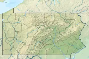
Rapp Creek is a tributary of Tinicum Creek in Nockamixon Township, Bucks County, Pennsylvania in the United States. Rapp Creek is part of the Delaware River watershed.
Statistics
Rapp Creek was entered into the Geographic Names Information System on 2 August 1979 as identification number 1184658. It appears in the Pennsylvania Gazatteer of Streams as identification number 03235 which indicates that Rapp Creek has a watershed of 6.97 square miles (18.1 km2). Rapp Creek and Beaver Creek meet their confluences together at Tinicum Creek's 6.40 river mile.[1][2]
Course
The headwaters of Rapp Creek rises from an unnamed pond south of Coffman Hill in upper Bucks County and flows into Lake Warren within a few hundred feet. Lake Warren was formed as a result of an earthen dam about 1935 and is owned by the Pennsylvania Fish and Game Commission. The dam is about 10 feet high, 110 feet long which allows Warren to contain a surface area of 15 acres (6.1 ha). After Lake Warren, Rapp continues generally southeastward for about two-thirds of its length receiving a tributary from the left. Then as it turns to flow to the southeast, it picks up a tributary from the right bank next to a quarry. After a short length it meets Beaver Creek to form Tinicum Creek.[1]
Geology
- Appalachian Highlands Division
- Piedmont Province
- Gettysburg-Newark Lowland Section
- Brunswick Formation
- Lockatong Formation
- Diabase
- Gettysburg-Newark Lowland Section
- Piedmont Province
Rapp Creek begins in a region of diabase, an igneous intrusion rising during the Jurassic and the Triassic which consists of dark and very fine grained labradorite and augite. It then flows into the Lockatong Formation, a sedimentary layer consisting of dark-gray to black argillite, shale, with some limestone and calcareous shale. Shortly before it meets the Tinicum, it passes into the Brunswick Formation, which consists of sedimentary mudstone, siltstone, and shale. Mineralogy includes argillite and hornfels.[3]
Crossings and Bridges
| Crossing | NBI Number | Length | Lanes | Spans | Material/Design | Built | Reconstructed | Latitude | Longitude |
|---|---|---|---|---|---|---|---|---|---|
| Clay Ridge Road | 7567 | 17 metres (56 ft) | 1 | 2 | Steel stringer/multi-beam or girder | 1917 | - | 40°28'54.3"N | 75°8'49.2"W |
| Bunker Hill Road | - | - | - | - | - | - | - | - | - |
| Quarry Road | 7573 | 16 metres (52 ft) | 1 | 2 | Masonry Arch-deck | 1900 | - | 40°29'49.9"N | 75°9'56.4"W |
| Beaver Run Road | 7563 | 24 metres (79 ft) | 2 | 1 | Masonry Arch-deck | 1902 | 1963 | 40°30'44.8"N | 75°9'13.3"W |
| Marienstein Road | - | - | - | - | - | - | - | - | - |
| Colonial Way | - | - | - | - | - | - | - | - | - |
| Lonely Cottage Road | 7625 | 7 metres (23 ft) | 2 | 1 | Steel stringer/multi-beam or girder | 1960 | - | 40°31'58.9"N | 75°9'14.5"W |
| Lake Warren Road | - | - | - | - | - | - | - | - | - |
See also
References
- 1 2 "GNIS Feature Search". TNM download. U.S. Geological Survey, U.S. Department of the Interior. Retrieved 15 January 2018.
- ↑ http://www.lycoming.edu/cwi/pdfs/paGazetterOfStreams.pdf
- ↑ "Pennsylvania Geological Survey". PaGEODE. Pennsylvania Department of Conservation and Natural Resources. Archived from the original on April 11, 2014. Retrieved 10 December 2017.