Rehoboth Basterland | |||||||||
|---|---|---|---|---|---|---|---|---|---|
| 1979–1989 | |||||||||
 Flag | |||||||||
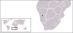
 Location of Rehoboth within South West Africa. | |||||||||
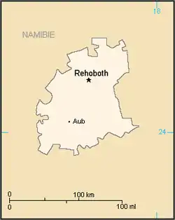
 Map of Rehoboth. | |||||||||
| Status | Bantustan | ||||||||
| Capital | Rehoboth | ||||||||
| History | |||||||||
• Established | 1979 | ||||||||
• Re-integrated into Namibia | May 1989 | ||||||||
| Currency | South African rand | ||||||||
| |||||||||

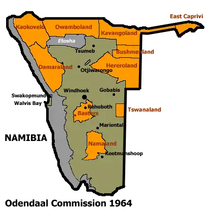
Allocation of Land to Bantustans according to the Odendaal Plan. The homeland of Rehoboth is in the centre of the territory.
Rehoboth (or Basterland) was a homeland in South West Africa (present-day Namibia) intended by the apartheid-era government to be a self-governing homeland for the Baster people in the area around the town of Rehoboth.
The Bantustan existed until 29 July 1989, a few months prior to the Independence of Namibia.
Governance
The Rehoboth Self-government Act, 1976 established a Government of Rehoboth consisting of a Legislative Council with the ability to pass legislation known as "Acts" and a Kaptein's Council, led by an elected Kaptein.[1] The office of Kaptein itself dates to the period of German colonial rule.
Leaders
| Tenure | Incumbent | Affiliation |
|---|---|---|
| 2 July 1979 to May 1989 | Johannes "Hans" Diergaardt Kaptein of the Basters | RFP |
See also
References
External links
- Rehoboth Basters Archived 2010-02-27 at the Wayback Machine, information on the history of the Baster community in Namibia.
This article is issued from Wikipedia. The text is licensed under Creative Commons - Attribution - Sharealike. Additional terms may apply for the media files.