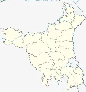
Rojhuwas, Rewari | |
|---|---|
 Rojhuwas, Rewari Rojhuwas Village in Rewari  Rojhuwas, Rewari Rojhuwas, Rewari (India) | |
| Coordinates: 28°18′32″N 76°36′34″E / 28.308948°N 76.609500°E | |
| Country | India |
| Government | |
| • Body | Village panchayat |
| Time zone | UTC+5:30 (IST) |
Rojhuwas is a village in Jatusana Tehsil in Rewari district of Haryana, India. It belongs to Gurgaon division. It is located 16 kilometres (9.9 mi) north of its District headquarters at Rewari, 2 kilometres (1.2 mi) from Jatusana, and 315 kilometres (196 mi) from the state capital if Chandigarh.
123401 is its pincode and postal head office is Tehsil Road Rewari. Rohrai, Parkhotampur, Musepur, Gopalpur Gazi, Haluhera are the nearby villages to Rojhuwas.
References
This article is issued from Wikipedia. The text is licensed under Creative Commons - Attribution - Sharealike. Additional terms may apply for the media files.