| Salmon River Reservoir | |
|---|---|
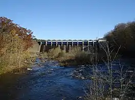
 View of the dam that impounds the upper Salmon River Reservoir, October 2008 | |
 Salmon River Reservoir  Salmon River Reservoir | |
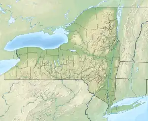
| Location | Oswego County, New York, United States |
| Coordinates | 43°32′39″N 75°55′10″W / 43.54417°N 75.91944°W |
| Type | Reservoir |
| Primary inflows | Salmon River |
| Primary outflows | Salmon River |
| Basin countries | United States |
| Surface area | 3,379 acres (13.67 km2) |
| Average depth | 19 feet (5.8 m) |
| Max. depth | 55 ft (17 m) |
| Shore length1 | 30.6 miles (49.2 km) |
| Surface elevation | 938 ft (286 m)[1] |
| Islands | 11 Burdick Island, Huckleberry Island |
| Settlements | Redfield, New York |
| 1 Shore length is not a well-defined measure. | |
Salmon River Reservoir, also known as the Redfield Reservoir, is a man-made lake located near the hamlet of Redfield, New York. The reservoir was created with the completion of a hydroelectric dam in 1912. It has the capacity to hold 56,000 acre-feet (69,000,000 m3) of water.[2][3] It is the larger of the Salmon River's two reservoirs.
Fishing
Fish species present in the lake include brown trout, rainbow trout, smallmouth bass, walleye, yellow perch, and pumpkinseed sunfish. Access is permitted by a concrete ramp off Orwell-Redfield Road, five miles (8.0 km) west of Redfield, and from County Route 17 in the hamlet of Redfield. A beach access launch is also available from the CCC Road off Orwell-Redfield Road, four miles (6.4 km) west of the hamlet of Redfield.[4]
References
- ↑ "Salmon River Reservoir". dec.ny.gov. NYSDEC. 1998. Retrieved 4 May 2017.
- ↑ "Salmon River Reservoir". NYS Department of Environmental Conservation. Retrieved May 29, 2017.
- ↑ Sawchuck, Daniel J. (2003). Salmon River Falls Unique Area Unit Management Plan (PDF). NYS Department of Environmental Conservation. pp. 4–7. Retrieved May 29, 2017.
- ↑ Sportsman's Connection (Firm) (2011-01-01), Western Adirondacks New York fishing map guide: includes lakes & streams for the following counties: Allegany, Broome, Cattaraugus, Cayuga, Chautauqua, Chemung, Cortland, Erie, Livingston, Madison, Monroe, Niagara, Onondaga, Ontario, Orleans, Oswego, Schuyler, Seneca, Steuben, Tioga, Tompkins, Wayne, Wyoming, and Yates., Sportsman's Connection, ISBN 978-1-885010-63-6, OCLC 986498446