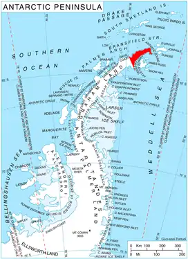
Location of Trinity Peninsula.
Schmidt Peninsula (63°19′S 57°54′W / 63.317°S 57.900°W) is a small peninsula connected by a low isthmus to Cape Legoupil, Trinity Peninsula. Its western extremity is Bahamonde Point.
The peninsula was named by the Chilean Antarctic Expedition of 1947-48 for Captain Hugo Schmidt Prado, Chilean Army, the first commander of Base Bernardo O'Higgins established in 1948 on this peninsula.
Map
- Trinity Peninsula. Scale 1:250000 topographic map No. 5697. Institut für Angewandte Geodäsie and British Antarctic Survey, 1996.
![]() This article incorporates public domain material from "Schmidt Peninsula (Antarctica)". Geographic Names Information System. United States Geological Survey.
This article incorporates public domain material from "Schmidt Peninsula (Antarctica)". Geographic Names Information System. United States Geological Survey.
This article is issued from Wikipedia. The text is licensed under Creative Commons - Attribution - Sharealike. Additional terms may apply for the media files.