 | |
|---|---|
| 西湘バイパス | |
| Route information | |
| Length | 14.5 km[1] 1.8 km (Ishibashi Branch Route)[1] (9.0 mi) Main Route |
| Existed | 1967[2]–present |
| Major junctions | |
| From | Seishō-Ninomiya Interchange in Ninomiya, Kanagawa |
| To | Hakoneguchi Interchange in Odawara, Kanagawa Ishibashi Interchange in Odawara, Kanagawa |
| Location | |
| Country | Japan |
| Highway system | |
The Seishō Bypass (西湘バイパス, Seishō Baipasu) (lit. West Shōnan Bypass) is a toll road in Kanagawa Prefecture, Japan. It is owned and managed by Central Nippon Expressway Company.
Overview
Officially the road is designated as a bypass for National Route 1. It is also classified as a road for motor vehicles only (自動車専用道路, Jidōsha Senyō Dōro) and access is controlled with interchanges and junctions in a similar manner to national expressways in Japan.
The road closely follows the coastline of Sagami Bay, facilitating access between the Tokyo urban area and the city of Odawara in western Kanagawa Prefecture. At the eastern terminus the Seishō Bypass continues as a toll-free road managed by the Ministry of Land, Infrastructure and Transport. In the west, the main route terminates near the resort town of Hakone, while a short branch route terminates at an intersection with National Route 135 which leads to the resort town of Atami and the Izu Peninsula.
The first section of the road was opened to traffic in 1967 and the entire route was completed in 1972.[3] The main route has 4 lanes of traffic and the Ishibashi branch route has 2 lanes.
There are three toll collection points along the road. On the main route at the Tachibana Toll Plaza, a toll of 250 yen is collected from regular passenger cars. At Kōzu Interchange these vehicles are charged 150 yen at the eastbound exit and westbound entrance. At Ishibashi Interchange 200 yen is collected. Electronic Toll Collection (ETC) is accepted for payment, however no discount programs are in effect.
In September 2007 Typhoon Fitow caused extensive damage to the road, reducing some sections to two lanes of traffic and forcing the complete closure of other sections. The entire road was restored to full capacity on April 25, 2008.[4]
Interchange list
- IC - interchange, JCT - junction, PA - parking area, TB - toll gate
Main Route
| Name | Connections | Dist. from Origin |
Notes | Location (all in Kanagawa) |
|---|---|---|---|---|
| Through to | ||||
| Seishō-Ninomiya IC | 0.0 | Ninomiya | ||
| Tachibana IC/ Tachibana TB/ Seishō PA |
2.8 | IC: Ninomiya-bound entrance and exit only PA: Ninomiya-bound only |
Odawara | |
| Kōzu IC/ Seishō PA |
Pref. Route 72 (Matsuda Kōzu Route) |
5.5 | PA: Hakone-bound only | |
| Sakawa IC | 8.0 | Ninomiya-bound entrance only | ||
| Odawara IC | 9.6 | Ninomiya-bound entrance, Hakone-bound exit only | ||
| Hayakawa JCT | 11.6 | |||
| Hayakawa IC | 12.2 | Ninomiya-bound entrance, Hakone-bound exit only | ||
| Hakone Turnpike | ↓ | Ninomiya-bound entrance, Hakone-bound exit only | ||
| Odawara-nishi IC | 13.8 | Local road access via Odawara-Atsugi Road only | ||
| Hakoneguchi IC | 14.5 | |||
| Through to | ||||
Ishibashi Branch Route
| Name | Connections | Dist. from Origin |
Notes | Location (all in Kanagawa) |
|---|---|---|---|---|
| Hayakawa JCT | 11.6 | Odawara | ||
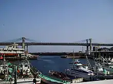
| Odawara Blue Way Bridge | ↓ | |||
| Ishibashi IC | 13.4 | |||
References
- 1 2 "E-NEXCO Drive Plaza Route Search". Retrieved 2008-06-03.
- ↑ Ministry of Land, Infrastructure and Transport, Kanto Bureau. "50 Years of History Online Magazine, Series 4". Retrieved 2008-06-03.
{{cite web}}: CS1 maint: multiple names: authors list (link) - ↑ Japan Civil Engineering Contractors' Association. "Construction History of Japan". Archived from the original on 2007-02-17. Retrieved 2008-06-03.
- ↑ Ministry of Land, Infrastructure and Transport, Kanto Bureau, Yokohama Office. "Status of Seisho Bypass Restoration". Retrieved 2008-06-03.
{{cite web}}: CS1 maint: multiple names: authors list (link)
External links
| National Expressways | |
|---|---|
| Toll Roads | |