| Lake Sentani | |
|---|---|
| Danau Sentani | |
 | |
 Lake Sentani | |
| Location | Jayapura Regency, Papua, Indonesia |
| Coordinates | 2°37′S 140°34′E / 2.61°S 140.56°E |
| Catchment area | 600 km2 (230 sq mi) |
| Max. length | 28 km (17 mi) |
| Max. width | 19 km (12 mi) |
| Surface area | 104 km2 (40 sq mi) |
| Max. depth | 52 m (171 ft) |
| Residence time | Short |
| Surface elevation | 73 m (240 ft) |
| Settlements | Sentani |
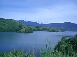
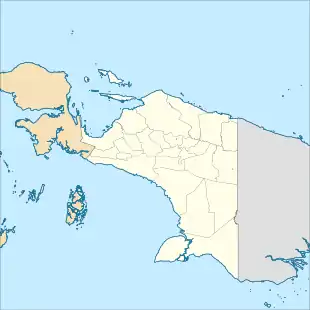
Lake Sentani is a tropical, shallow, and at low-altitude open lake located at the northeast extremity of the Jayapura Regency in the Indonesian province of Papua, about 20 kilometres (12 mi) from the provincial capital, Jayapura City. It is located just to the south of the town of Sentani.
The lake, which is considered by the local population as the home of the rainbows, is part of the Cyclops Strict Nature Reserve and contains several endemic species of fish.[1]
Hydrology
Lake Sentani lies at the foot of the Mesozoic mafic and ultramafic rocks of the Cyclops ophiolite mountains in a fault-controlled depression at an elevation of 73 metres (240 ft) above sea level. Sentani is an irregularly shaped body with approximate maximum length extending from east to west of 28 kilometres (17 mi) and, from north to south, 19 kilometres (12 mi) of breadth. With a surface area of 104 square kilometres (40 sq mi), Lake Sentani is the largest lake of the Intan Jaya region.[2]
Lake Sentani receives its water primarily from direct precipitation with an average annual rainfall around the lake of about 2 metres (6.6 ft),[3] and by mountain streams. The average evaporation on the lake is about 0.4 metres (1.3 ft) with seasonal variation in inflow.[4] The lake outflows into the Jafuri and Tami rivers to the Pacific Ocean near the Papua New Guinea border.[1][2]
Geology

Lake Sentani, the best studied of Irian Jaya lakes, is relatively stable and intact. It is widely believed to have evolved by the tectonic damming and uplift of an arm of the sea, but such a connection has not been demonstrated yet.[2]
Natural history
Lake Sentani is thermally stable, with temperatures ranging from 29 to 32 °C (84 to 90 °F) in the top 10 metres (33 ft); the surface pH is 6.2–6.8, and plankton levels are low at 1–2 mg/L except in the westernmost basin, where water circulation is limited, turbidity is doubled, and seasonal algal blooms, with resultant fish mortality.[3][5][4] Preliminary bottom sediment samples from the eastern part of the lake have yielded sparse populations of arcellacean microfauna, dominated by Centropyxid types. In other parts of the world these species are found associated with brackish or polluted water conditions, raising the possibility that there is residual salinity in the deeper parts of the lake.[2]
It may be small, but it harbors 34 species of fish, of which 13 are resident natives, 8 anadromous and 13 introduced. Besides having its own species of rainbowfish (Sentani rainbowfish and red rainbowfish), Lake Sentani is also home to two other fish species that cannot be found anywhere else, the Sentani gudgeon and Sentani goby.[1][6] Sawfish up to 3 metres (9.8 ft) were well known in the lake until the 1970s and are a common motif in traditional Sentani art, but appear to have been extirpated.[7] Fish are extensively raised in ponds and cages around the perimeter of the lake and the introduction of species (particularly carp and tilapia) has been both accidental and intentional.[2]
In this part of the world and at this latitude rainbows are visible only after a hard rain, but in Lake Sentani they are visible all the time, at least, by seeing the Sentani rainbowfish that, along with many others, are unique to this lake.[1]
History
During World War II the United States Navy built a naval base at the Lake as part of Naval Base Hollandia. The base operated from 1944 to 1945.[8][9]
Economy
Many of the Sentani people, who inhabit the islands, perimeter and environs of the lake, still have a traditional subsistence economy based on fishing and sago harvesting. This has been sustainable for centuries but local reports suggest that catch yields have diminished in recent years. Whether this is a result of overfishing (as a result of population growth and/or market pressure), pollution or introduction of foreign species is not established. Many of the residents occupy dwellings built on posts over the lake, which thus serves as a depository for sewage, leading to locally high coliform bacteria counts,[10][11] but also to nutrient enrichment. Water hyacinth (Eichornia crassipes), introduced since the early 1970s, has become a major plant pest and may contribute to the decline of some species.[2]
Much of the mountainous terrain between the north shore of the lake and the ocean falls within the Cyclops Strict Nature Reserve. The future management of the reserve and buffer zone, and the environmental quality of the lake, are strongly interdependent. Recently a major reforestation project of grassland on the slopes surrounding the lake has been initiated, with the support of forest companies operating in Papua. This ecoregion is located within one of the most populated areas of New Guinea, but it is threatened by overfishing, the introduction of new species, which could be harmful to the endemic species in this lake.[1] and aquaculture. A major sustainable development issues for the inhabitants of the lake and surroundings is the existing proposal to build a hydroelectric power plant through a dam placed on the Jafuri river. Several feasibility and environmental impact studies have been published, but the cost/benefit consequences of this project have not been released yet.[12][2]
Notable attractions
On a hill at the northwest of the Lake, there is a megalithic and petroglyphic place called Doyo Lama. Some archaeologists think that it was built under Micronesian influence.[13]
See also
References
Notes
- 1 2 3 4 5 WWF 2001.
- 1 2 3 4 5 6 7 Moore et al.
- 1 2 FAO 1972.
- 1 2 Howard 1987.
- ↑ CIDA 1985.
- ↑ Hoese, D.F., and G.R. Allen (2015). Descriptions of three new species of Glossogobius (Teleostei: Gobiidae) from New Guinea. Zootaxa 3986(2): 201-16. doi: 10.11646/zootaxa.3986.2.4
- ↑ Renyaan 1993.
- ↑ "Building the Navy's Bases, vol. 2 (part III, chapter 26)". US Navy.
- ↑ Humboldt Bay, pacificwrecks.com
- ↑ Daawia 1992.
- ↑ Budi et al. 1994.
- ↑ UNCEN 1984.
- ↑ Art of the South Seas under direction of Douglas NEWTON, p. 180
Bibliography
- Budi, I. M.; Agustini, V.; Kirenius, M.; Suyono, I. J.; Rufina, E. (1994), Study Tentang Kualitas Air Danau Sentani di Desa Ayapo, Kecamatan Sentani, Kabupaten Jayapura [Study of Lake Sentani Water Quality in Ayapo village, Subdistrict of Sentani, District of Jayapura] (in Indonesian), Program Pendidikan Matematika dan Ilmu Pengetahuan Alam, Universitas Cenderawasih
- Daawia (1992), Kualitas Air Secara Mikrobiologi Dengan Indikator Coliform dan E. coli Terhadap Perairan Danau Sentani di Daerah Netar Desa Nendali, Kecamatan Sentani, Kabupaten Jayapura [Microbiological water quality assessment by coliform indicator and E. coli in the area of Netar, Nendali village, Subdistrict of Sentani, District of Jayapura, SI thesis] (in Indonesian), Fakultas Keguruan dan Ilmu Pendidikan, Universitas Cenderawasih
- Howard, K. T. (1987), Inland Fisheries Development Irian Jaya, Government of Indonesia UNDP/IRBD Regional Planning Investigation, Preparation and Experimental Area Development Project, Nusa Tenggara, Southeast Sulawesi and Irian Jaya
- Moore, John M.; Rocchi, Ann; Renyaan, Samuel J., The Background of Lake Sentani, park.org
- Related article
- "Danau Sentani: A lake created by a fault in the earths' crust". indahnesia.com.
- Odada, Eric O.; Olago, Daniel O.; Ochola, Washington; Ntiba, Micheni; Wandiga, Shem; Gichuki, Nathan; Oyieke, Helida, eds. (2005), Proceedings of the 11th World Lakes Conference, Nairobi, Kenya, 31 October to 4th November 2005 (PDF), vol. I, Ministry of Water and Irrigation, Kenya; International Lake Environment Committee Foundation (ILEC), Japan; Pan African START Secretariat, Nairobi, Kenya
- Related articles
- Anshari, Gusti Z.; et al., Roles of government, scientists and NPOs in the development of Indonesia Lake Vision, p. 1
- Lehmusluoto, Pasi; et al. (2003), Indonesian lake crisis, a reality?, p. 343
- Ratcliffe, John (1984), Cyclops Mountains Strict Nature Reserve Management Plan 1985-1989, WWF
- Renyaan, S. J. (1993), Hoeft, R. (ed.), "The Freshwater Fishes of Lake Sentani, Jayapura, Irian Jaya", Proceedings of the Biological Society of New Guinea, Wau Ecology Institute
- Environmental Impact Analysis of Sentani Lake Hydroelectric Power Project, Irian Jaya (Executive Summary, Appendices and Map), Environmental Study Center of Cenderawasih University, 1984
- Related article
- Pusat, Tim (1983), Laporan Kemajuan Studi Analisa Dampak Lingkungan Proyek PLTA Sentani, Irian Jaya [Progress Report on Environmental Impact Analysis Study of the Hydro Electric Power Plant Project, Sentani, Irian Jaya] (in Indonesian), Studi Lingkungan Hidup, Universitas Cenderawasih
- Inland Fisheries Development in West Irian. Report on Project Results, Conclusions and Recommendations, FAO, 1972
- Lakes Kutubu and Sentani, WWF, 2001, archived from the original on September 30, 2007
- Sentani Lake Hydro Electric Development Assessment, Canadian International Development Agency (CIDA), 1985
Further reading
- Allen, Gerald R.; Cross, N. J. (1980), Descriptions of 5 New Rainbow fishes (Melanotaeniidae) from New Guinea, Rec. West. Aust. Mus.
- Allen, Gerald R.; Boeseman, M. (1982), Collection of Freshwater Fishes from Western New Guinea with Descriptions of Two New Species (Gobiidae and Eleotridae), vol. 2, Rec. West. Aust. Mus., pp. 67–103
- Antoh, S.; Holle, E.; Rantetampang, A.; Wasaraka, A. (1986), Suatu Studi Deskriptif Tentang Ekologi Desa Sabron Dosay dan Danau Sentani Kecamatan Sentani Kabupaten Jayapura [Descriptive Study of Ecology of Sabron Dosay village and Lake Sentani, Subdistrict of Sentani, District of Jayapura] (in Indonesian), Panitia Penyelenggara Mapala Wilayah V, Universitas Cenderawasih
- Boeseman, M. (January 1956). "The Lake Resources of Netherlands New Guinea". SPC Quarterly Bulletin.
- Cheeseman, L.E. (1938). "The Cyclops Mountains of Dutch New Guinea". Geographical Journal (91). doi:10.2307/1787814. JSTOR 1787814.
- Hermkens, Anna-Karina (1997), The Way of the Objects: Analogical Inference and the Allocation of Meaning and Order in Lapita, Dongson and Lake Sentani Material Culture (MA Thesis), Theoretical Archaeology, Rijksuniversiteit, Leiden.
- Parts
- "Table of contents, list of figures, acknowledgements" (PDF). PapuaWeb.
- "Introduction" (PDF). PapuaWeb.
- "Part I: Archaeology as Anthropology" (PDF). PapuaWeb.
- "Part II: Lake Sentani: Geographical and pre-historical context" (PDF). PapuaWeb.
- "Part III: Formal Analyses of Lapita, Dongson and Lake Sentani designs" (PDF). PapuaWeb.
- "Part IV: Context of the Lake Sentani Material" (PDF). PapuaWeb.
- "Part V: Lake Sentani: A structural analysis of myths" (PDF). PapuaWeb.
- "Part VI: Summary and Conclusions" (PDF). PapuaWeb.
- "References" (PDF). PapuaWeb.
- "Supplement" (PDF). PapuaWeb.
- Holthuis, L. B. (1982). Gressitt, J. L. (ed.). "Freshwater Crustacea Decapoda of New Guinea". Biogeography and Ecology of New Guinea. Monographiae Biologicae. The Hague: Dr. W. Junk Publishers. II: 603–619. doi:10.1007/978-94-009-8632-9_28. ISBN 978-94-009-8634-3.
- Lantang, D.; Tanjung, Tanta, R. (1993), Etnobotani Masyarakat Tepera Depapre, Kabupaten Jayapura [Ethnobotany of Tepera Depapre Community, District of Jayapura] (in Indonesian), Falkultas Keguruan dan Ilmu Pendidikan, Universitas Cenderawasih
- Renyaan, S. J. (1994), Sustainable use of Lutjanus Goldiei (Papuan Blackbass) in the Djafuri River System, Jayapura, Lembaga Pembangunan Insani dan Biosfer Indonesia, Dewan Riset Nasional dan Departemen Kehutanan
- Survei, Tim (1983), Laporan Survei Kualitas Perairan Danau Sentani, Sungai Jafuri dan Teluk Yautefa (Survey Report on the Water Quality of Lake Sentani)
- van Royen, P. (1965). "An Outline of the Flora and Vegetation of the Cyclops Mountains". Botany. Nova Guinea (21).
- Laporan Penelitian Analisa Daerah Aliran Sungai Kamp Walker Waena, Jayapura [Research Report on Analysis of the Water Catchment Area of Kamp Walker River, Waena, Jayapura] (in Indonesian), Jurusan MIPA, Fakultas Keguruan dan Ilmu Pendidikan, Universitas Cenderawasih, 1994
- Hermkens, Anna-Karina (2007). "Gendered Objects. Embodiments of colonial collecting in Dutch New Guinea". Pacific History. 42 (1): 1–20. doi:10.1080/00223340701286727. S2CID 161207518.