Shengzhou
嵊州市 | |
|---|---|
 | |
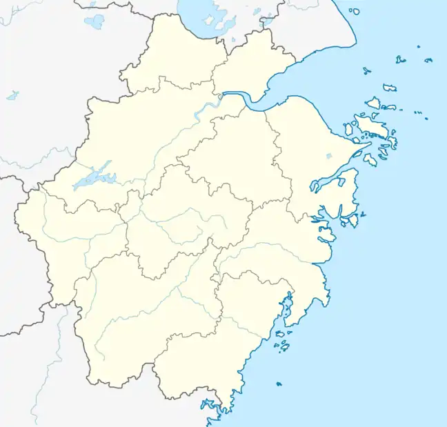
 Shengzhou Location in Zhejiang | |
| Coordinates: 29°36′N 120°49′E / 29.600°N 120.817°E | |
| Country | People's Republic of China |
| Province | Zhejiang |
| Prefecture-level city | Shaoxing |
| Area | |
| • County-level city | 1,789.07 km2 (690.76 sq mi) |
| • Urban | 1,789.07 km2 (690.76 sq mi) |
| • Metro | 3,002.06 km2 (1,159.10 sq mi) |
| Population (2020 census[1]) | |
| • County-level city | 675,226 |
| • Metro | 1,094,262 |
| Time zone | UTC+8 (China Standard) |
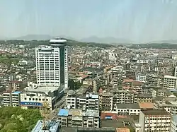
Shengzhou (Chinese: 嵊州; pinyin: Shèngzhōu), formerly Shengxian or Sheng County, is a county-level city in central Zhejiang, south of the Hangzhou Bay, and is the south-eastern part of the prefecture-level city of Shaoxing. It is about 1.5 hours drive from the provincial capital of Hangzhou through the Hangzhou-Ningbo, Shangyu-Sanmen Expressway. As of the 2020 census, its population was 675,226, but 1,094,262 lived in the built-up area made of Shengzhou City and Xinchang County largely being conurbated.[2]
Economy
The city is the national and international top producer of ties.[3]
Art
Shengzhou is the origin of the Yue opera, the second most popular Chinese opera.
Administrative divisions
As of 2020, Shengzhou is divided into 4 Subdistricts, 10 Towns and 1 Township.[4]
Subdistricts
- Shanhu Subdistrict (剡湖街道)
- Sanjiang Subdistrict (三江街道)
- Lushan Subdistrict (鹿山街道)
- Pukou Subdistrict (浦口街道)
Towns (镇, zhen)
- Ganlin (甘霖)
- Changle (长乐)
- Chongren (崇仁)
- Huangze (黄泽)
- Sanjie (三界)
- Shihuang (石璜)
- Gulai (谷来)
- Xianyan (仙岩)
- Jinting (金庭)
- Xiawang (下王)
Township (乡, xiang)
- Guimen (贵门)
Climate
| Climate data for Shengzhou (1991–2020 normals, extremes 1981–2010) | |||||||||||||
|---|---|---|---|---|---|---|---|---|---|---|---|---|---|
| Month | Jan | Feb | Mar | Apr | May | Jun | Jul | Aug | Sep | Oct | Nov | Dec | Year |
| Record high °C (°F) | 24.2 (75.6) |
28.9 (84.0) |
33.0 (91.4) |
34.8 (94.6) |
36.6 (97.9) |
37.8 (100.0) |
41.2 (106.2) |
40.8 (105.4) |
38.7 (101.7) |
35.9 (96.6) |
31.8 (89.2) |
25.7 (78.3) |
41.2 (106.2) |
| Mean daily maximum °C (°F) | 9.3 (48.7) |
12.0 (53.6) |
16.4 (61.5) |
22.6 (72.7) |
27.0 (80.6) |
29.4 (84.9) |
34.2 (93.6) |
33.4 (92.1) |
28.8 (83.8) |
23.8 (74.8) |
18.2 (64.8) |
11.9 (53.4) |
22.3 (72.0) |
| Daily mean °C (°F) | 5.0 (41.0) |
7.1 (44.8) |
11.1 (52.0) |
16.8 (62.2) |
21.6 (70.9) |
24.8 (76.6) |
28.9 (84.0) |
28.2 (82.8) |
24.0 (75.2) |
18.7 (65.7) |
13.2 (55.8) |
7.2 (45.0) |
17.2 (63.0) |
| Mean daily minimum °C (°F) | 1.9 (35.4) |
3.6 (38.5) |
7.2 (45.0) |
12.4 (54.3) |
17.4 (63.3) |
21.4 (70.5) |
25.0 (77.0) |
24.6 (76.3) |
20.6 (69.1) |
14.9 (58.8) |
9.4 (48.9) |
3.6 (38.5) |
13.5 (56.3) |
| Record low °C (°F) | −7.6 (18.3) |
−6.3 (20.7) |
−3.3 (26.1) |
0.1 (32.2) |
7.9 (46.2) |
11.4 (52.5) |
18.1 (64.6) |
17.9 (64.2) |
11.8 (53.2) |
2.3 (36.1) |
−3.4 (25.9) |
−9.5 (14.9) |
−9.5 (14.9) |
| Average precipitation mm (inches) | 74.2 (2.92) |
75.9 (2.99) |
128.3 (5.05) |
119.1 (4.69) |
125.5 (4.94) |
247.2 (9.73) |
124.4 (4.90) |
168.6 (6.64) |
110.1 (4.33) |
56.1 (2.21) |
68.4 (2.69) |
57.3 (2.26) |
1,355.1 (53.35) |
| Average precipitation days (≥ 0.1 mm) | 12.6 | 12.0 | 15.6 | 14.8 | 14.2 | 16.9 | 11.4 | 14.4 | 11.9 | 7.8 | 10.6 | 10.2 | 152.4 |
| Average snowy days | 4.2 | 3.1 | 1.0 | 0.1 | 0 | 0 | 0 | 0 | 0 | 0 | 0.1 | 1.6 | 10.1 |
| Average relative humidity (%) | 76 | 74 | 73 | 71 | 73 | 81 | 74 | 77 | 79 | 76 | 77 | 74 | 75 |
| Mean monthly sunshine hours | 97.8 | 100.3 | 119.6 | 144.8 | 156.2 | 125.5 | 221.7 | 203.7 | 150.9 | 149.7 | 115.3 | 111.2 | 1,696.7 |
| Percent possible sunshine | 30 | 32 | 32 | 37 | 37 | 30 | 52 | 50 | 41 | 43 | 36 | 35 | 38 |
| Source: China Meteorological Administration[5][6] | |||||||||||||
Transportation
- Shengzhou North railway station
- Shengzhou Xinchang railway station
Food
Shengzhou is famous for its variety of local snacks and southeast China style dishes. Examples include: Xiaolongbao (小笼包), Doufubao (豆腐包), Youtiao, and Shengzhou Chaoniangao (嵊州炒年糕).
References
- ↑ "China: Zhèjiāng (Prefectures, Cities, Districts and Counties) - Population Statistics, Charts and Map".
- ↑ "China: Zhèjiāng (Prefectures, Cities, Districts and Counties) - Population Statistics, Charts and Map".
- ↑ "Tough Times in Tie City | China International Business". Archived from the original on 2011-07-07. Retrieved 2011-01-04.
- ↑ "2020年统计用区划代码".
- ↑ 中国气象数据网 – WeatherBk Data (in Simplified Chinese). China Meteorological Administration. Retrieved 25 June 2023.
- ↑ 中国气象数据网 (in Simplified Chinese). China Meteorological Administration. Retrieved 25 June 2023.