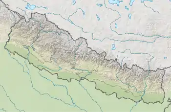
| Shey Phoksundo National Park | |
|---|---|
| शे-फोकसुण्डो | |
 Phoksundo Lake | |
 Shey Phoksundo National Park | |
| Location | Nepal |
| Coordinates | 29°21′29″N 82°50′44″E / 29.3581°N 82.8456°E |
| Area | 3,555 km2 (1,373 sq mi) |
| Established | 1984 |
| Governing body | Department of National Parks and Wildlife Conservation |
Shey Phoksundo National Park is the largest and only trans-Himalayan national park in Nepal. It was established in 1984 and covers an area of 3,555 km2 (1,373 sq mi) in the districts of Dolpa and Mugu in the Mid-Western Region, Nepal. The protected area ranges in elevation from 2,130 to 6,885 m (6,988 to 22,589 ft).[1][2] Phoksundo Lake is the park's prominent feature, located at an elevation of 3,612 m (11,850 ft).[1]
The park's headquarters are in Palam, Dolpa District.
Geography
The park's elevation varies from 2,130 m (6,990 ft) in the southeast near Ankhe to 6,883 m (22,582 ft) at the summit of Kanjiroba Himal at the southern edge of the Tibetan plateau. Phoksundo Lake at an elevation of 3,660 m (12,010 ft) in the upper reaches of the Suligad river is surrounded by glaciers and is known for its turquoise color.[1]
Phoksundo Lake has a water surface of 494 ha (1,220 acres), and was declared a Ramsar site in September 2007.[3] The lake is up to 145 m (476 ft) deep, measured using echo-sounding technology.[4]
The Langu river drains the high Dolpo plateau located in the north-east of the park. The Suligad and Jugdual rivers form the southern catchment flowing south into the Thuli Bheri River.[5]
Culture
Several gompas are within the park including Shey Gompa, which was established in the 11th century.[1]
References
- 1 2 3 4 Bhuju, U. R.; Shakya, P. R.; Basnet, T. B.; Shrestha, S. (2007). Nepal Biodiversity Resource Book. Protected Areas, Ramsar Sites, and World Heritage Sites (PDF). Kathmandu: International Centre for Integrated Mountain Development, Ministry of Environment, Science and Technology, in cooperation with United Nations Environment Programme, Regional Office for Asia and the Pacific. ISBN 978-92-9115-033-5.
- ↑ GoN/MoFSC /2014). Nepal Biodiversity Strategy and Action Plan 2014-2020. Government of Nepal, Ministry of Forests and Soil Conservation, Kathmandu, Nepal
- ↑ Bhandari, B. B. (2009). "Wise use of wetlands in Nepal". Banko Janakari. 19 (3): 10–17.
- ↑ Anonymous (2004). Rara is Nepal's deepest lake: Survey. Nepalnews.com
- ↑ Majupuria, T. C.; Kumar, R. (1998). Wildlife, National Parks and Reserves of Nepal. Bangkok: S. Devi, Saharanpur and Tecpress Books. ISBN 974-89833-5-8.