South Karnataka | |
|---|---|
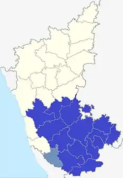 South Karnataka in Blue, Kodagu in Light blue | |
| Country | |
| State | Karnataka |
| Region | Old Mysore Region |
| Largest city | Bengaluru[1][2] |
| Headquarter | Bengaluru[1][2] |
| Area | |
| • Total | 84,969 km2 (32,807 sq mi) |
| • Rank | 2nd:Karnataka |
| Population (2011) | |
| • Total | 31,819,889 |
| • Rank | 1st:Karnataka |
| • Density | 370/km2 (970/sq mi) |
| Demonym | Dakshina Kannadiga |
| Languages | |
| • Official | Kannada |
| Time zone | UTC+5:30 (IST) |
| Vehicle registration | KA |
| Sex ratio | 965 ♂/♀ |
| Literacy | 76% |
South Karnataka generally refers to the southern part of Karnataka state, excluding the coastal areas. It generally corresponds to former Mysore state.[3] Kannada dialect of South Karnataka is slightly different as compared to North Karnataka.
Districts
There are 15 districts in South Karnataka:
See also
References
- 1 2 "Karnataka (India): Districts, Cities, Towns and Outgrowth Wards – Population Statistics in Maps and Charts". Citypopulation.de.
- 1 2 H.S. Sudhira; T.V. Ramachandra; M.H. Bala Subrahmanya (2007). "City Profile — Bangalore" (PDF). Cities. Bangalore: Environmental Information System (Centre of Ecological Sciences), Indian Institute of Science. 24 (5): 382. doi:10.1016/j.cities.2007.04.003.
- ↑ Pattanashetti, Girish (16 July 2010). "The saga of the unification movement". Thehindu.com. Retrieved 20 January 2019.
This article is issued from Wikipedia. The text is licensed under Creative Commons - Attribution - Sharealike. Additional terms may apply for the media files.