State Route 301 | ||||
|---|---|---|---|---|
| Route information | ||||
| Maintained by ALDOT | ||||
| Length | 0.428 mi[1] (689 m) | |||
| Existed | 2016–present | |||
| Major junctions | ||||
| South end | ||||
| North end | ||||
| Location | ||||
| Country | United States | |||
| State | Alabama | |||
| Counties | Calhoun | |||
| Highway system | ||||
| ||||
| ||||
State Route 301 (SR 301) is a north–south route located entirely in Calhoun County in east-central Alabama.[2] The route is 0.428 miles (0.689 km) long.
Route description

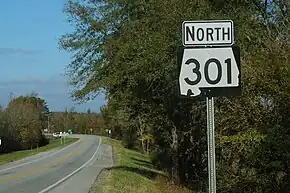
A sign denoting northbound Alabama State Route 301.
SR 301 is a former alignment of U.S. Route 431 (US 431) in the Oxford area. It begins at a junction with US 78 on the north side, and it ends at a junction with Interstate 20 (I-20) and US 431 at exit 191.[2]
History
The SR 301 designation was established in February 2016 when US 431 was re-routed onto I-20 after the completion of the Anniston Eastern Bypass. US 431 followed a concurrency with US 78, but this short link road between the two U.S. Highways became known as SR 301.
Major intersections
The entire route is in DeArmanville, Calhoun County.
| mi[1] | km | Destinations | Notes | ||
|---|---|---|---|---|---|
| 0.00 | 0.00 | Southern terminus; I-20 exit 191; road continues south as US 431 (SR 1) | |||
| 0.428 | 0.689 | Northern terminus | |||
| 1.000 mi = 1.609 km; 1.000 km = 0.621 mi | |||||
See also
References
- 1 2 "Milepost/General Highway Maps" (PDF). Alabama Department of Transportation. Retrieved November 20, 2018.
- 1 2 Alabama Department of Transportation (2017). Sweet Home Alabama Official Highway Map (Map) (2017–2018 ed.). Montgomery: Alabama Department of Transportation. § J15.
External links
Template:Attached KML/Alabama State Route 301
KML is not from Wikidata
 Media related to Alabama State Route 301 at Wikimedia Commons
This article is issued from Wikipedia. The text is licensed under Creative Commons - Attribution - Sharealike. Additional terms may apply for the media files.
