.jpg.webp)
Stepney Green Park, looking north from the Stepney Way entrance
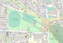
Map of Stepney Green Park
Stepney Green Park is a 4.62-hectare (11.4-acre) park in Stepney, Tower Hamlets, London.[1] It is a remnant of a larger area of common land. It was formerly known as Mile End Green.[2]
During the 2010s, a large area of the park was used on a temporary basis to build Crossrail. The Stepney Green cavern is now located below the park.
It gives its name to the surrounding neighborhood of Stepney Green.
See also
References
- ↑ "Stepney Green Park". towerhamlets.gov.uk.
- ↑ "Stepney: Communications | British History Online". www.british-history.ac.uk. Retrieved 27 June 2020.
External links
51°31′04″N 0°02′51″W / 51.5179°N 0.0475°W
This article is issued from Wikipedia. The text is licensed under Creative Commons - Attribution - Sharealike. Additional terms may apply for the media files.