Sydney Orbital Network | |
|---|---|
 | |
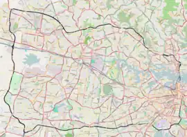
| Map of the Sydney Orbital Network | |
| General information | |
| Type | Freeway |
| Location | Sydney |
| Length | 110 km (68 mi) |
| Opened | Completed 2007 |
| Route number(s) | |
| Major junctions | |
| Highway system | |
The Sydney Orbital Network is a 110 kilometre[1] motorway standard ring road around and through Sydney, the capital of New South Wales in Australia. It runs north from Sydney Airport, underneath the CBD to the North Shore, west to the Hills District, south to Prestons and then east to connect with the airport. Much of the road is privately owned and financed by tolls.

History
Planning for this beltway, orbital or ring road began as early as 1962 under the "County of Cumberland scheme" (CCS) and was talked about as far back as 1944. Then, from 1973 to 1989, things started to take shape with new sections opening-up and then further advancing by 1999. In 2007, the Lane Cove Tunnel opened, completing the orbital network.
Motorways that make up the orbital road
The 110 km Sydney orbital consists of several motorways and freeways, they are listed below:
- Eastern Distributor
- Western Distributor
- Southern Cross Drive
- General Holmes Drive
- M5 Motorway
- Westlink M7
- M2 Hills Motorway
- M4 Motorway
- M8 Motorway
- Lane Cove Tunnel
- Gore Hill Freeway
- Warringah Freeway
- Sydney Harbour Tunnel
- WestConnex
- NorthConnex
The major sunken/underground sections of the orbital are:
- Sydney Harbour Tunnel
- Eastern Distributor
- M5 East tunnel
- Epping Tunnel (M2 Hills Motorway, although not really a major tunnel)
- Sunken Section of the M2 Hills Motorway (The trench between Epping Road)
- Lane Cove Tunnel
- WestConnex
The major elevated sections are:
- Parts of the Westlink M7
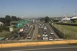
- Parts of Southern Cross Drive and General Holmes Drive (past the airport)
Tolling
The Sydney Orbital Road Network consists of a number of roads built by private companies: tolling is mostly unavoidable when using the road network. A $6.95 toll was added to the M5 East motorway from King Georges Road to Marsh Street on the 5th of July 2020,[2] to coincide with the opening of the M8 tunnel.
| Road | Direction | Opened | Toll Collection Method | Toll Pricing | Price | Operator |
|---|---|---|---|---|---|---|
| Eastern Distributor | Northbound | 1999 | Electronic | Flat rate | $7.23 | Transurban |
| M5 South Western Motorway | Both | 1992 | Electronic | Flat rate | $4.65 | Interlink Roads |
| M5 East Motorway | Both | 2001 | Electronic | Flat rate | $6.95 | WCX M5 PT Pty Ltd[3] |
| Westlink M7 | Both | 2005 | Electronic | Distance based | $0.3996/km - capped at $7.99 | NorthWestern Roads Group (NWRG) |
| M2 Hills Motorway | Both | 1997 | Electronic | Each direction/ Fixed | $7.16 (North Ryde) $3.58 (Pennant Hills Road) $2.53 (Windsor Road) $2.12 (Lane Cove Road) $3.58 (Herring & Christie Roads) | Transurban |
| Lane Cove Tunnel | Both | 2007 | Electronic | Flat rate | $3.27 | Transurban |
| Sydney Harbour Tunnel | Southbound | 1992 | Electronic | Time based | Weekdays $3.00 (9.30am - 4pm) $4 (6.30am - 9.30am, 4pm - 7pm) $2.50 (7pm - 6.30am); Weekends $3 (8am - 8pm) $2.50 (8pm - 8am) | Transport for NSW |
Highway links
Intercity highways are linked to the Orbital, moving traffic away from the old busy National Routes. They are:
- NorthConnex - linking M1 Pacific Motorway, Newcastle and Brisbane to M2 Hills Motorway
- M4 Motorway - linking Great Western Highway and Bathurst to Westlink M7
- Hume Motorway - linking Melbourne and Canberra to M5 Motorway and Westlink M7
- King Georges Road - linking Princes Highway, Princes Motorway and Wollongong to M5 Motorway
Proposed or missing freeway/motorway links
- M6 Motorway – A proposal that links the New M5 Tunnels and the southern suburbs of Sydney, as the M6 Motorway. The only section which was built is the Captain Cook Bridge and its approaches. Land is still reserved north of this point through Sandringham, and south through the Royal National Park. In October 2017, the government announced it will proceed with Stage 1 of the F6 extension, which will run via two 4 km tunnels linking the New M5 tunnels at Arncliffe to President Avenue at Kogarah.[4] In October 2019, the government announced a name change of the extension to M6 Motorway and also confirmed the completion date of Stage 1 would be pushed back to late 2025, with major construction to begin by early 2022.[5]
- Western Harbour Tunnel - linking the WestConnex via the Rozelle Interchange (opened in December 2023) with the North Shore at Cammeray.
See also
References
- ↑ RTA Website Motorways and tolling
- ↑ "Tolling | Westconnex". Retrieved 7 September 2020.
- ↑ "Tolling | Westconnex". Retrieved 7 September 2020.
- ↑ "F6 Extension - Stage 1". Roads & Maritime Services. Retrieved 30 October 2019.
- ↑ "Sydney's south on the move with the new M6". NSW Government. 29 October 2019. Retrieved 30 October 2019.