Tenggarong | |
|---|---|
| Country | |
| Province | East Kalimantan |
| Regency | Kutai Kartanegara Regency |
| Government | |
| • Camat | Arfan Boma Pratama, AP. |
| Area | |
| • Total | 398.10 km2 (153.71 sq mi) |
| Population (2022)[1] | |
| • Total | 106,669 |
| • Density | 270/km2 (690/sq mi) |
| Time zone | UTC+8 (ICT) |
| Villages | 14 |
Tenggarong is a town in and the capital of Kutai Kartanegara Regency of East Kalimantan Province, Indonesia. Tenggarong (abbreviated: TRG [2]) is also a district (kecamatan). The former Kutai Kartanegara Sultanate's capital was likewise located in Tenggarong.[3]
Historically, the then capital was called Tepian Pandan. At some point, the Kutai Kartanegara Sultan, Aji Muhammad Muslihuddin, changed the name from Tepian Pandan to Tangga Arung (literally house of king). In application, the people of Kutai would then shorten this name by combining the two words Tangga Arung to Tenggarong.[3]
The Tenggarong district is divided into 12 Kelurahan and 2 villages (desa), had a total area of 398.10 km 2 with a population of 106,669 in mid 2022.[1]
Climate
Tenggarong has a tropical rainforest climate (Af) with heavy rainfall year-round.
| Climate data for Tenggarong | |||||||||||||
|---|---|---|---|---|---|---|---|---|---|---|---|---|---|
| Month | Jan | Feb | Mar | Apr | May | Jun | Jul | Aug | Sep | Oct | Nov | Dec | Year |
| Mean daily maximum °C (°F) | 29.9 (85.8) |
30.2 (86.4) |
30.3 (86.5) |
30.3 (86.5) |
30.3 (86.5) |
29.7 (85.5) |
29.4 (84.9) |
29.8 (85.6) |
30.0 (86.0) |
30.6 (87.1) |
30.4 (86.7) |
30.2 (86.4) |
30.1 (86.2) |
| Daily mean °C (°F) | 26.4 (79.5) |
26.6 (79.9) |
26.6 (79.9) |
26.8 (80.2) |
27.0 (80.6) |
26.5 (79.7) |
26.2 (79.2) |
26.5 (79.7) |
26.7 (80.1) |
27.1 (80.8) |
26.8 (80.2) |
26.7 (80.1) |
26.7 (80.0) |
| Mean daily minimum °C (°F) | 23.0 (73.4) |
23.0 (73.4) |
23.0 (73.4) |
23.3 (73.9) |
23.7 (74.7) |
23.4 (74.1) |
23.0 (73.4) |
23.3 (73.9) |
23.4 (74.1) |
23.6 (74.5) |
23.3 (73.9) |
23.2 (73.8) |
23.3 (73.9) |
| Average rainfall mm (inches) | 171 (6.7) |
170 (6.7) |
204 (8.0) |
239 (9.4) |
177 (7.0) |
152 (6.0) |
135 (5.3) |
130 (5.1) |
111 (4.4) |
142 (5.6) |
200 (7.9) |
212 (8.3) |
2,043 (80.4) |
| Source: Climate-Data.org[4] | |||||||||||||
Gallery
 Jalanan kota Tenggarong pada malam hari.
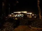 Museum Mulawarman
 Masjid Jami Sultan Sulaiman.
.jpg.webp) Kedaton Koetai Kartanegara.
Kedaton Koetai Kartanegara.
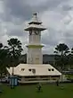 Bentong Hours
.jpg.webp) Monument to A.M. Sangaji
Monument to A.M. Sangaji Adipura Monument
 Lithography view at Tenggarong (1887).
References
- 1 2 3 Badan Pusat Statistik, Jakarta, 2023.
- ↑ http://ftp.paudni.kemdiknas.go.id/paudni/2011/06/SNI_7657-2010_Singkatan_Nama_Kota.pdf
- 1 2 "The Origin of Erau". Retrieved 17 January 2011.
- ↑ "Climate: Tenggarong". Climate-Data.org. Retrieved 24 November 2020.
Regencies and cities of East Kalimantan | ||
|---|---|---|
Capital: Samarinda | ||
| Regencies | ||
| Cities | ||
| Towns and villages | ||
0°24′S 116°58′E / 0.400°S 116.967°E